When it comes to multi-day camping expeditions, the Bostock To Revelstoke Traverse is a forgotten gem of the Northern Selkirk Mountains. Spanning 91km between two scenic parks, Glacier National Park and Mt Revelstoke National Park, the route connects the Bostock Trailhead to the Meadows in the Sky Parkway, totalling a hair-raising 7000m of vertical gain over 5-7 days. The route follows the height of land for the most part, traversing expansive glaciers, climbing undulating ridges, and bagging high peaks. It’s one of my personal favourites since it rewards the adventurer with panoramic views of the high country and minimizes heinous bushwhacking. Let’s not forget the efforts of its pioneers. The route takes you through Selkirk Mountain Experience’s prized ski touring tenure as well as Selkirk Tangiers Heli Skiing. Impeccable backcountry practices are a must.
This route is located within a Winter Restricted Area (WRA) governed by the Winter Permit System of Glacier National Park. Check the WRA status before travelling through it.
Related: The Wapta Traverse: A Jaw-Dropping 6-Day Ski Tour
Report from April 12, 2021
Day 1: Bostock Trailhead – Tangiers River
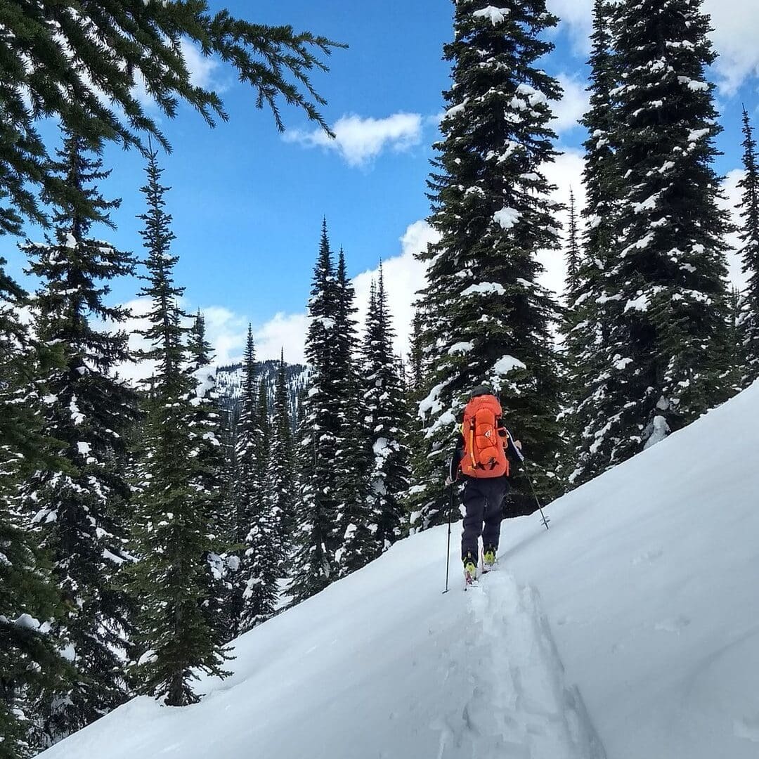
After a short drive to the Bostock Trailhead, we shouldered our heavy bags stuffed to the brim with 8 days worth of food as well as the usual camping and glacier travel apparatus. The weight was soul-crushing, but we were determined to complete the Bostock-Revelstoke traverse, planned a month prior. We slithered along the refrozen snow of the Bostock Trail, hopping over the occasional dirt patch. While the winter granted us an above-average snowpack in the alpine, a warm spring was settling in the valleys. We walked past the exit of the McGill Chutes, two large slidepath terminating at the creek below. Within a few hours of back-breaking travel, we reached Bostock Pass, the first milestone.
In the near distance, we spotted Wolverine Ridge watching over Casualty Creek, a great location for future basecamp plans. We could also faintly see Farm Pass, our next objective.
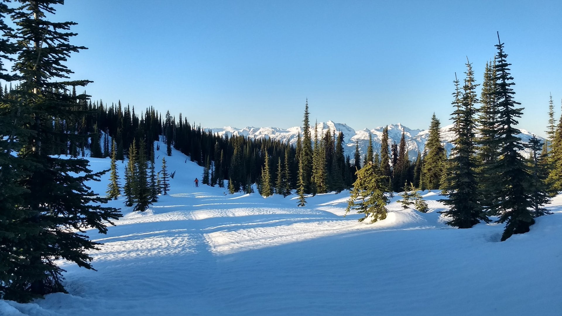
With a short jaunt to the West, we reached Farm Pass, a wide opening through the Corbin Peak ridge. We ripped skins and glided down Farm Creek, pushing along with our poles when needed. After crossing many unexpected flats, we followed the valley, plunging into a narrow canyon.
We did our best to contour along the left bank around a broad shoulder but, alas, were forced to shoulder our skis and hike up the slope. Given the dense, wet snow and the shoulder’s topography, we were naturally sucked into the canyon. With great effort, we used our recent elevation gain to round the shoulder, putting us above the Tangiers River. We descended the slope through heinous chop until the river stopped us in our tracks. We meandered along the bank looking for an appropriate crossing. Within minutes, we were barefoot, drying our feet, now frozen solid, on the west bank. Hopefully, this was our first and last river crossing.

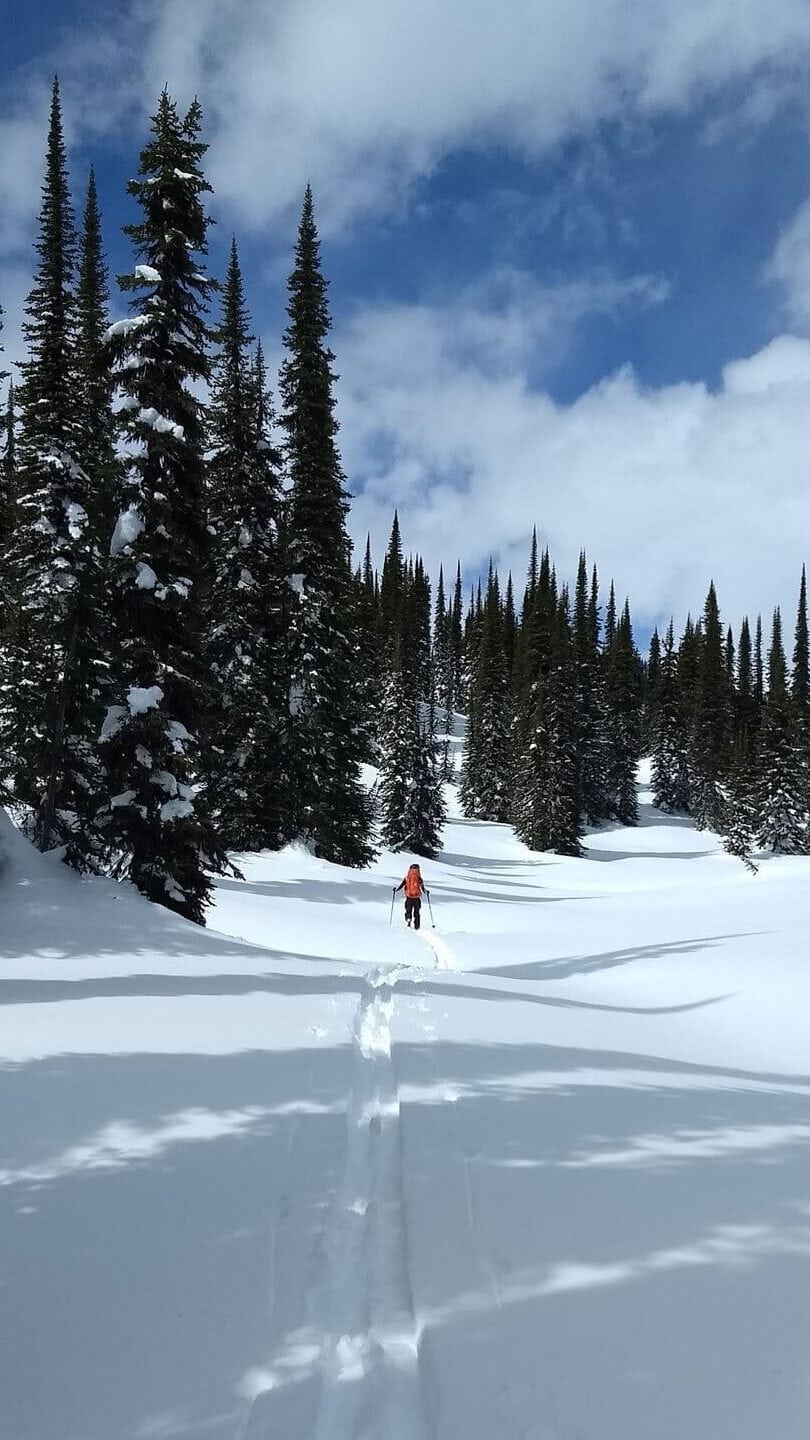
Instead of pitching camp onsite, we pushed further south along the Tangiers to warm up our tired bodies.
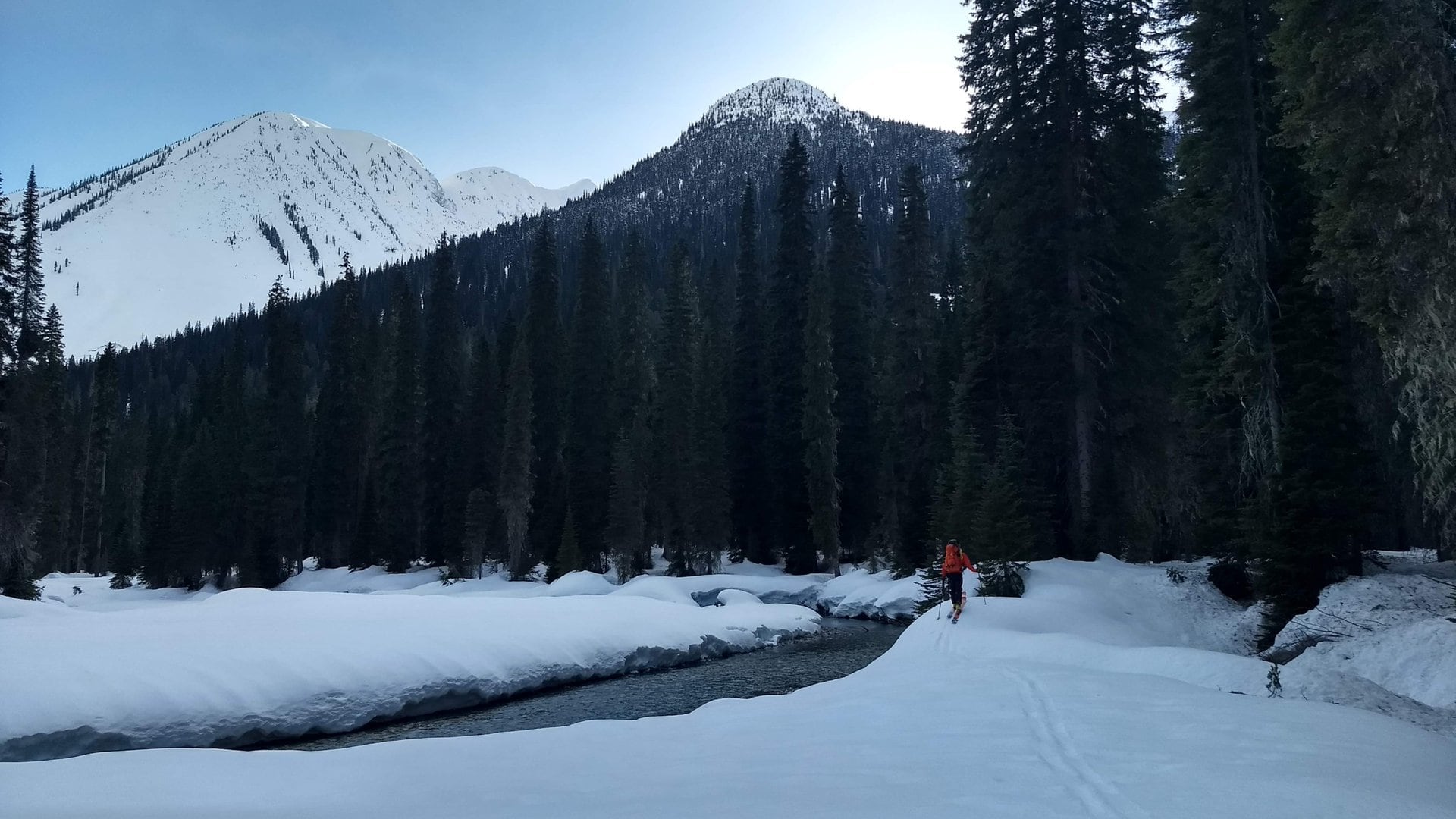
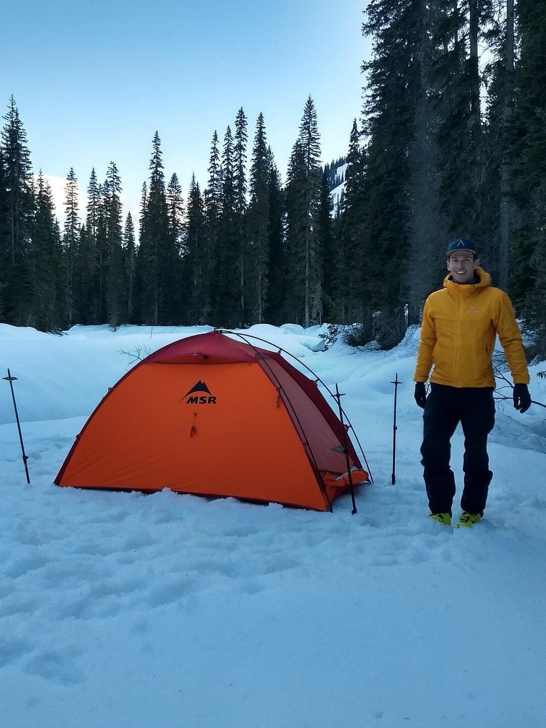
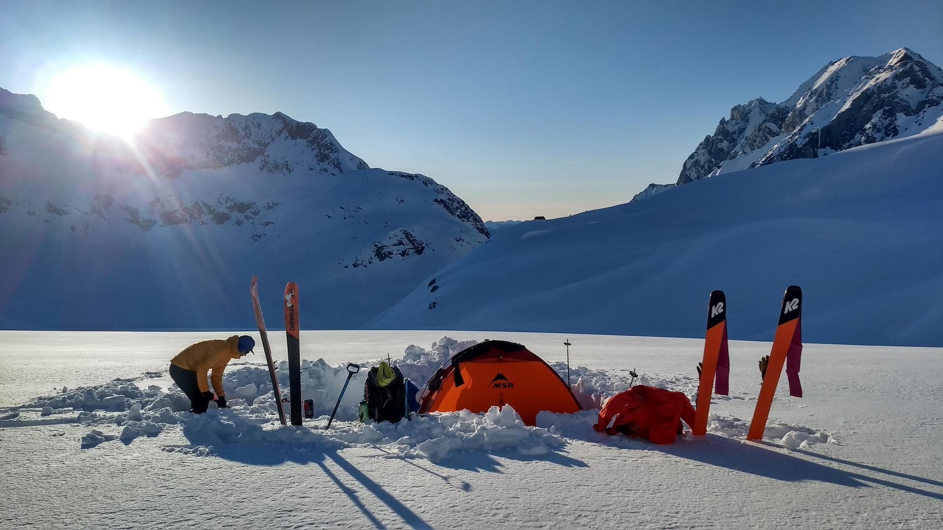
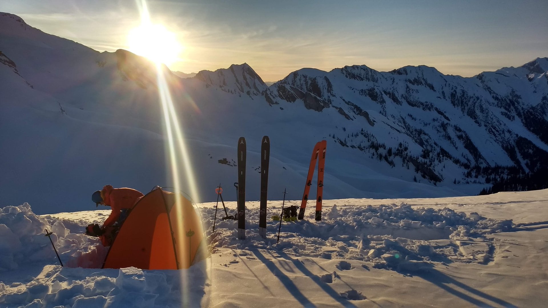
Once our feet were toasty, we pitched our tent below the Fang Glacier’s outflow stream at valley elevation. What a glorious camping spot! We fell asleep to the peaceful sound of water running past our tent.
Day 2: Tangiers River – Dismal Glacier
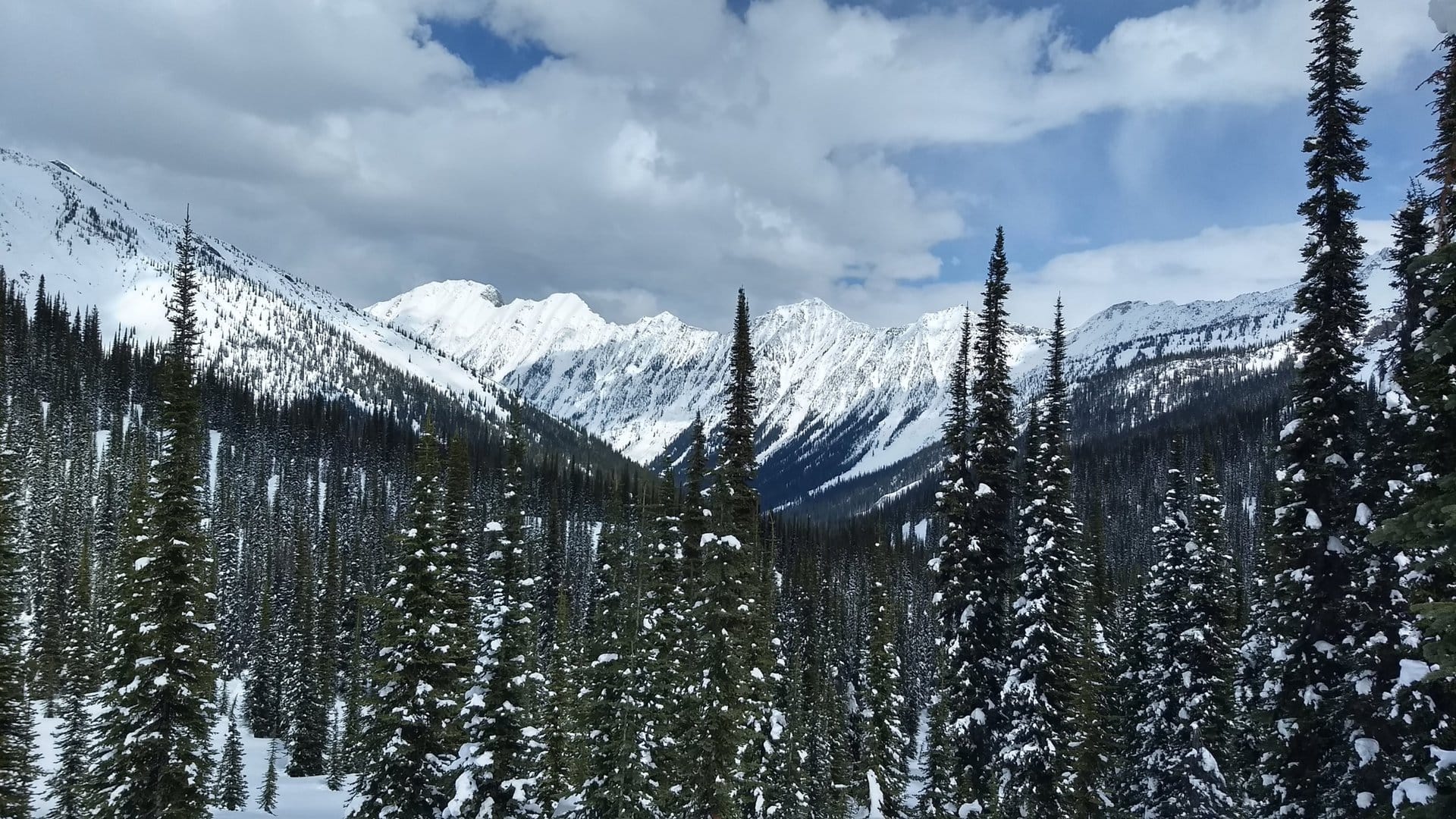
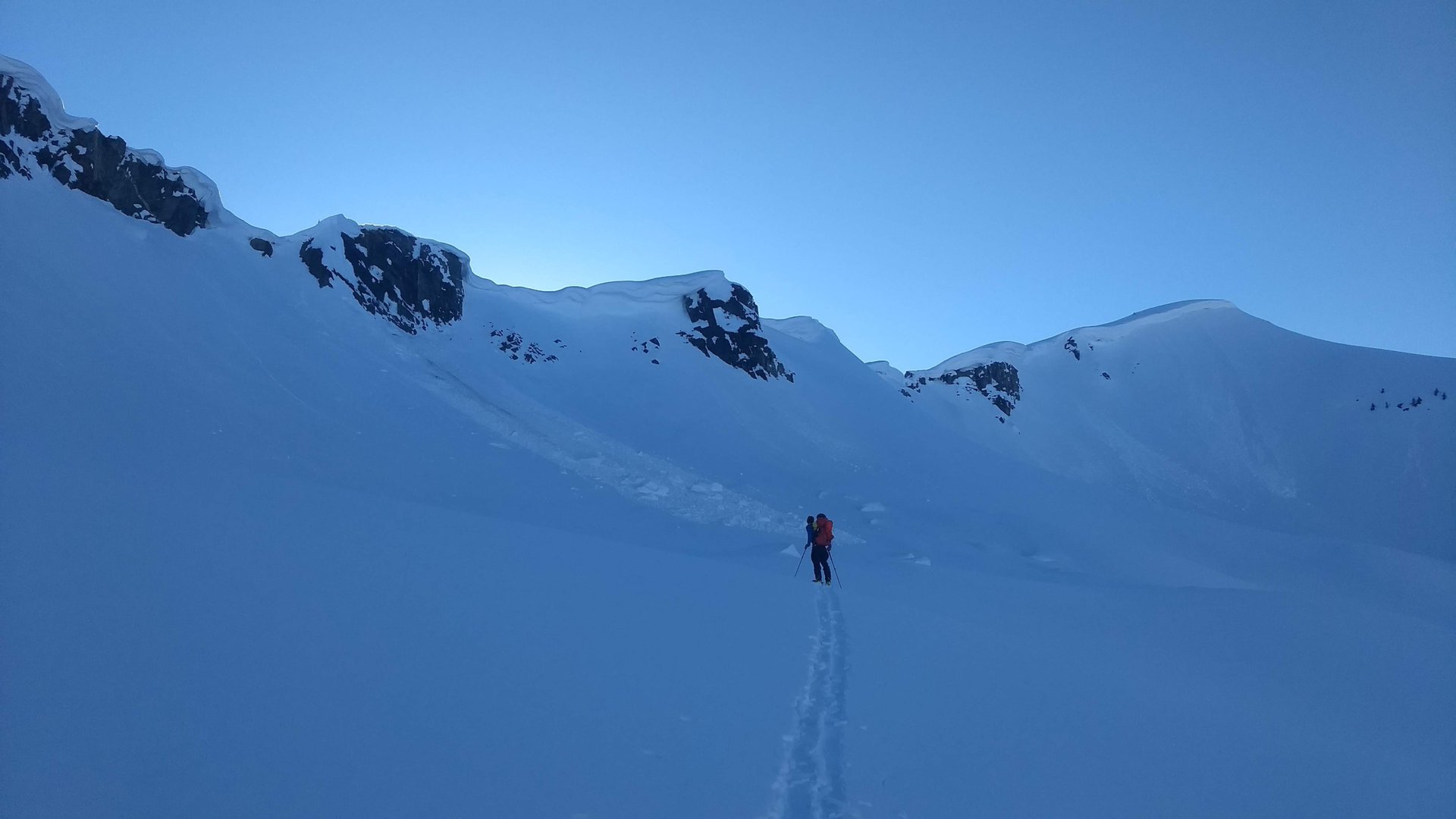
We woke up to the frost in suspension, glistening in our headlamp’s beam. Our humid breath and the nearby running water had created a thin ice film along the tent walls. Day 2 was daunting. A 1650m ascent was waiting for us, from the Tangiers Valley to Fang Col, with loaded packs. After a hearty breakfast, we followed Fang Creek towards its named glacier, a straightforward ascent.
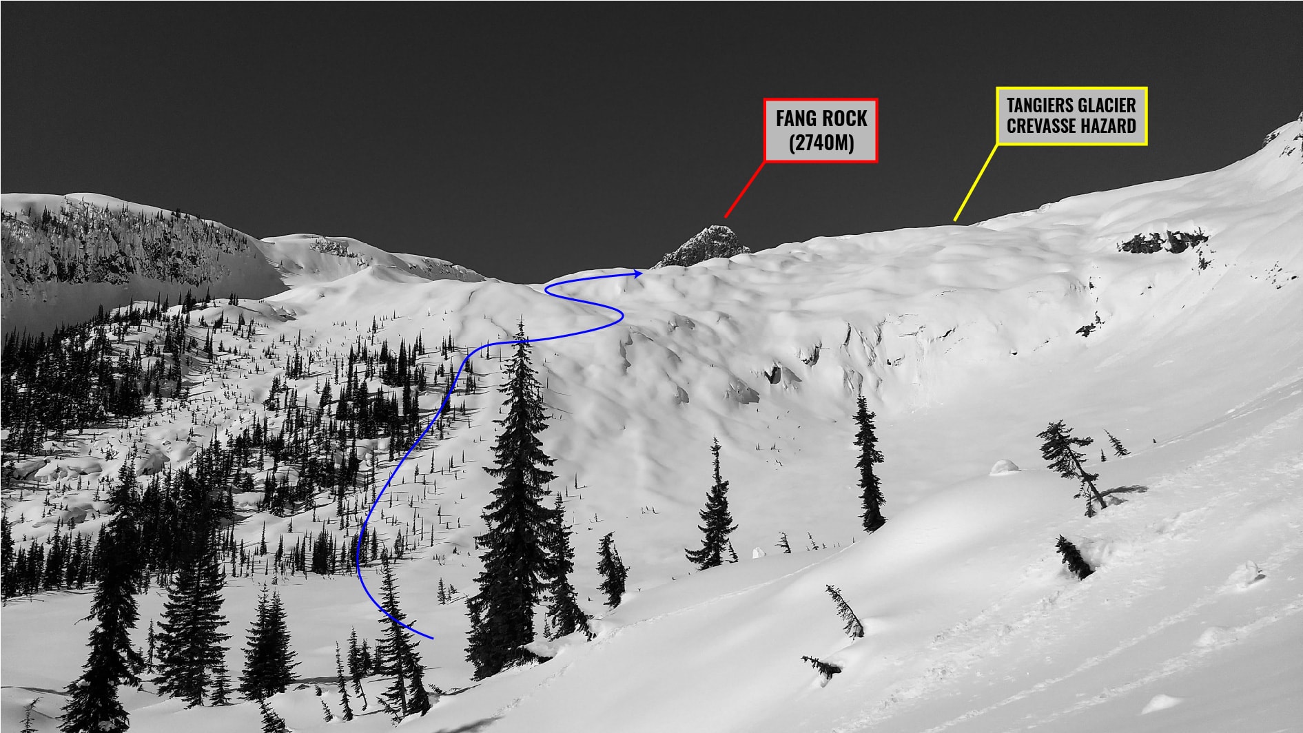
By the time we gained the undulating moraines below the glacier, the sun was beaming. We were sweating every ounce of water we had drunk, making every step through the moist snow a little harder. We walked by a striking pillow field bordering the Fang Valley. Fang Rock, a black spire sticking out of the glacial landscape, was towering over us.
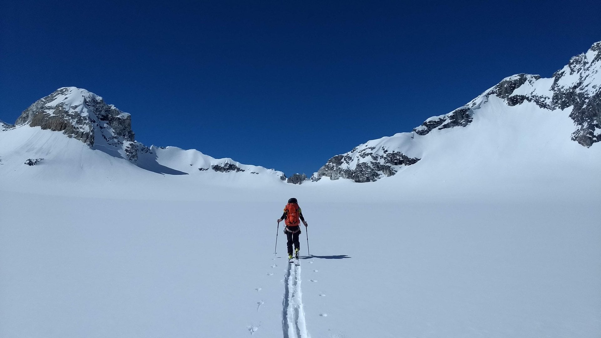
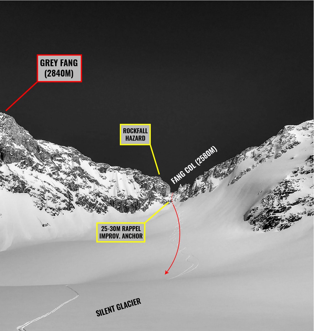
Within an hour, we crossed the toe of the Tangiers Glacier and stepped onto the upper flat area. My right hip flexor muscle was seizing up, a stark reminder of an old injury in my earlier days in Chamonix. While Freddy powered ahead, I painfully (and slowly) traversed across the flats to Fang Col, our high point of the day.
To our surprise, we found a 3-piece ski pole next to the rappel station, fresh cordelette slung around a frozen boulder. After deliberating with Freddy, we figured it must have been forgotten by a previous party, excited – or frightened – by the long rappel. That’s a bad way to end a traverse. We rigged up our system and rappelled 25m down the rock slabs onto the Silent Glacier below.
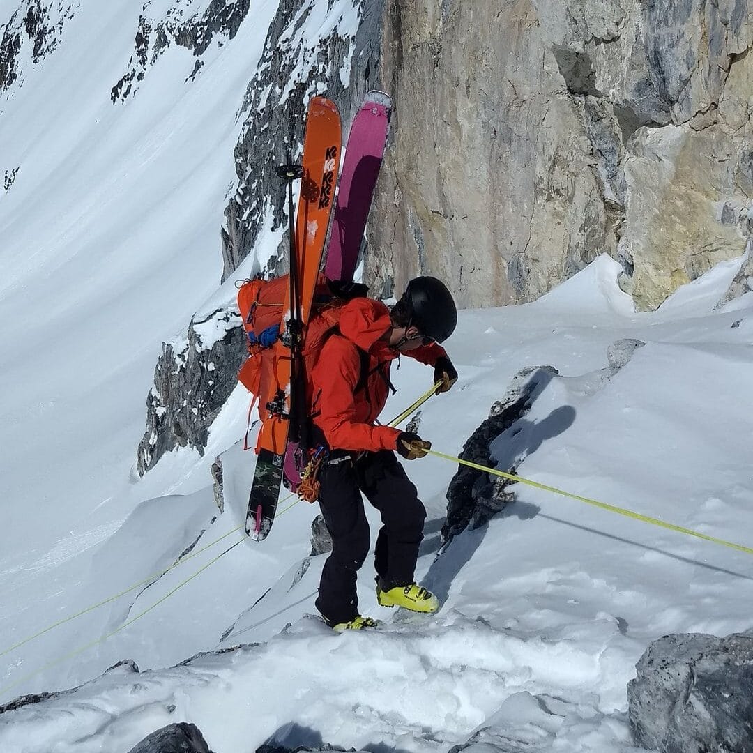
Exhausted by the long ascent, I mistakenly forgot to remove the backup knot at the end of the rope and it got stuck in the rappel carabiner 25m above us. Oops! I yanked a few times on the stuck end with no avail. As a last resort, I climbed a few meters and jumped down the slope, dumping my full weight on the rope. Lucky me, the knot passed through the carabiner. I successfully recovered the rope. Sorry, Freddy! After this stressful mishap, we skied a few magical turns down the Silent Glacier.
A few high-fives later, we were racing up the ramp to Silent Col. Boy, were we tired at that point? Our legs only managed to get us up there.

At Silent Col, we quickly found the rappel anchors installed by Swiss Mountain Guide, Ruedi Beglinger, which marks the boundary of the SME tenure. We rappelled 15m past summer Via Ferrata anchors onto the Dismal Glacier. The SW face of Fridden Peak, to our direct right, was clearly heating up. Snowballs and rocks were falling on the nearby slope. Best to hurry up.
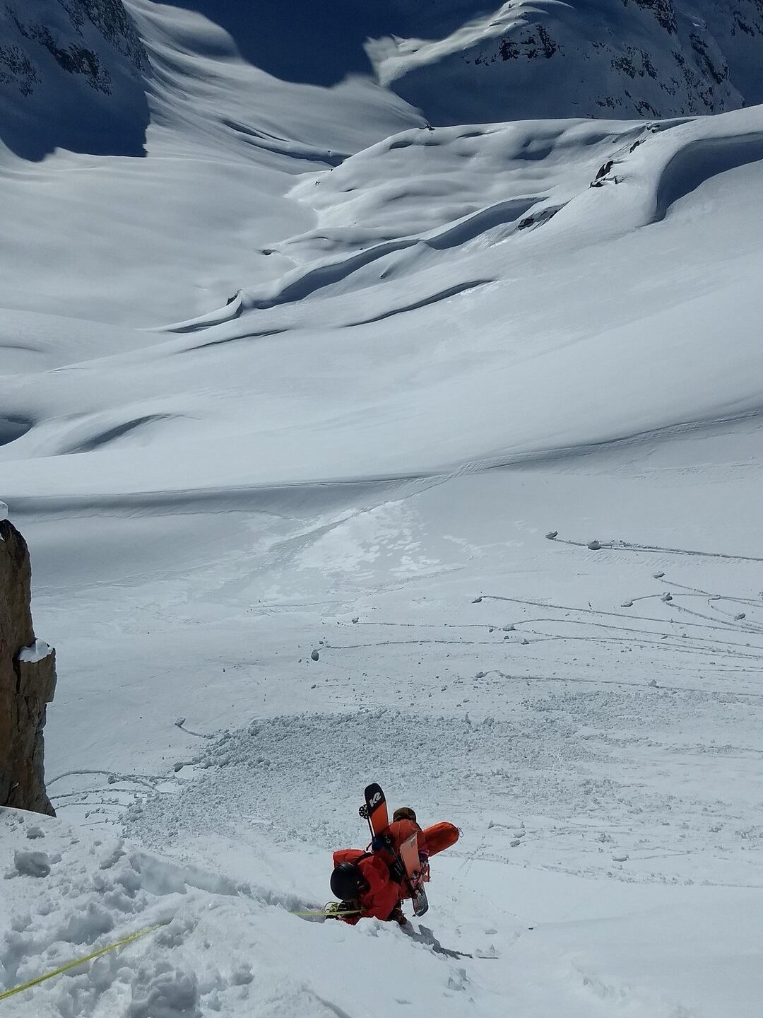
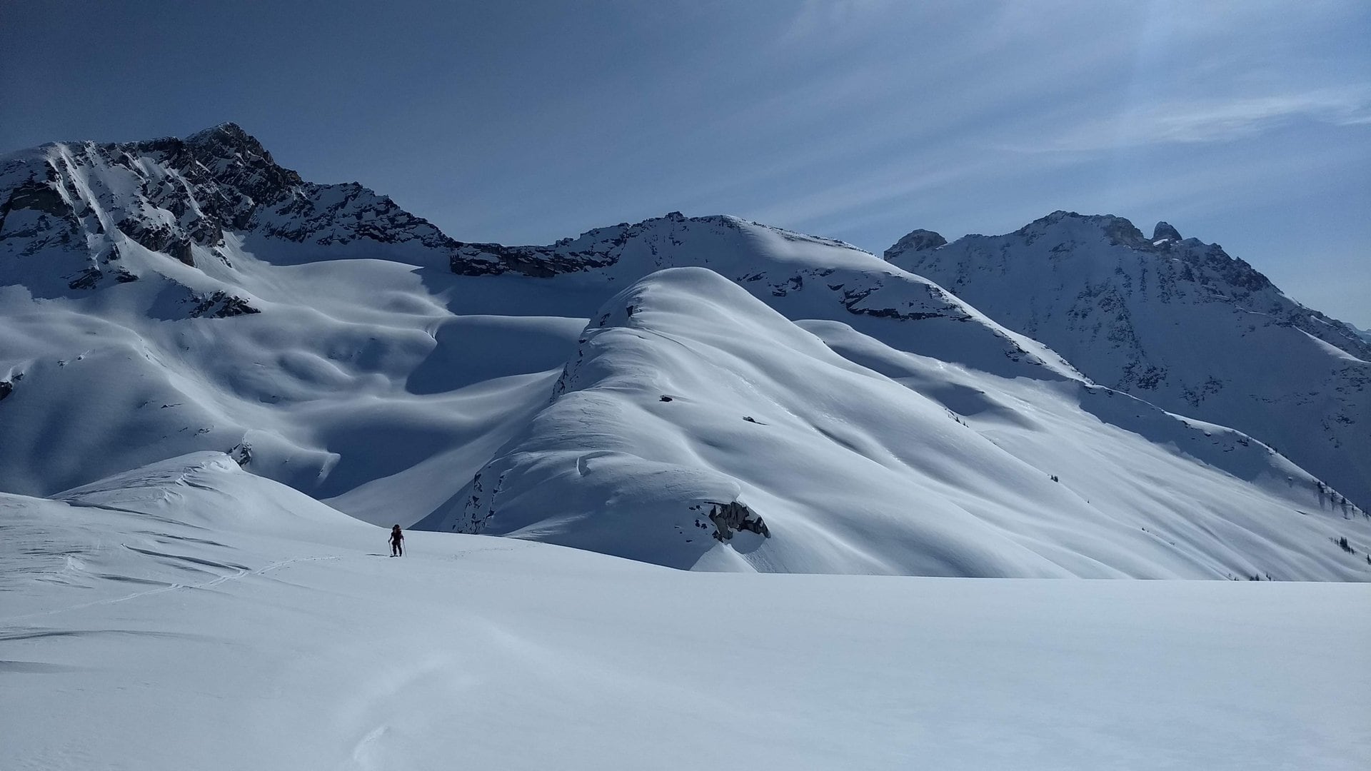
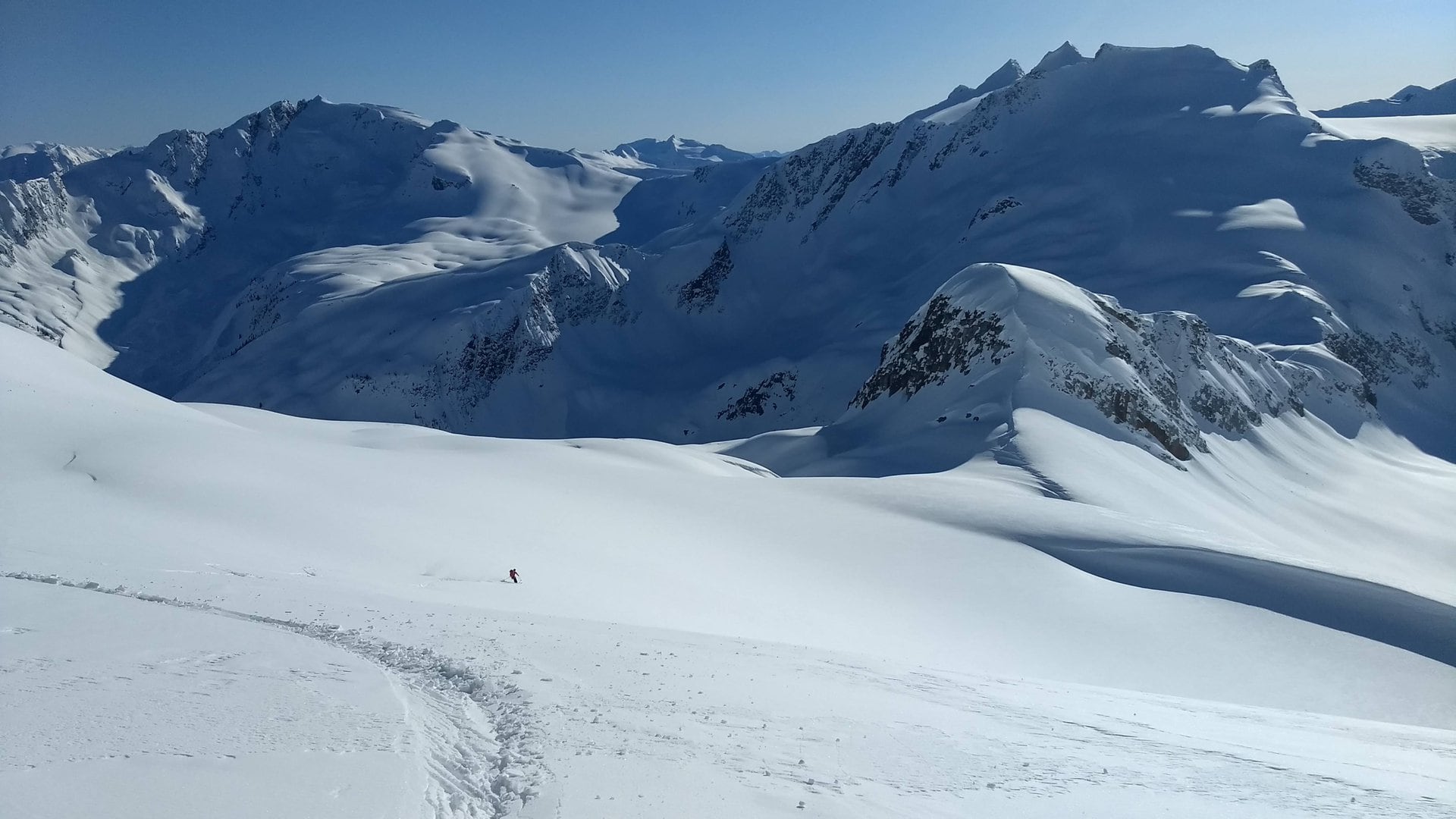
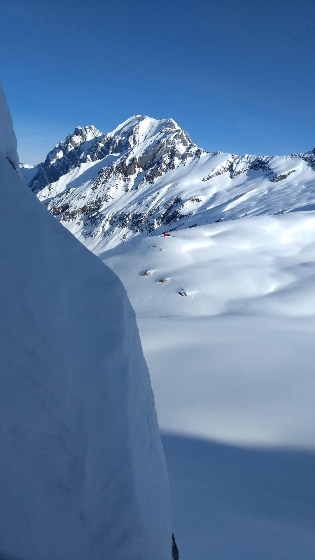
We skied the Dismal Glacier, halting on a flat area below the Juliana Ridge. A perfect spot for a camp at a viewing distance from the Moloch Chalet. This was arguably the most scenic but technical and arduous day of our Bostock-Revelstoke Traverse.
Day 3: Dismal Glacier – Laforme Spire
We woke to yet another bluebird day at the foot of Mt Moloch.
After slipping in our frozen shells, we contoured the base of the Juliana Ridge, looking for a way up onto it. After some discussion, we settled on a rocky chute to the left of the ridge.
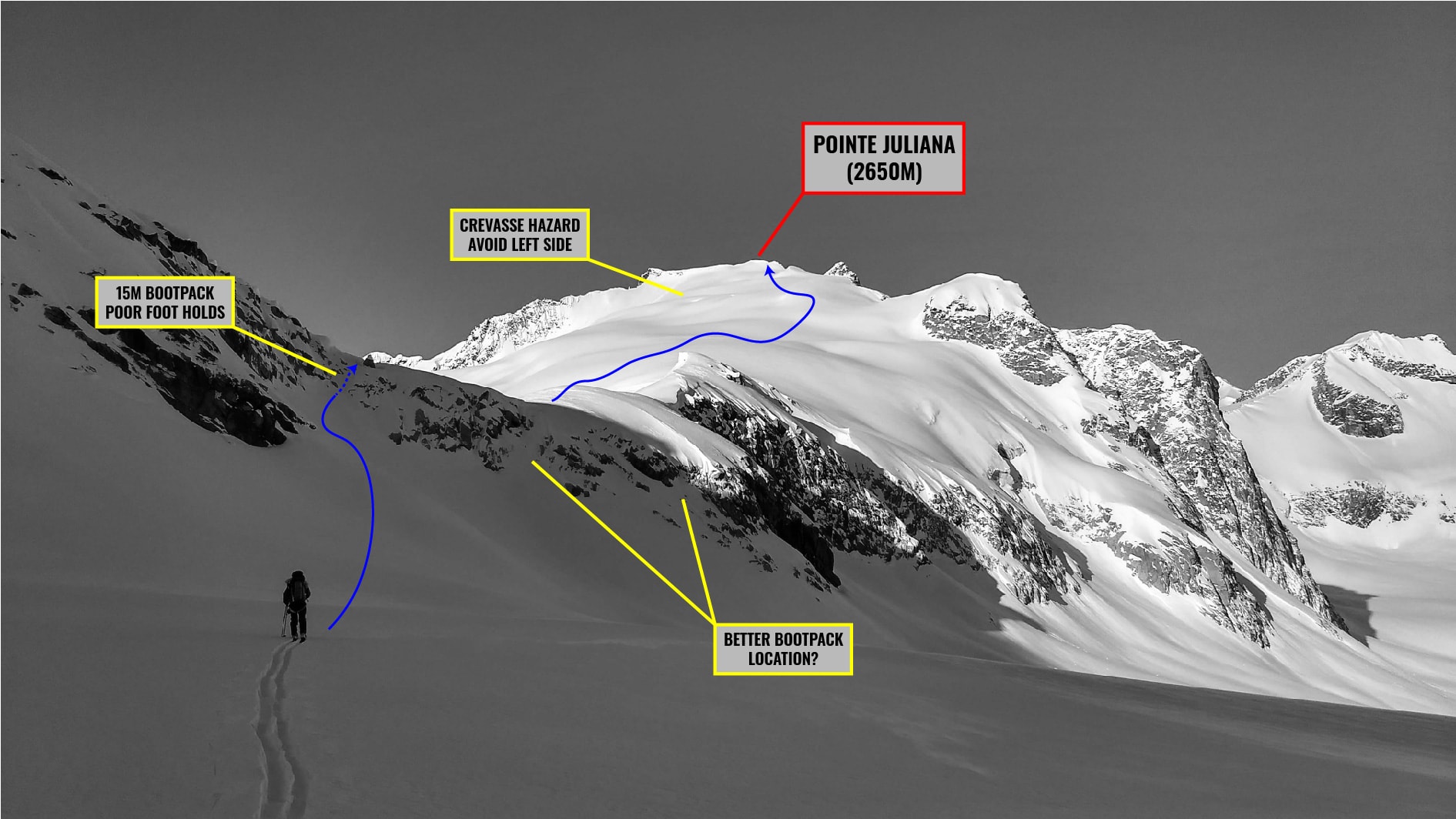
Freddy led the bootpack, kicking steps in the faceted snow. As expected, the upper section was coated with a thin layer of facetted, sugary snow that made for poor footing. He eventually made it up top, only for Freddy to scrape the chute down to bare rocks. I soloed most of the climb until the very end where my partner threw me an emergency length of cordelette as a hold. The views of the surrounding Valleys were astounding from our perch. Mt Moloch stood high and mighty across the Dismal Glacier. What a beast!

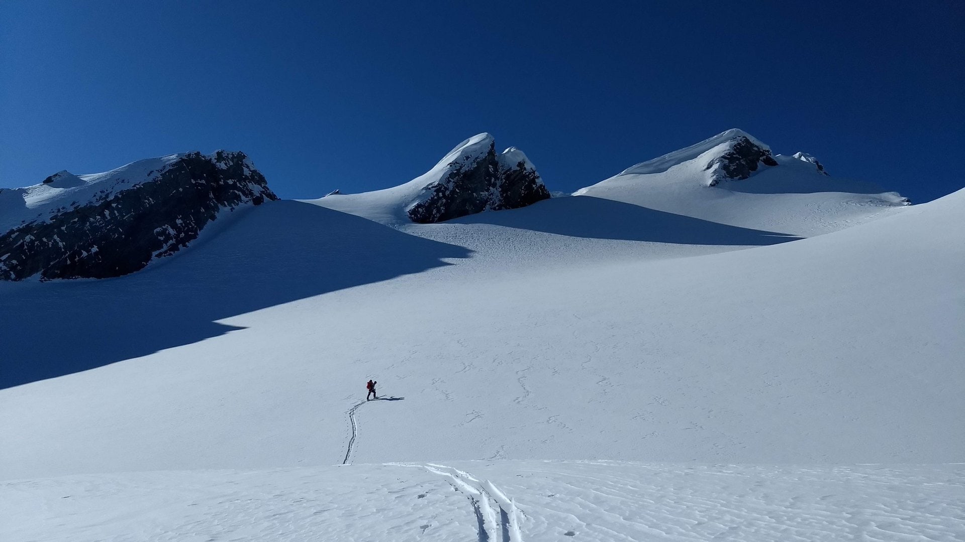
We walked up the Juliana Glacier, maintaining the climber’s right to avoid gaping crevasses, buried by a previous freak storm. The slope was roasting in the 9 AM blaze. As forecasted, temperatures were to spike over the next few days, indicating a period of heightened avalanche hazard. Thankfully, this came with a strong high-pressure system and perfectly clear skies.
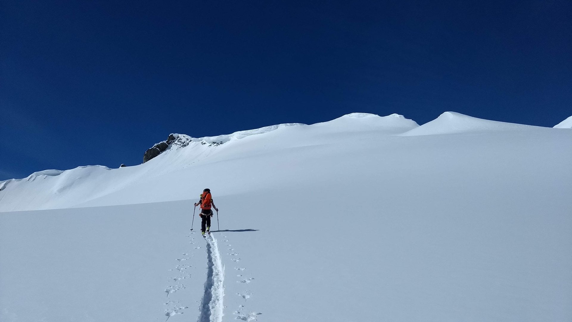
On the lookout for sneaky crevasses, we reached Pointe Juliana, a subpeak of Philharmonic Peak and a convenient access to the upper Dismal Glacier. As it was difficult to estimate the slope’s gradient and length, we kept our skins and slowly glided across the glacial plain. In retrospect, we could have easily ripped our skins, setting us up for the steeper descent to come.
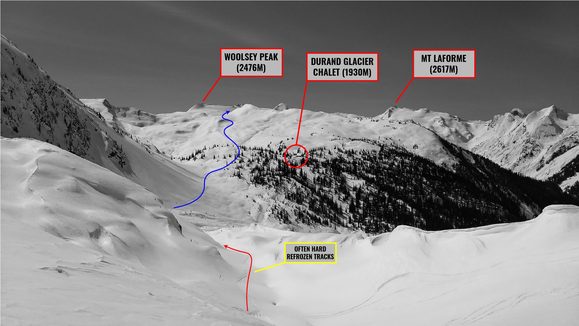
Once we gained the edge of the plain, we skied down a broad, icy gully flanked by a rock face and a jagged icefall. It’s important to nail the entrance and stay far away from the skier’s right blind roll into the icefall. The gully led onto the Durrand Glacier. We pushed across the flats and were forced through yet another gully. We followed several sets of refrozen ski tracks down winding terminal moraines onto a well-used uptrack leading to the Durrand Glacier Chalet. We scoped out the operation’s headquarters for a minute, were greeted by a lovely Golden Retriever, and proceeded with the regular programming.
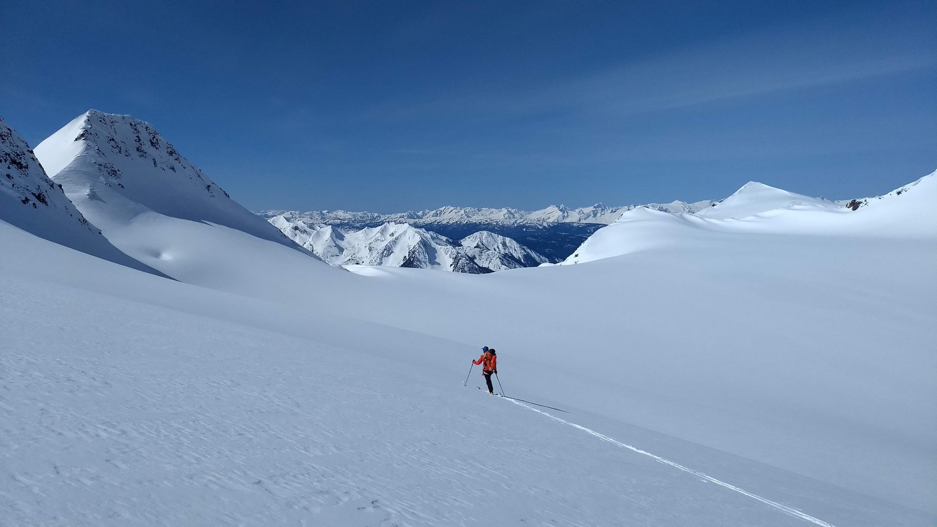
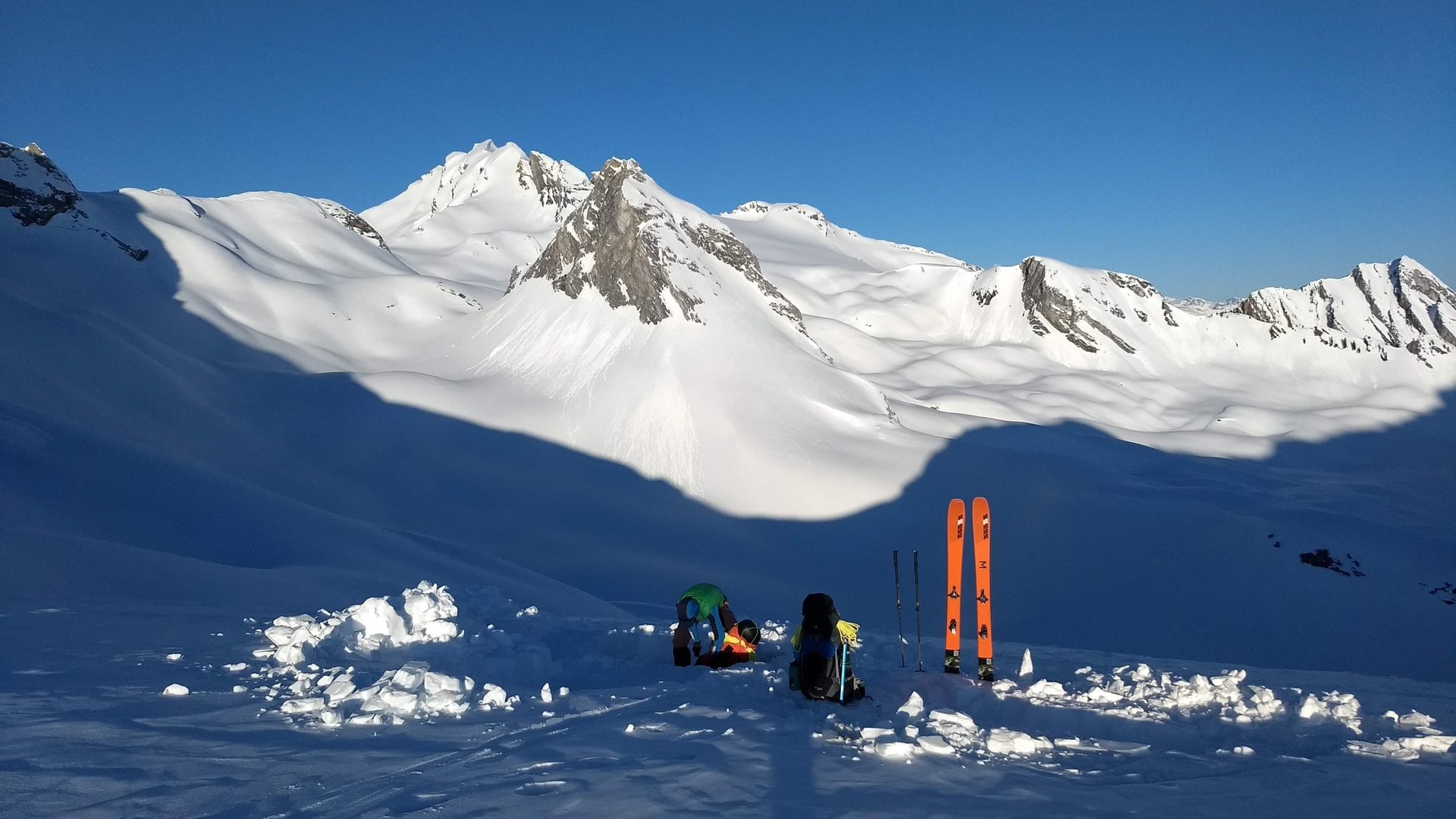
In the heat of the day, we climbed up a series of mellow bumps and elongated ridges below Woolsey Peak. We traversed a steep slope to the West to gain Elm Col (next to Elm Peak) leading into the head of the Woolsey Valley. I know – a confusing naming scheme… After a long water break, we jumped into the valley and contoured below a corniced ridge as best as we could given the complex terrain. This was a foolish mistake, the worst of our Bostock-Revelstoke Traverse. While we managed the traverse without a hitch, we were stranded for 20 minutes below large cornices and a steep, potentially unstable slope, during the hottest part of the day and a spring heat wave. In other words, the wet slab and cornice hazard was at an all-time high. Fortunately, we got to live another day and learn from our mistakes.
By 5 PM, we reached our camp at a col between the Woolsey Valley and the Laforme Spire. The views from here were jaw-dropping. We fell asleep to the sun setting behind Mt Florina.
Day 4: Laforme Col – Laforme Lake
We woke up to the beautiful, frozen mountainscape overlooked by the Laforme Spire and Mt Laforme in the background. Being at the top of an alpine col meant the sunshine was hitting us right as we stepped out of the tent.
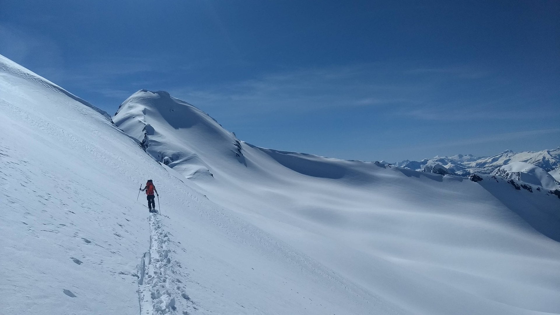
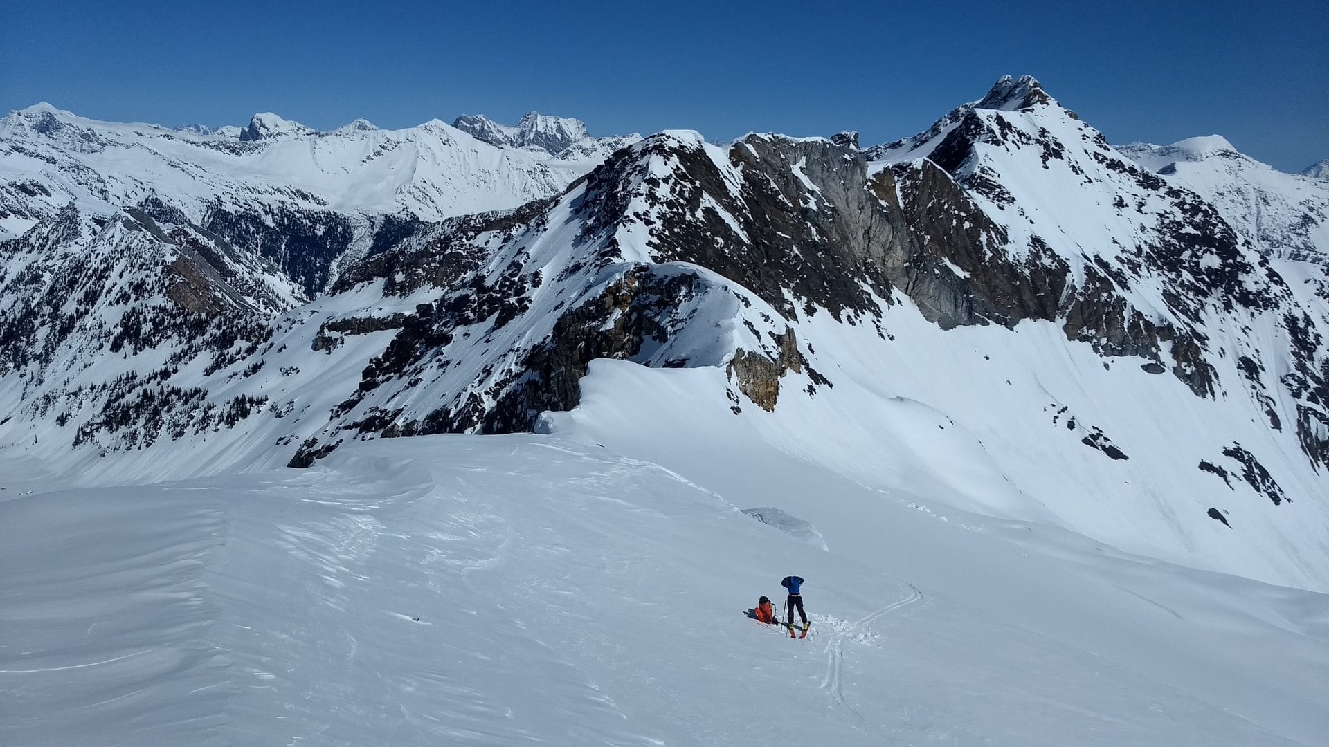
We donned our ski crampons to contour around the steep, icy western slopes of the Laforme Spire bowl. After a tiring bout of side-hilling, we climbed up the snow field north of Mt Laforme to an unnamed col at the top of its north ridge.
By mid-morning, we gained the north ridge col. After inspecting the vicinity, Freddy crossed over into a steep snow tongue while I settled on downclimbing a short rocky section leading into the slope west of the ridge. Both of our options were slow and arduous, especially with our heavy packs, but we made it. We skied down the west-facing slope, still frozen over and contoured around a subpeak to yet another col leading into the Elm Valley.
The initial beta recommended walking atop the ridge at the head of the Elm Valley. Given the seasonal conditions, there was no way in hell we could do that. Instead, we choose to traverse a long flat bench leading into a series of steep, narrow gullies topped by large cornices. We were trying to minimize our elevation loss. Yet again, we made a mistake and skied some wet soup at the height of the afternoon with a significant cornice hazard overhead and cliffs below. There’s no doubt that was sketchy. In hindsight, we should have dropped right from the col into the Elm Valley and climbed back up. In any case, after our excursion into the gnar, we skinned up a mellow ridge and hopped into a different drainage.
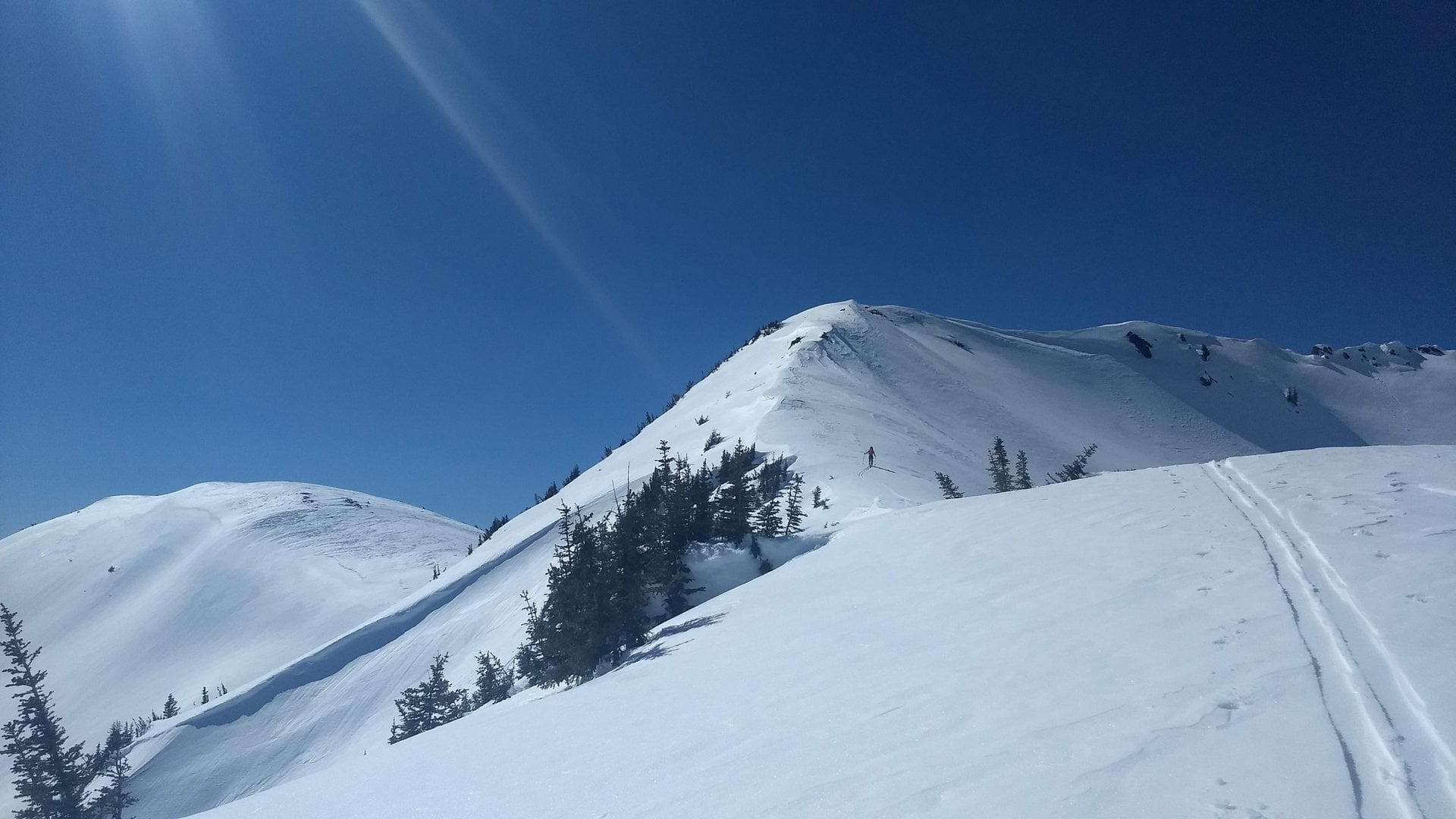
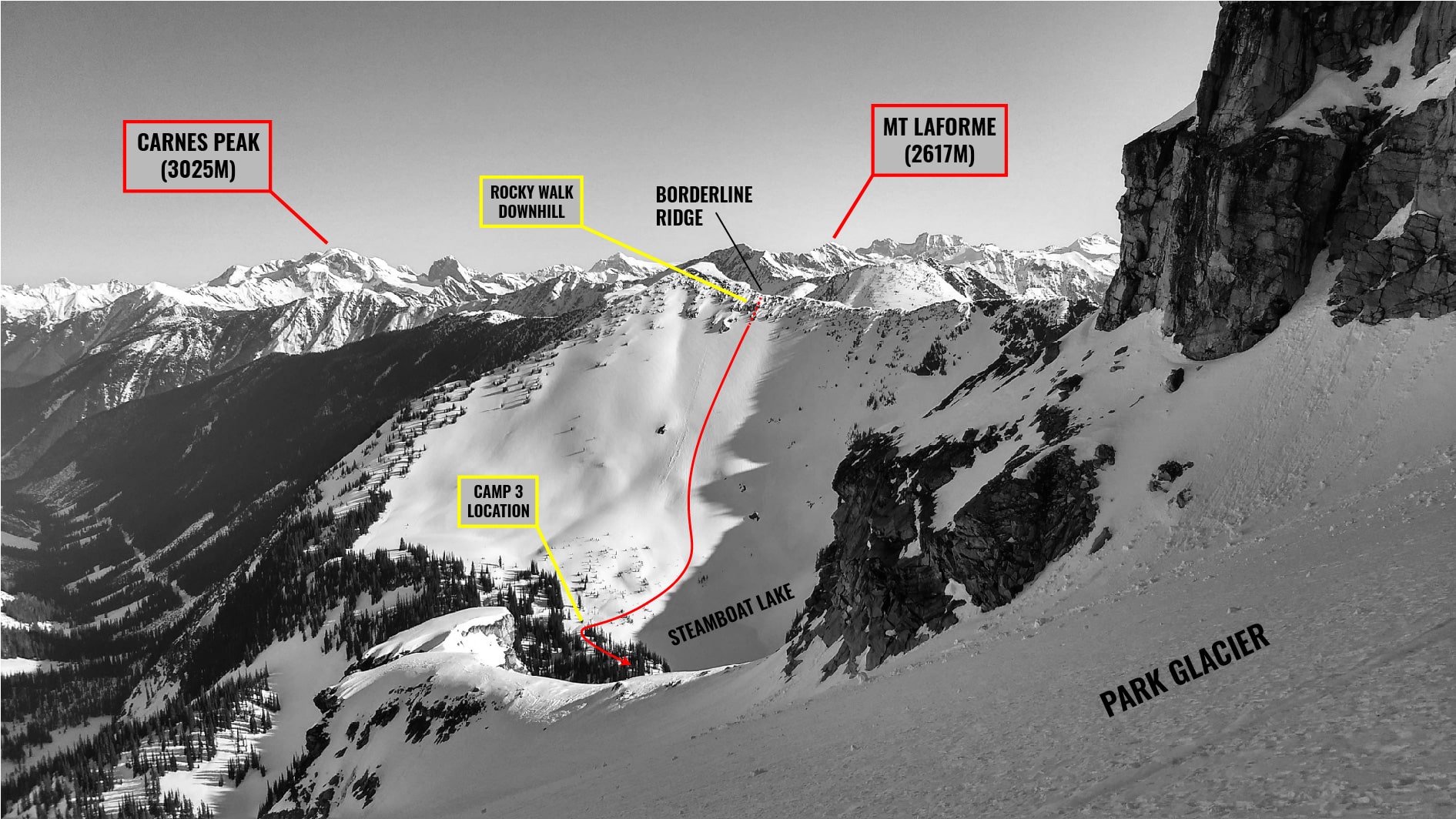
The rest of the day was of less interest. We followed a series of bumps along a very long ridge running generally south along Laforme Creek. Oftentimes, the ridge became quite complex so we dropped into the valleys on either side to circumnavigate the tricky sections. It was a hard day, mentally. By late afternoon, we contoured across the head of Maunder Creek and bootpacked up the same ridge (Borderline Ridge) that we’d been following for what seemed like an eternity.
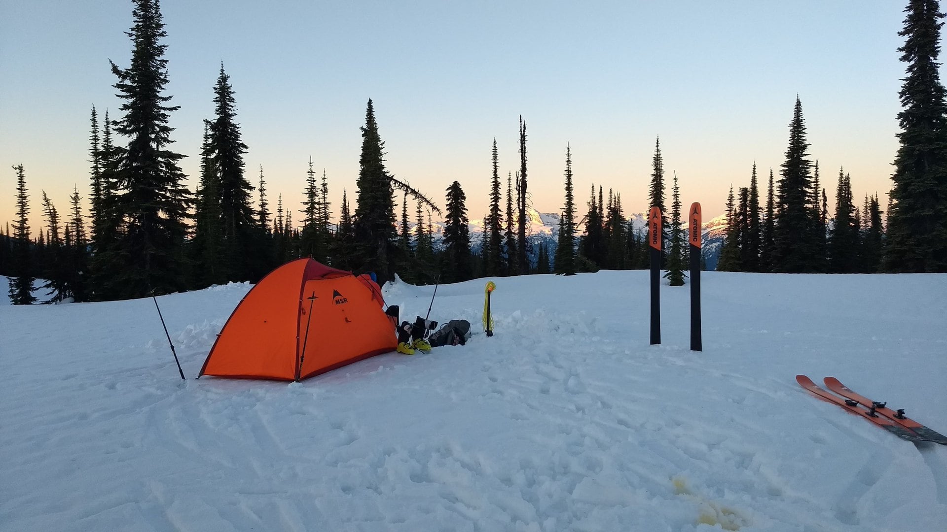
From our high point, we skied falline into a small alpine lake, Steamboat Lake, at the head of Laforme Creek. We set up camp in the shadow of Mt St-Cyr, looming over us to the south.
Day 5: Steamboat Lake (Mt St-Cyr) – Heather Lake
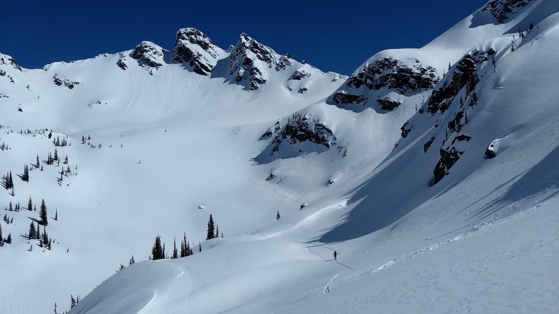
After tearing down camp, we crossed Steamboat Lake and approached Mt St-Cyr. What a beauty and a sight for sore eyes on the Bostock-Revelstoke Traverse! We climbed its north glacier rolling steeply into the Laforme Valley. We could see a faint uptrack, nearly erased by the winds, perhaps from a heli-touring crew. Within an hour, we gained the St-Cyr Col (west of the peak).
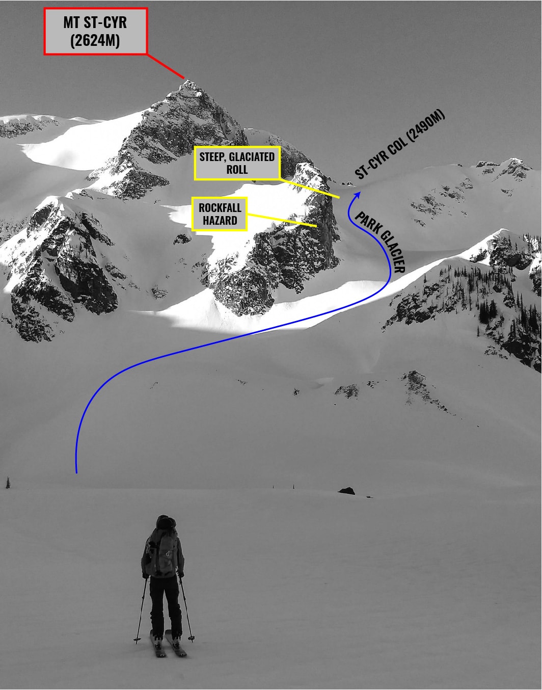
We took a snack break at the col while basking in the sunlight, which we had been deprived of since the day prior. We looked at the next section through the Woolsey Glacier past Mt Coursier, marking our entrance into the Mt Revelstoke National Park.
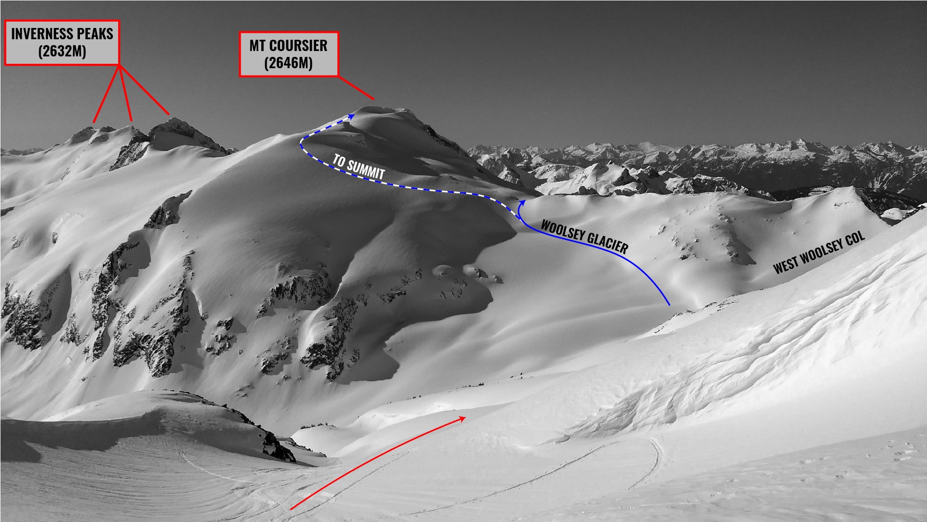
We skied down the south face in mid-morning corn and traversed towards the Woolsey Glacier. We dropped once more into Gordon Lake flanked by its pocket glacier. There really isn’t much left of it. We continued south toward Mt Coursier Col giving way to the Clachnacudainn Valley.

We contoured across the head of the Clachnacudainn and linked up with a bench above the Jade Lakes where we enjoyed a long break with incredible views of Mt Coursier, Harry and the couloir heaven that are the Inverness Peaks.
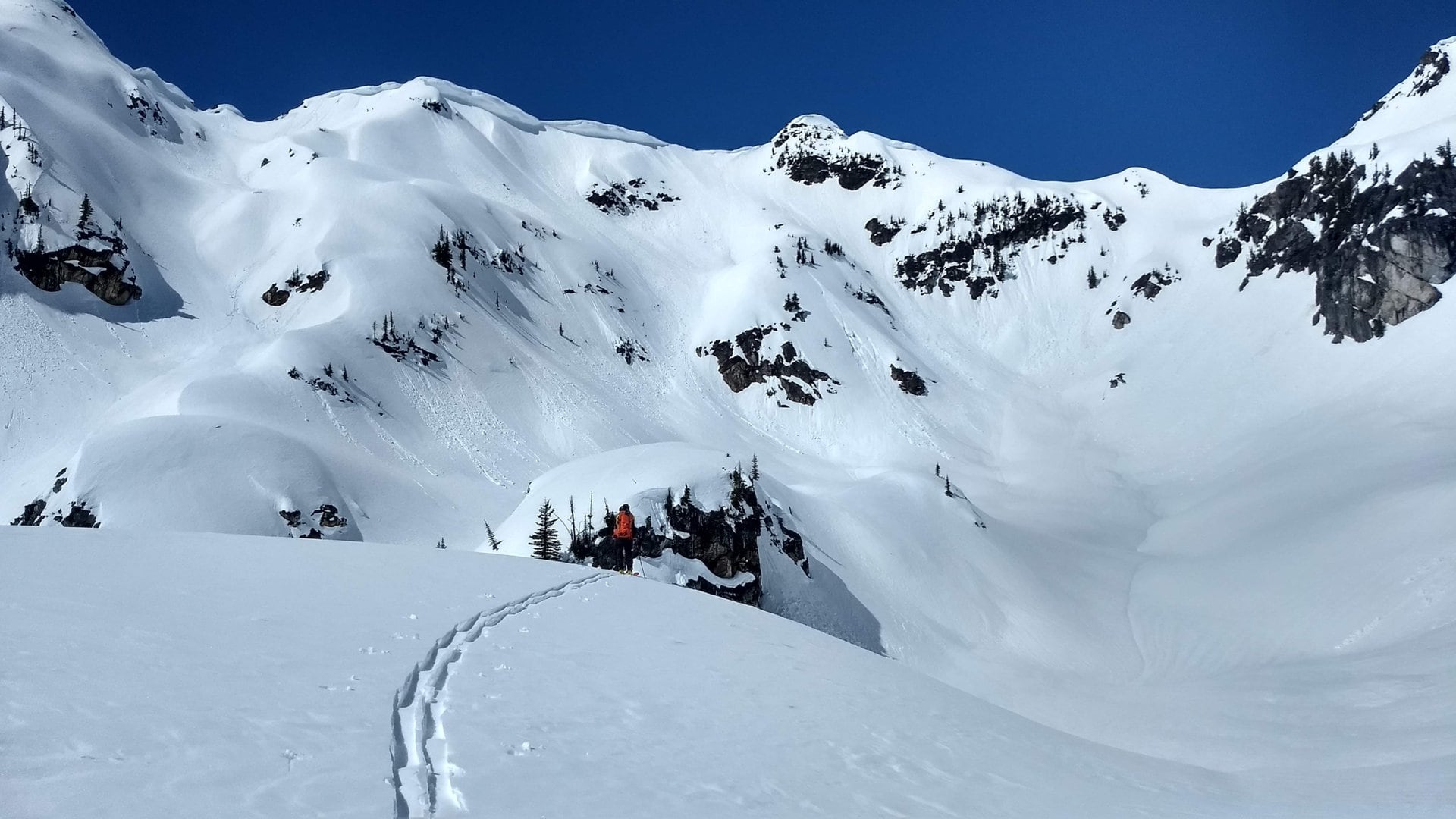
We side-hilled through the steep slope south of Mt Williamson and eventually gained Eva Pass, next to Jade Pass. This was familiar terrain that I had hiked in the summer using the Mt Revelstoke trail network.
We skied down to Eva Lake and followed the summer trail back to Heather Lake where we set up camp. By then, we had this winter camping game dialled.
Day 6: Heather Lake – Revelstoke
We woke up at sunrise. We took advantage of the cold morning to ski down the 26km of the frozen Meadows-In-The-Sky Parkway. Our final descent into Revelstoke was as fast as it gets. The road was covered by a thin layer of refrozen snow nearly all the way down to the park gates. Granted: we had to walk across 2-3 bare sections.
By 10 AM, we reached the park gates where we got a lift back to town, terminating our Bostock-Revelstoke Traverse.
Route Info
For more beta on my adventures, check out the Route Map. This online map interface is a repository of Beyond Our Peak’s published ski touring and mountaineering routes. It’s the best way to browse through trip reports. Give it a shot!
Pingback:How To Get Into Ski Touring (Backcountry Skiing) - Beyond Our Peak