I was shuffling through the legendary ski-mountaineering guidebook, Rogers Pass: Bootpacks, Uptracks & Bushwhacks, when my gaze stopped on the Southeast Couloir of Mt Afton, specifically the east variation. I studied the pictures for ages. I was captivated by that line. There’s something to be said about a mountaineer’s ambition: it only takes one good look to be enthralled by our goal, nearly to the point of intoxication. I had completed a nearly identical, albeit less exposed line west of the peak. The east variation was to be the perfect step-up. The Afton Southeast Couloir was steeper, dangerously exposed to avalanches and more technical.
This route is located within a Winter Restricted Area (WRA) governed by the Winter Permit System. Please check the WRA status before travelling through it.
Related: Forever Young Couloir: Skiing The Earth’s Crack
Report from February 3, 2020
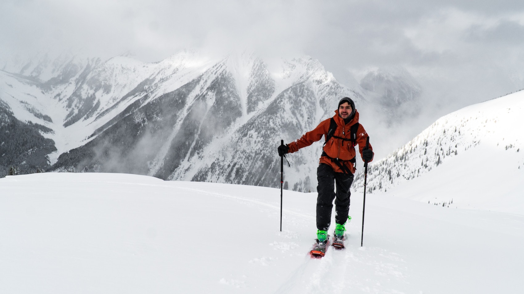
The bitter cold snapped me right out of my usual morning drowsiness, exacerbated by less than five hours of sleep. Today’s arctic blast was preceded by a week-long period of heavy rain which formed a thick rain crust up to 1800m. We knew Cedrik, George and I were in for a difficult ascent up the Mt Afton northwest ridge, known for its bushwhacks and steep incline. At every step, we stomped on our skis, beating a fragile step in the slope. When the ice became too hard, we resorted to walking up the forest, a first for me. Usually, bootpacks are only necessary in alpine terrain. This must have been the hardest uptrack I had ever set. Something that previously took one and a half hour now took three. Progress was frustratingly slow.

After much frustration and a snapped pole, we gained the Afton northwest ridge, scoured by yesterday’s record-breaking storm that generated 180 kph winds. Ironically, we swapped a rain crust for a rock-hard wind slab. Lucky us! The surrounding peaks were shrouded in low-lying clouds. Even then, the views were spectacular. I was just happy to share this moment with good friends and introduce them to one of my favorite areas of Rogers Pass.
We proceeded along the ridge, shielding our faces from the occasional gust. Only then did it get painfully cold. The sweat, produced when dealing with the rain crust below, was literally freezing between our layers. We interrupted our pace every few minutes to thaw our numbing fingers. With all the challenges ahead, we knew something good was waiting. We knew it was worth persevering for. We resumed our long walk, directed towards the Abott-Afton Col.

We kept our head on a swivel at all times as we were sniffing out potential hazards. The region’s avalanche forecasters called for stiff wind slabs and dangerous cornices, which is exactly what we observed along the way. We studied the north-facing headwall of Mt Afton, capped by oversized cornices. Our path would take us right beneath them. With cold temperatures and no solar input, we judged the risk was within our tolerance as long as the wind slabs were manageable. The hair-raising traverse definitely bothered our “spidey sense”, otherwise known as self-preservation instinct.
Cornice Hazard Fact
Fully knowing we couldn’t stop under the headwall, we sped through the wind-blown snow with dangerously cold hands and feet. We meant to minimize our time spent in the cornice’s crosshairs. Fortunately, we felt no cracking at all during the traverse.

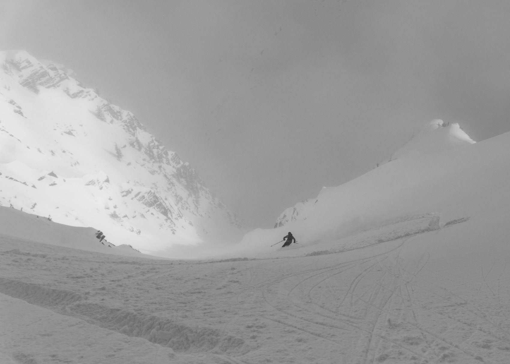
With the traverse successfully completed, one last obstacle separated us from the glorious powder beyond, a steep 100-meter long slope crowned by the Abbott-Afton High Col. We quickly gained the col and looked upon the Afton Southeast Couloir, stretching 300 meters below our feet.

The top of the couloir sported a slight convex roll bounded by two rock bands where the snowpack would potentially be shallower and hence weaker. This combination of terrain features combined with the forecasted wind slab hazard worried me. I asked Georges to ski-cut the entrance while on belay. If an avalanche were to release, the rope would prevent him from going for one last rocky ride. Thankfully, after two successive cuts, the snowpack held firm. And so, we skied the blissful powder… more than 30 cm of cold smoke.
We rode down the couloir filled with the lightest, driest powder imaginable. I’m currently reliving the run three days later and I am STOKED. We were greeted by a wonderful view of the Rampart, a wide ridge towering above the Asulkan Valley.

The run down to valley bottom was exceptional… until we were met by that devilish rain crust again, the source of all my troubles that day. We championed through the tough section and found our way back to the Asulkan summer trail, which I affectionately call the Asulkan Slog. After an hour of pushing along the nearly flat trail with a broken pole (remember?), we arrived at the Illecillewaet parking lot. We then skinned along the TransCanada Highway back to the Loop Brook car park, reminding me of the long walk back from Camp West. Ski touring at its finest: big mountains, shit snow and the ruckus of rumbling diesel engines.

Statistics
| Peak Elevation | 2438m |
| Vertical Gain/Loss | 1392m |
| Distance Traveled | 15.5km |
| Duration | 8.5h |
For more beta on my adventures, check out the Route Map. This google map interface is a repository of some of my ski touring, mountaineering and hiking adventures. It includes a loose GPS trace for your convenience.