The Wapta Traverse, or Wapta, as we call it, is a multi-day hut-based ski-touring trip that crisscrosses the Continental Divide, dipping into two protected areas, Banff National Park and Yoho National Park. Sounds like fun, eh? On top of traveling through two world-renowned parks, you cross two magnificent icefields, the Wapta and Waputik. It is usually completed in 4-5 days depending on your starting point. The traverse requires an intermediate level of skiing, excellent fitness, and prior glacier experience. If the altitude doesn’t get to you first, the crevasses will. As a general recommendation, think about hiring a mountain guide to assist you in completing the Wapta Traverse if your personal experience in alpine terrain is lacking.
You’ve got two alternate itineraries that both end at the Great Divide Lodge bordering the Trans-Canada Highway (Hw 1).
The Classic: Starting at the Bow Summit parking lot, you visit the Peyto, Bow, Balfour and Scott Duncan huts in that order. Note that some skiers skip the usually crowded Bow Hut and head straight for the Balfour Hut.
The Shortcut: Starting at the Bow Lake parking lot, you visit the Bow, Balfour and Scott Duncan huts in that order.
As for my group, we planned to stay two additional nights on the Wapta Icefield, one at the Peyto Hut and one at the Balfour Hut to bag some of the highest peaks in the region. The Wapta Traverse would span over six days of epic ski-mountaineering from dusk till dawn. We also choose to skip the Bow Hut.
Trip Report
Day 1: Bow Summit to Peyto Hut
Skip to the day’s itinerary map
I was as excited as I was intimidated by the Wapta Traverse. Spending 6 days at 2500+ meters on a vast blanket of snow, ice, and crevasses was a daunting endeavor. Fortunately, we would have the comfort of mountain huts on our side.


Report from March 14-19, 2020
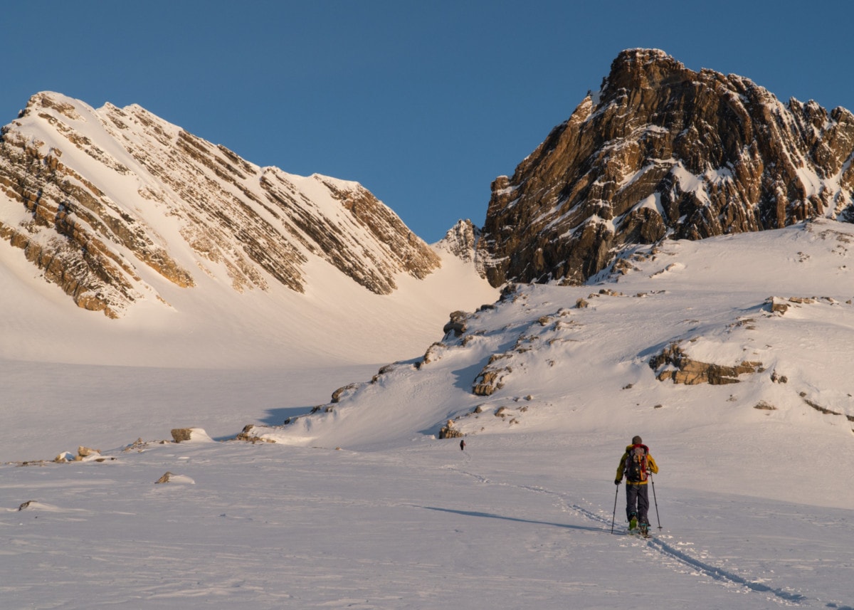
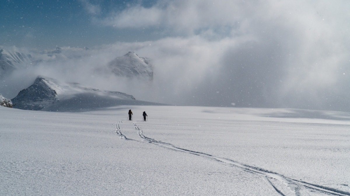
Joined by my favorite joke-slinger, Laurent and badass mountain chick, Kelsey, we pulled into the Bow Summit parking lot at an elevation of 2000m. That’s the beauty of touring from the Icefield Parkway: we get to skip the typical low-elevation bushwhack I have gotten accustomed to in Rogers Pass and even worse in Revelstoke.

From there, we skied down a sketchy hiking trail, zigzagging through the forested hills that surround Peyto Lake. Kelsey made her very own face print in the hard snow by somersaulting (face-first) with a fully-loaded pack as swing weight. Skin skiing is truly not for the faint of heart. After her rapid recovery, we crossed the frozen flats of Peyto Lake, fed by the glacial runoff of the Peyto Glacier, with no other humans in sight. The clouds were flying past Peyto Peak in the distance. Was a storm coming our way? The Wapta Traverse is known for sustaining awful weather at this time of the year.

Even at 2000m, it was getting seriously hot. We stripped down to our base layers while the weather was clement. It doesn’t help that we were carrying 50 lbs on our back. Streams of sweat were running down my back. We approached the hill behind which the Glaciology Stations was hiding. A quick snack break gave us a chance to properly scope out the terrain above. A long moraine led to a 40-degree north-facing planar slope with a nice convexity at its crest, the ideal avalanche terrain. Just as we were thinking of potential wind slabs, the wind picked up and cut our break short. Judging from the weather to our west, a storm was definitely rolling in. We cautiously climbed up the slope, feeling the snow with our poles.

We did find a few wind slabs on the way up, but they were quite stiff and supportive. We gained a wind-scoured ridge nearby where we donned our ski crampons. Soon enough, the crusty ridge turned to bare rocks. We finished the climb with a scramble through howling winds and thick fog. I’ve always been amazed at how quickly mountain weather can go from sun-out-guns-out to fear-for-your-life. With limited visibility, we felt our way through rocky outcrops, looking for our beacon of hope, the Glaciology Station. Fortunately, we had a handy GPS to guide us through the whiteout. After multiple detours, we rushed up the Peyto Glacier while battling the cold with frozen extremities.

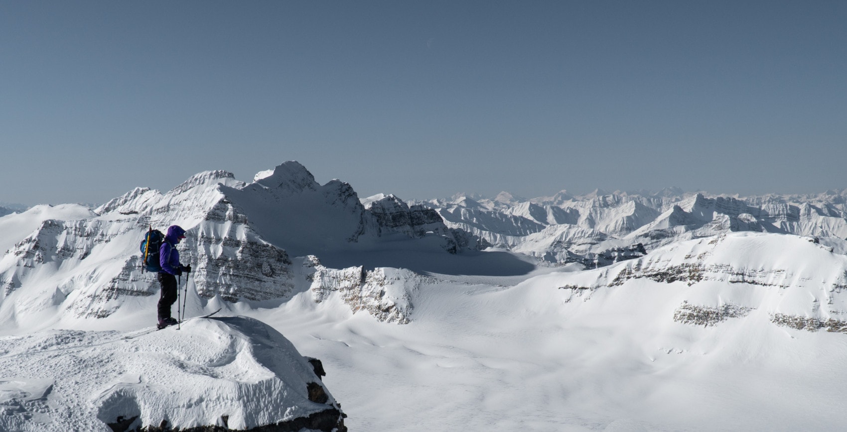
The crevasses were quite filled in after this very snowy winter. I probed a 320-cm snowpack depth on the glacier… and that’s because my probe is 320cm long. While we still had to watch for the gaping crevasses later in the trip, the news was quite a relief. We proceeded up the Peyto Glacier past Peyto Peak and Mt Thompson. I gazed at the distance where I could spot where the Wapta Traverse would lead us. What a sight!

5.5 hours after leaving the comfort of our vehicle, we arrived at the Peyto Hut, built at an elevation of 2500m. My heart was racing and my head was pounding, probably due to mild dehydration and altitude sickness. When the clouds parted later in the evening, the peaks gleamed under a setting sun, granting us a glimpse of the possibilities tomorrow. Just endless summits, all within our reach! We were all very excited, Laurent was very stoked… as always.

Since we would be spending an extra night at the hut, we were hoping to climb some of the nearby peaks. We jumped into trip planning mode and settled for mighty Mt Baker, the highest peak of the area toping at 3180m. I forced myself to sleep. Tomorrow’s ascent would test our endurance, both mentally and physically.
Day 2: Around Peyto Hut
Skip to the day’s itinerary map
We woke up to a gorgeous sunrise over the Wapta Traverse and an empty blue sky, a striking difference from the harsh weather we encountered yesterday.

The goal: ski the east slope of Mt Baker (3180m), 52 degrees of gnar. We knew what was waiting for us. The old wind-scoured shit snow would make things a little challenging for the descent. At the same time, we also had to watch out for stiff wind slabs and spontaneous cornice releases. To validate our worries, we spotted yesterday a slab avalanche triggered by a cornice fall. The likeliest cause was solar warming during the mid-march afternoon.

It took 1.5 hours to gain the Baker Col which rewarded us with a majestic view of the surrounding peaks. Yet more objectives in sight! The Canadian Rockies never cease to amaze me, especially near the Wapta Traverse. But this was the easy part. Our day’s work wasn’t quite over yet. The ridge ahead would prove to be a worthy obstacle.

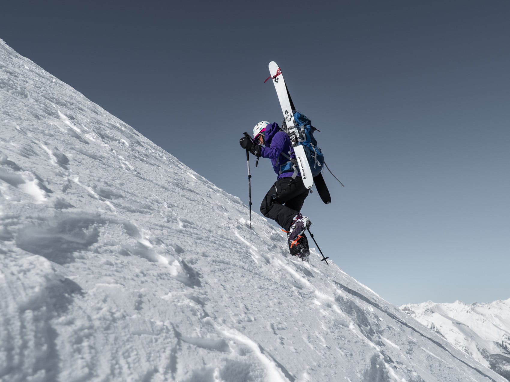
With crampons and ice axe out, we proceeded up the NE ridge of Mt Baker, consisting of a steep slope leading up to a knife-edge ridge. Not quite acclimatized yet, my head was pounding. I stopped several times for a breather. Kelsey and I alternated leading while Laurent was getting used to his brand new crampons. I’ve got to give him credit for doing all the work with flexible snowboard boots and flimsy crampons, a terrible combination for front pointing.
We stopped mid-way up the ridge once we had a good look at our ski run. Laurent spotted an entrance between two large cornices that would require some trenching before being safe and maybe a rappel. While not mandatory, it would reduce the risk of losing an edge when dropping into the line.

We continued up the ridge, one step after another. My heart was beating as fast as it could. The remainder of the ascent, although covered with loose faceted snow, wasn’t as difficult as I had anticipated. We gained the summit at around 1 PM as the sun was beaming. The view of the Wapta Traverse was exceptional. The warming cornices, not so much.

We wandered on the summit, looking for the entrance we spotted from below. Things are always different when viewed from the top. We were ultra-aware we might be standing on a cornice. After a bit of lollygagging, we found the entrance at which point we dug a sloping trench. The corridor would facilitate our entry into the steep slope below as well as reduce the likelihood of triggering a cornice. I call that good cornice control work. Judging from the sastrugi glazing our run, the skiing would be terrible. I was anxiously expecting a rough descent.
All my fears were confirmed. The run was exceptionally atrocious. The mix of variable snow and wind crust made the skiing very touchy. I almost lost an edge midway down as I was crossing over an exposed rock band. There really is nothing better to get the heart racing.

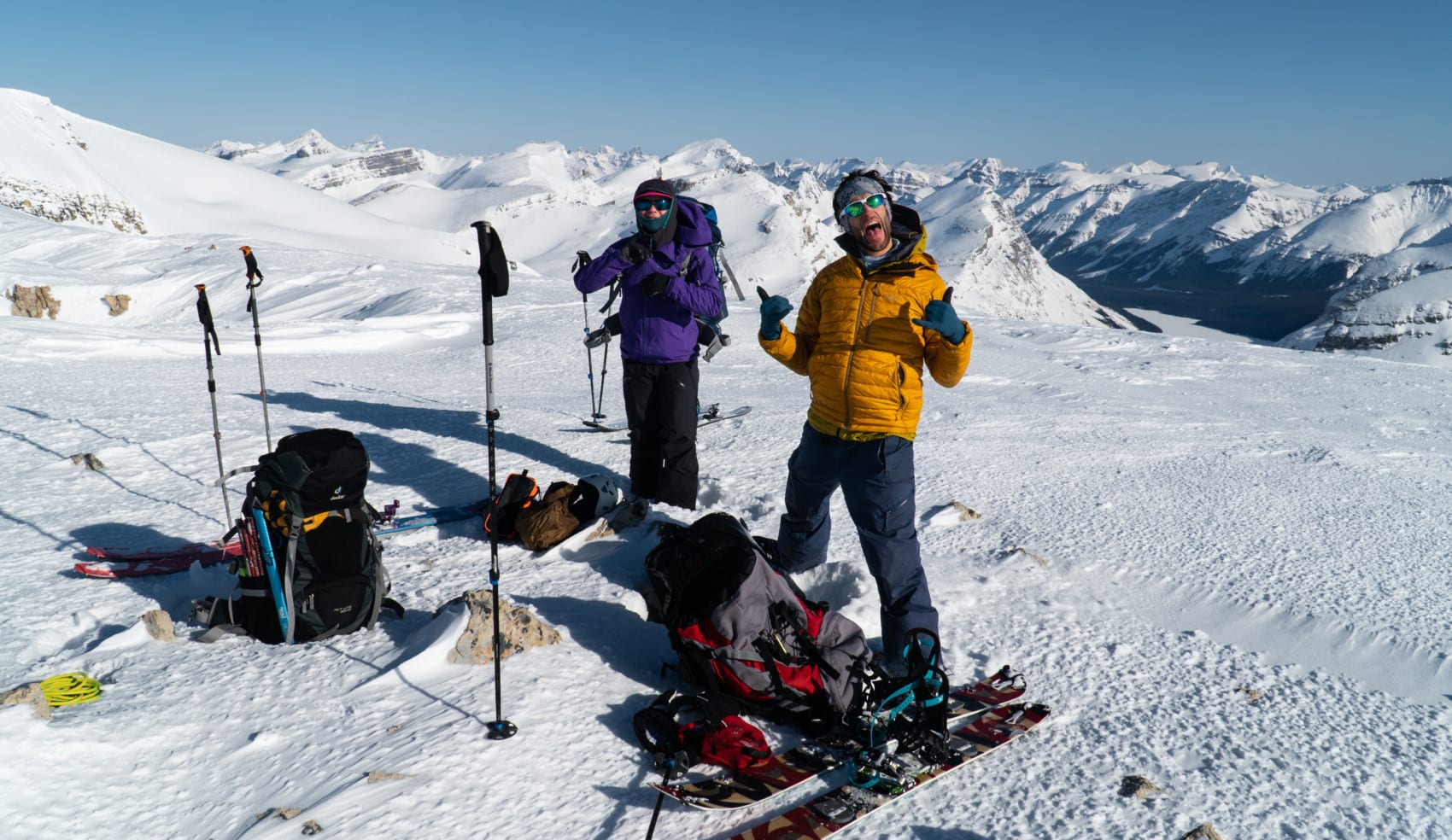
After this thrilling run, everything else seemed like a joke. We casually strolled back to the Peyto Hut, the first stop of the Wapta Traverse. Kelsey, who runs a distillery back home, brewed a hot salty broth. Not that the operation is very complicated, but I wanted to include her life’s story in this trip report. I thought it added some cool factor to the adventure.
Day 3: Peyto Hut to Balfour Hut
Skip to the day’s itinerary map
We were gearing up for a long day in the alpine beauty of the Wapta Icefield. Skipping the Bow Hut meant bagging Mt Rhondda (3062m), Saint-Nicholas Peak (2938m), and Vulture Peak (2957m), all in a single day. We were in good shape and the crew felt pretty jazzed up about of bagging a bunch of peaks. On my end, the pounding headaches were but a distant memory! We were unstoppable. As the early morning winds were sweeping the barren landscape, we stepped out into the dire cold of the Alberta Rockies and continued our Wapta Traverse towards the flat-topped ridge of Mt Rhondda.

As we approached the summit, we weighed our two options:
- We could climb looker’s left, following a natural ascent path along the gentle ridge
- We could walk straight up the middle of the ridge, going over a steep convexity. This path would considerably shorten our distance, but expose us to possible wind slabs along the way.
Officially, the avalanche hazard was at “moderate” in the alpine with possible wind slabs on all aspects (surprise, surprise!). However, from our findings in our specific terrain, we concluded that the slabs were very supportive and stubborn to trigger. It was worth the risk. We all agreed to get closer to the convexity and assess the snowpack at that point.

I approached the slope from a safe angle and started probing the area and performing a hand shear test. I identified a supportive 5cm-thick wind crust on top of a rather dense snowpack. Nothing to worry about. We raced up the convexity probing the snow for possible crevasses along the way.
After stashing some of our gear next to a rock mound, we headed up the flat ridge until we reached the summit of Mt Rhondda. The scenery seemed like a seamless painting of vast mountain range below and a deep blue sea above. I couldn’t resist the urge to snap a few photos. Interestingly, we spotted ski tracks snaking down the crevasses of the Collie Glacier, midway through the Bow-Yoho Traverse that Laurent and I completed in 2019. This one takes a path perpendicular to the Wapta Traverse.

We stayed a few moments longer at the summit and headed back to the spot we stashed gear. We pressed on towards our next objective: the Saint Nicholas col. From the top of the ridge, we could see, past the Bow Glacier, a collection of summits most of which we would climb at a later point.
To be honest, navigation on the Wapta is as straight-forward as it gets… under good weather. Walk from point A to point B, bag a few summits along the way, and avoid crevasses like the plague. For the most part, it’s possible to minimize exposure to avalanche terrain through careful route-finding. Mind you, I recognize it can be very daunting for the inexperienced or when the weather turns for the worst. Again, I cannot reinforce the importance of hiring a certified mountain guide from local outfits such as Yamuska which frequently organizes the Wapta Traverse. Those guys know the itinerary by heart and can navigate the glaciers in a whiteout with their eyes closed.

After an hour of catching up to Kelsey who was racing across the Bow Glacier, we arrived at the foot of the col. I stared in awe at the striated headwall of Saint Nicholas Peak. What an imposing beauty of a mountain and one hell of an exposed scramble to its summit from the col! I was certainly looking forward to conquering it.

The ascent up the col was extremely simple. We then walked the knife-edge ridge towards Saint Nicholas Peak, just to get a good look at the final pitch to its summit. From our angle, it looked vertical and extremely exposed. At first glance, we believed it wasn’t safe at all without some kind of belay. We didn’t bring the necessary gear, specifically snow pickets. When all hope was lost, I zoomed in on one of my close-up photographs. A closer look revealed a way up. Perspective is so different from afar. Since our time budget was tight, we decided to shelve the summit for tomorrow.
We pressed on towards Vulture Peak, another mountain to complement our repertoire. Some call it a peak, I call it a hill. While very mellow, we knew it would offer good skiing… finally.

As expected from such a simple peak, the ascent was straight-forward. A few switchbacks later, we reached the top amid uncomfortably strong glacial drafts. We quickly transitioned for skiing. I expected wind-blow conditions as well as a typical Rockies crust, similar to conditions found on the flank of Mt Baker. Oh, was I wrong! We were rewarded with 20cm of dry fast powder over a rock hard base. Perfect for some aggressive powder carving. This was by far the best snow we’ve had all trip. Skiing Rogers Pass all season made me forget that powder snow is a blessing, an uncommon occurrence in other parts of Canada. This is why I moved to Revelstoke, BC, in the first place.

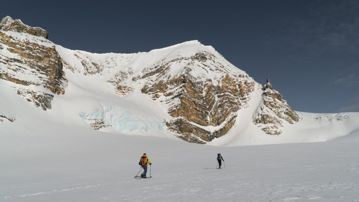
With renewed vigor and a bit of pushing, we skied the gentle, downward incline of the Vulture Glacier towards the Balfour Hut, a cozy refuge at the foothills of Mt Balfour, the mightiest peak of the area. We choose it for our day 5 objective. On the way down, I scoped out its glacier. With seracs looming over it and large crevasse fields breaking up its flow, the Balfour Glacier is the crux of the Wapta Traverse and naturally requires expert navigation skills.

At the hut, we were greeted by two families with 10-12-year-old kids. Children! Completing the Wapta Traverse with their family in four days with tiny skis, hand-made skins, and on-frame bindings. What the hell! If I were to do the Wapta at that age, I would be climbing Everest by 18. In any case, I was impressed by their calm demeanor which quickly dismissed my fears of a sleepless night.

Our day ended with a ball of fire that vanished behind Mt Gordon. The alpine sunset was mind-blowing, adding to an already perfect day in the mountains. The sun painted a soft orange glaze over the white blanket of snow. Such beauty makes us temporarily forget about our problems, an idyllic escape to our overly complex lives.
Day 4: Around Balfour Hut
Skip to the day’s itinerary map
We woke up to an epic sunrise… for the third time on our Wapta Traverse. The mountains were of an oversaturated pink. No photo could ever do it justice. As for the skies above, we couldn’t have asked for better weather. A high-pressure system was lingering over the Rockies and would hold until tonight. This meant bad news for tomorrow’s climb up the Balfour Glacier to the High Col. Hopefully, the clouds would be high enough for us to safely wind our way through the crevasses and icefalls. Fingers crossed!

An efficient breakfast consisting of oatmeal and yet more oatmeal brought my little engine up to operating temperature – it takes a while for my body to wake up in the morning. We climbed back up the Vulture Glacier, hoping to conquer both Saint Nicholas Peak and Mt Olive (the north and south summits) starting from the col we crossed yesterday. The plan was to ski the west slopes from the Olive Col and dip back onto the Vulture Glacier through the Vulture Col, leading into a wide couloir, sporting an incline of 45-50 degrees. Taking the Vulture Col instead of the Saint-Nicholas col is a more engaging, albeit more difficult alternative to the Wapta Traverse. Attempt only during periods of good snow stability.

Since we weren’t 100% sure the couloir was skiable, we would approach it from below. At first glance, the couloir was a definite go but there was a chance we could hit some wind slabs on the way down, due to yesterday afternoon’s strong winds and the slope’s sheltered nature. We knew we would have to carefully assess the slope before dropping in.
We veered climber’s right, passing below Mt Olive as we were heading towards the Saint Nicholas Col. The gentle climb was harder than I thought. I was falling prey to my usual morning grogginess and most likely some accumulated muscle fatigue over the last few trying days. I’m like a diesel engine: it takes a while to warm up, but, once I’m at temperature, I will push hard and steady.
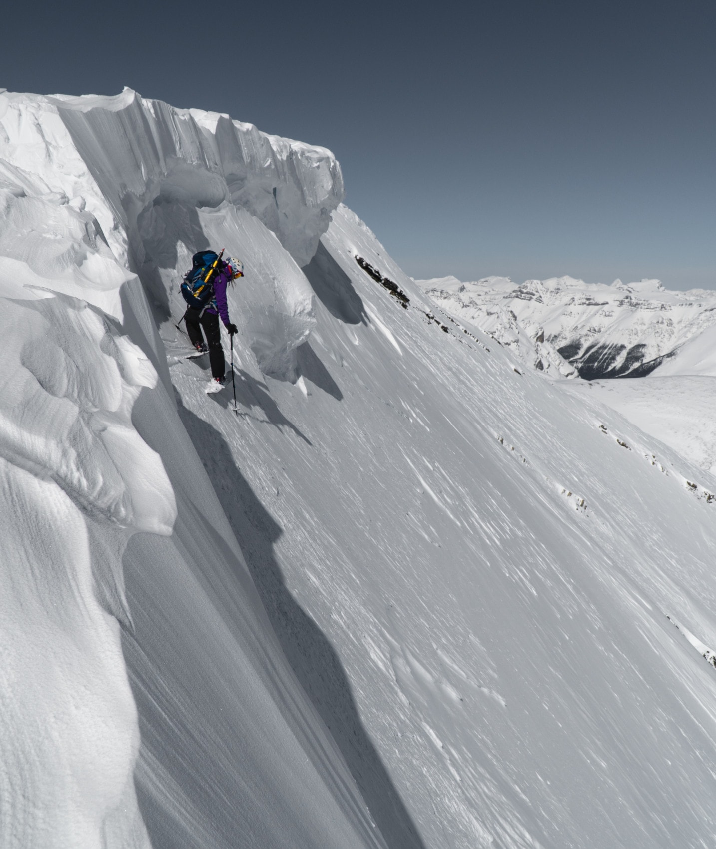
An hour later, we reached the col at which point Kelsey and Laurent stashed their packs for the ascent of Saint Nicholas Peak. Our crampons and ice tools made quick work of the exciting boot pack. The trail hugged a towering headwall on our left and a super-slick slope, on our right. The vertigo was real… as was the exposure.

While we invested very little effort into the short scramble, it still rewarded with an otherworldly experience. Saint Nicholas Peak was high on my list at the time. I vowed to revisit the peak when its steep east face would be in condition for a ski descent. We looked back at our tracks with much satisfaction, especially after postponing the climb yesterday.

Back on the Wapta Traverse itinerary, we backtracked to our closest neighbor, Mt Olive. The climb was exposed at times but easily manageable with the proper ice tools. With high spirits, we reached the north summit which granted us a gorgeous view of the Balfour massif. I scrutinized the Balfour Glacier, preparing for tomorrow’s ascent. Kelsey pressed on while keeping a safe distance from the large cornices to the northeast.
After a bit of scrambling, we gained the south peak, the true Mt Olive at an elevation of 3126m. Laurent peered over the ridge to the south searching for a decent view of the Vulture Col. He looked down upon the hair-raising couloir, 200m below. From our angle, it definitely looked challenging. After travelling this far on the Wapta Traverse, we were up for it.

After a 15-minute break, we then double-backed to the Olive Col where we dropped into the west bowl. The snow quality varied from sheer ice to shallow powder. It didn’t stop Laurent from launching party tricks on the way down. A few fancy rotations later, he made it to the bottom of the bowl.

Now on to the final step of the day’s adventure: a straight shot to the Balfour Hut. We moved on to the Vulture Col nearby. I ditched my skis and downclimbed to the entrance for a quick survey of the slope. I needed to get a grasp of the conditions before dropping in. Surprise, surprise! It was crusty as hell. Great for snow stability. Horrible for skiing, a small sacrifice for our safety. I’ll take it. After all, I planned on completing the Wapta Traverse for the views and the mountaineering, not for the skiing. It’s really one long walk.

Drained by a long day of exploration, we glided down the Vulture Glacier back to the Balfour Hut. The complex slopes of the Balfour Glacier, part of the Waputik Icefield, lay across the valley. I took a mental snapshot of the scenery, onto which I overlaid tomorrow’s itinerary. Visualizing my route helps me plan the day. It also gets me really stoked for the adventure to come. This was going to be an EPIC!

Day 5: Balfour Hut to Scott Duncan Hut
Skip to the day’s itinerary map
We woke at the same time and peered out the small window from the comfort of the Balfour Hut. Today’s weather was best described as “atmospheric” – mountain guides frequently use colorful words to describe the weather conditions, such as “temperamental”, “emotional” or “spicy”. The clouds were hovering just below the High Col. Still, visibility was adequate for safe travels if the weather holds. After all, mountain weather is known to be a temperamental beast.
Here’s the plan. We would first scale the toe of the Balfour Glacier and traverse beneath the large seracs on Mt Balfour under the cover of an elongated crevasse field. Once past that point, we would climb a choke between a cliff and the aforementioned crevasse field which brings us dangerously close to possible icefalls (from collapsing seracs). We’ll then make short work of the glacier’s upper portion, zigzagging between the remaining open crevasses. And just like that, we would cross the Balfour High Col, toping at around 3000m. If the weather is in our favor, we would attempt to bag Mt Balfour, highest of the Wapta at 3284m. The whole endeavor reminded me of my previous excursions on the complex glaciers of Chamonix which required equally careful navigation.

We left the hut at 7:30 AM with ropes coiled around our torso and a bunch of dangly bits hanging by our harnesses. We climbed the toe of the glacier as the sun was slowly rising above Mt Hector, a distant giant. The warmth of the sun caressed our haggard faces for a mere moment before we stepped in the shadow of the towering cliff ahead. It was windy and cold. While painful to us, the cold would preserve the serac’s integrity and the snowpack’s stability.
We traversed under the crevasse field which shielded us from possible icefall on the flanks of Mt Balfour. Theoretically, the large gash would capture debris barreling down the sheer face. I clipped my extended probe to my harness as I knew I would be probing often today The probe would help me find hidden crevasses. Thankfully, snow conditions were pretty stable. I still had my avalanche radar on but didn’t have to tip-toe up the slope.

I was trail-breaking at an unsustainably fast pace, to reduce our time spent under the seracs looming overhead. Coupled with the challenging weather, I was thoroughly drained by the time we reached the relative safety of the upper, mellower glacier. I caught myself looking back frequently at the imposing seracs, snapping the odd photo. My freezing hands could barely operate the buttons.

A short stint later, we gained the Balfour High Col where the visibility was slowly improving. Unfortunately, Mt Balfour was still shrouded in dense clouds. The reality dawned upon me. There was absolutely no point in pushing for the summit we have never climbed in zero visibility. Today was not the day for some serious peak bagging.
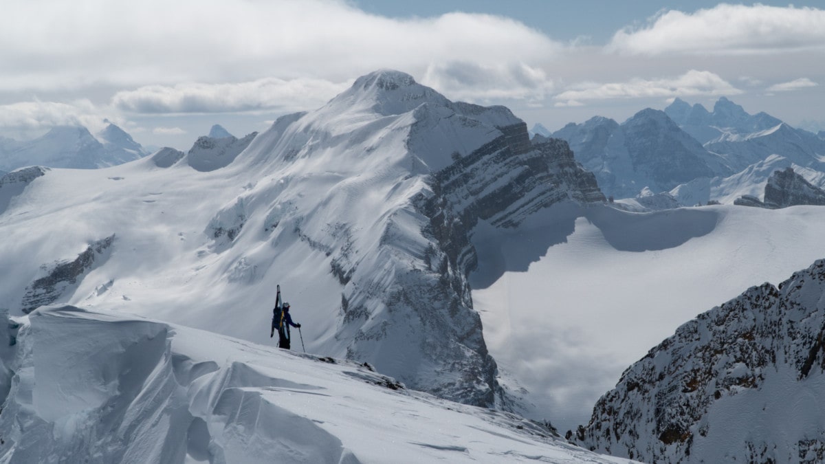
We crossed over from the Balfour Glacier to the Daly Glacier and carried on to Lilliput Mountain (2925m), a smaller peak bounding the eastern end of the icefield.

Lilliput mountain, shrouded in clouds. Taken from the Balfour High Col. Photo: Beyond Our Peak 
The crew, bootpacking up the Liliput ridge during a short break in cloud cover. Photo: Beyond Our Peak

After a sketchy ski descent where I blew an edge on a buried rock, we made it to the slopes of the Scott Duncan Hut The refuge had by far the best location. Looking over the flats of the Daly Glacier, it rested on a rocky bench at the foot of Mt Daly, one of the area’s most captivating peaks. Its perch also granted us an uninterrupted view of the surrounding valleys, making for one of the best sunset spots on the Wapta Traverse.

We stripped down to the bare essentials for one last mountain climb. We had decided to climb Mt Daly since we didn’t get to summit Mt Balfour. It took no time at all to convince Kelsey to jump back in her wet liners after she had already settled into the hut life. With ice tools and crampons on, we ascended the scoured western slope in the afternoon. It felt damn good to break up ski touring with some proper mountaineering.

Kelsey, front pointing up the Daly west face. Photo: Beyond Our Peak 
Laurent, carefully digging his crampons in the snow on Mt Daly. Photo: Beyond Our Peak


Higher up, we were stopped by a seemingly impassable cliff band. Kelsey veered left and then right, looking for an alternate way up. Alas, the left extremity ended up in an exposed climb topped by a cornice. This wasn’t an option even with a belay. When all hopes for a summit was almost lost, she ventured left where she found a pencil couloir. Our crampons made short work. All credits to Kelsey’s mountain sense for this one.
At 4 PM, we gained the false summit of Mt Daly after a frustrating swim-up facetted snow. The true summit was better left for a summer excursion. The skies were clear for the most part and rewarded us with a 360-degree view of the glaciers below and, most importantly, a clean shot at Mt Hector, a mountain I was looking forward to bagging later in April/May.

The descent was a slight bit hairy by my standards as we were creeping down the 45-degree slope. The prominent cliff right below us justified the snail’s pace. In the meantime, Kelsey was comfortably running down the face. This woman is completely devoid of fear. The afternoon’s excitement terminated with a hearty supper consisting of cliff bars and dehydrated meals. We enjoyed a warm cup of hot cocoa under the evening light, our last alpine sunset of the trip. Hopefully, many more to come.

Day 6: Scott Duncan Hut to Great Divide Lodge
Skip to the day’s itinerary map
We woke up at the wee hour of the morning. I was dreaming of a piping hot shower and certainly not looking forward to slipping in my moist liners in -25C weather. To make matters worse, the Scott Duncan Hut is small and has virtually no ventilation. Crammed with nine smelly backcountry skiers, it wasn’t all roses and daisies.
After our usual morning breakfast routine, we skied down the foot of Mt Daly and headed for the “Pyramid”, a cone-shaped peak that indicates the start of the Niles Drainage. We followed Niles creek where Laurent and I both face-planted. I bit cleanly through my tongue. Blood, so much blood. It seemed like some hopeless chap was murdered this very day. We skied down a mix of the worst bulletproof crust as I was drowning in my own blood. I would rather describe the descent as controlled slippage. Our progress was painfully slow.

By the end of the creek, I couldn’t feel my toes and knew the frostbite had already settled in. I wiggled them non-stop for half an hour to get a semblance of blood flow going. After billy-goating down a frozen waterfall, we arrived at the confluence of the Niles and Sherbrook Creek leading into Sherbrook Lake. We knew we were close. A toboggan track meandering through the sparse forest dumped us right behind the Great Divide Lodge, marking the end of our EPIC journey. Somehow, I wasn’t quite done yet. I wanted more of it, the thrill of exploration.

The overwhelming mix of the day’s frustration and physical exhaustion morphed into a deep sense of accomplishment. That’s the greatest thing about ski mountaineering. Successfully enduring the suffering triples the reward, the satisfaction of pushing your mental and physical limit.

NOTE: For future reference, I heavily recommend taking the Sherbrook drainage down if snow conditions are bad. Following Niles Creek was hairy at times.
Statistics
| Day 1 | Day 2 | Day 3 | Day 4 | Day 5 | Day 6 | Total | |
|---|---|---|---|---|---|---|---|
| Highest Point (m) | 2498 | 3177 | 2756 | 3117 | 3128 | 2684 | 3177 |
| Vertical Gain/Loss (m) | 764 | 752 | 1046 | 1052 | 1221 | 137 | 4972 |
| Distance Traveled (km) | 11.3 | 6.5 | 16 | 12.6 | 11.3 | 12.9 | 70.6 |
| Duration (hrs) | 5.5 | 6.5 | 8.0 | 8.5 | 9.0 | 5.0 | 42.5 |
For more beta on my adventures, check out the Route Map. This map interface is a repository of some of my ski touring, mountaineering and hiking adventures. It includes a loose GPS trace for your convenience.
Day 1 – Blue, Day 2 – Purple, Day 3 – Green, Day 4 – Yellow, Day 5 – Red, Day 6 – Black