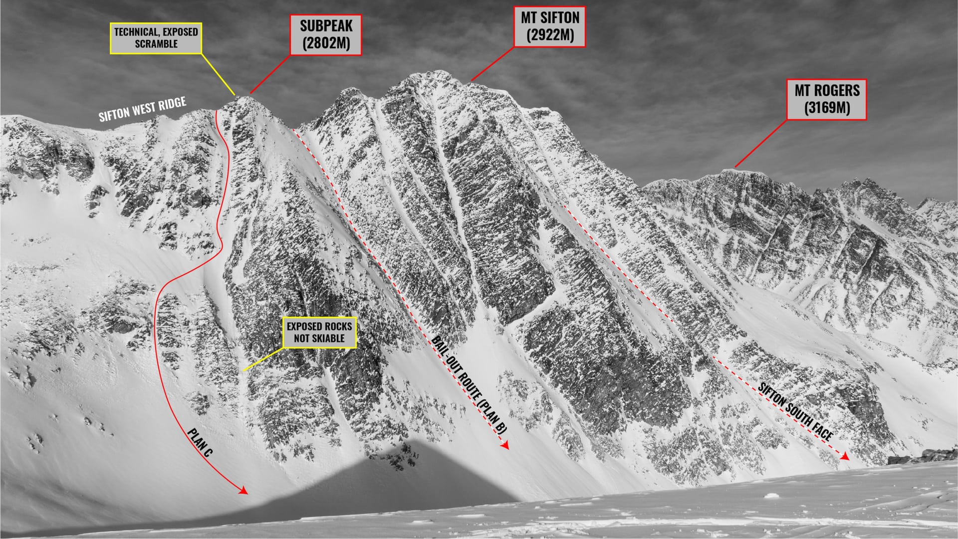
The Sifton South Couloir, or rather our “creative” variation on the ski-mountaineering classic, is a hell of a spicy line. To say the truth, it was our backup of backups, our plan C, after an ultra-exposed scramble ground our progress to a halt. While we opted to ascend the west ridge of Mt Sifton – conquered in 2020 through its more technical southeast ridge – an easier option might be to bootpack straight up the south face given good snowpack stability. As for the line itself: if the hidden rocks don’t destroy your bases on the way down, the occasional ice and power-sluff might send you barreling down the couloir. Its steep incline (upwards of 50 degrees) is not to be trifled with. As you might have realized, the entire couloir is a no-fall zone. Hanging over a serious cliff band, you either ski the line flawlessly, or you don’t make it. A tumble here would most likely be fatal…
This route is located within a Winter Restricted Area (WRA) governed by the Winter Permit System. Please check the WRA status before travelling through it.
Related: Swiss Couloir, Rogers Pass: 50 Degrees of Gnar
Report from February 10, 2021
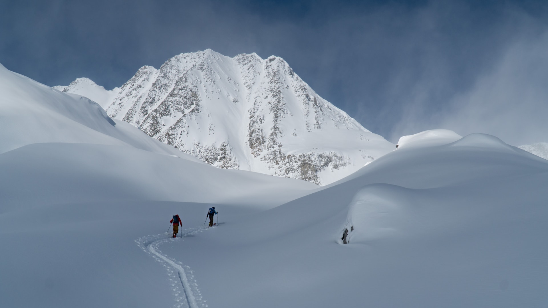
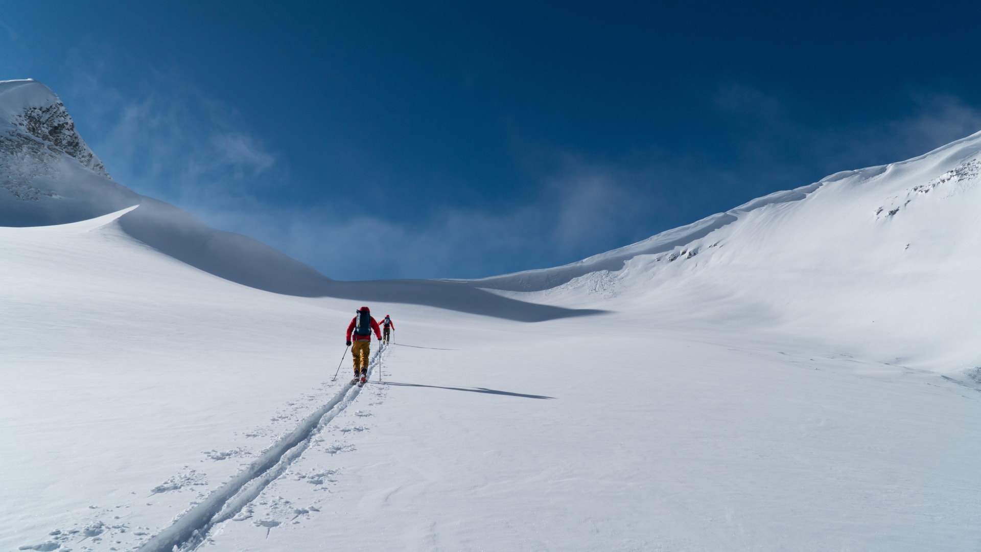
It was -23C in the alpine. Jeff, Freddy and I crawled into our warmest layers and headed out of the Hermit Parking Lot, at the bottom of – you guessed it – the Hermit drainage. We toured up the steep, icy switchbacks of the Hermit Meadow trail flying past an enormous pillow field that seemed to have appeared out of nowhere. Within 90 minutes, we were up at 2100m, standing on the buried wooden platforms of the Hermit Meadows Campground. In retrospect, we should have gone directly up the Grizzly Path instead of following the well-trodden uptrack to the Rogers Peaks.
Hermit Parking Lot Fact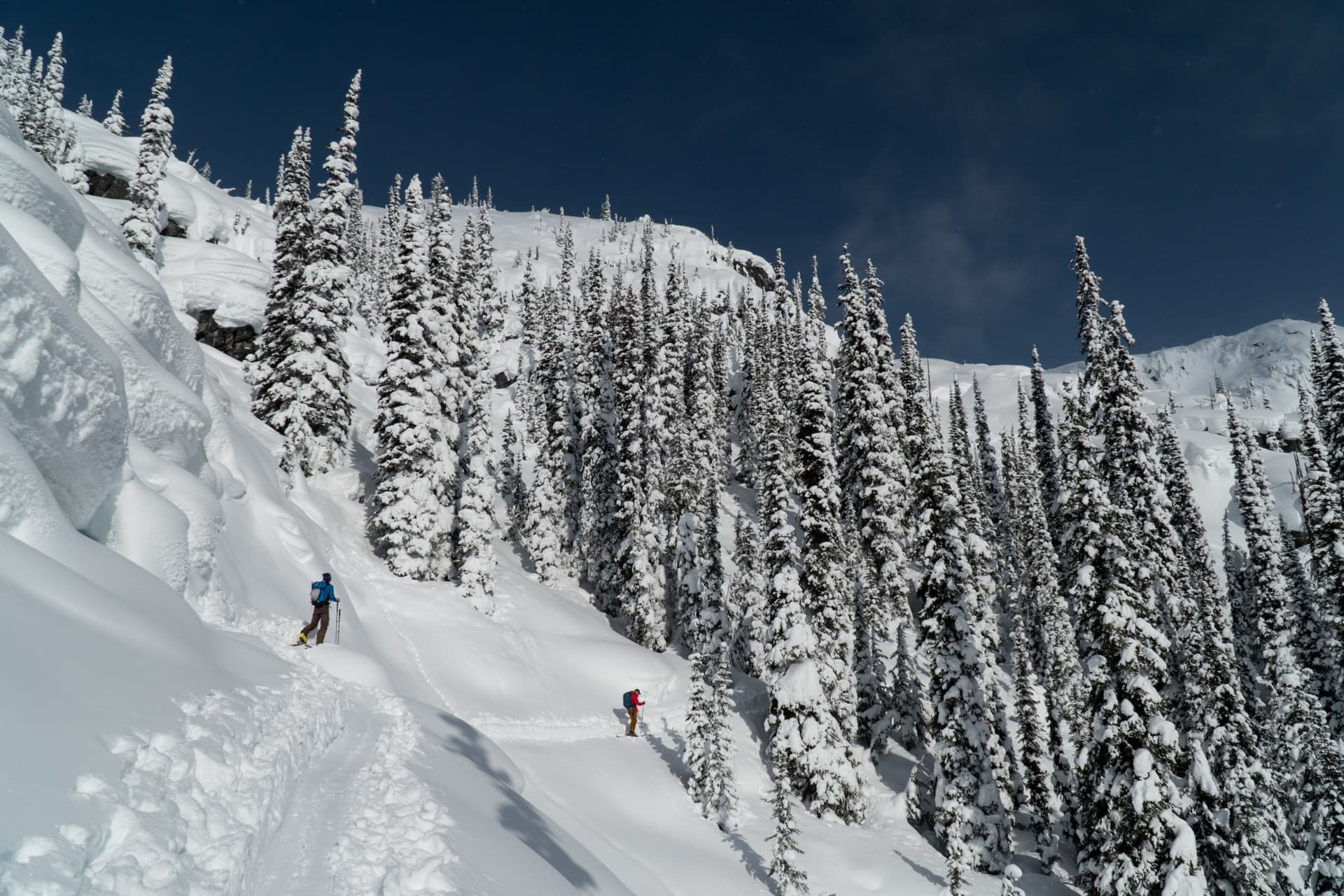
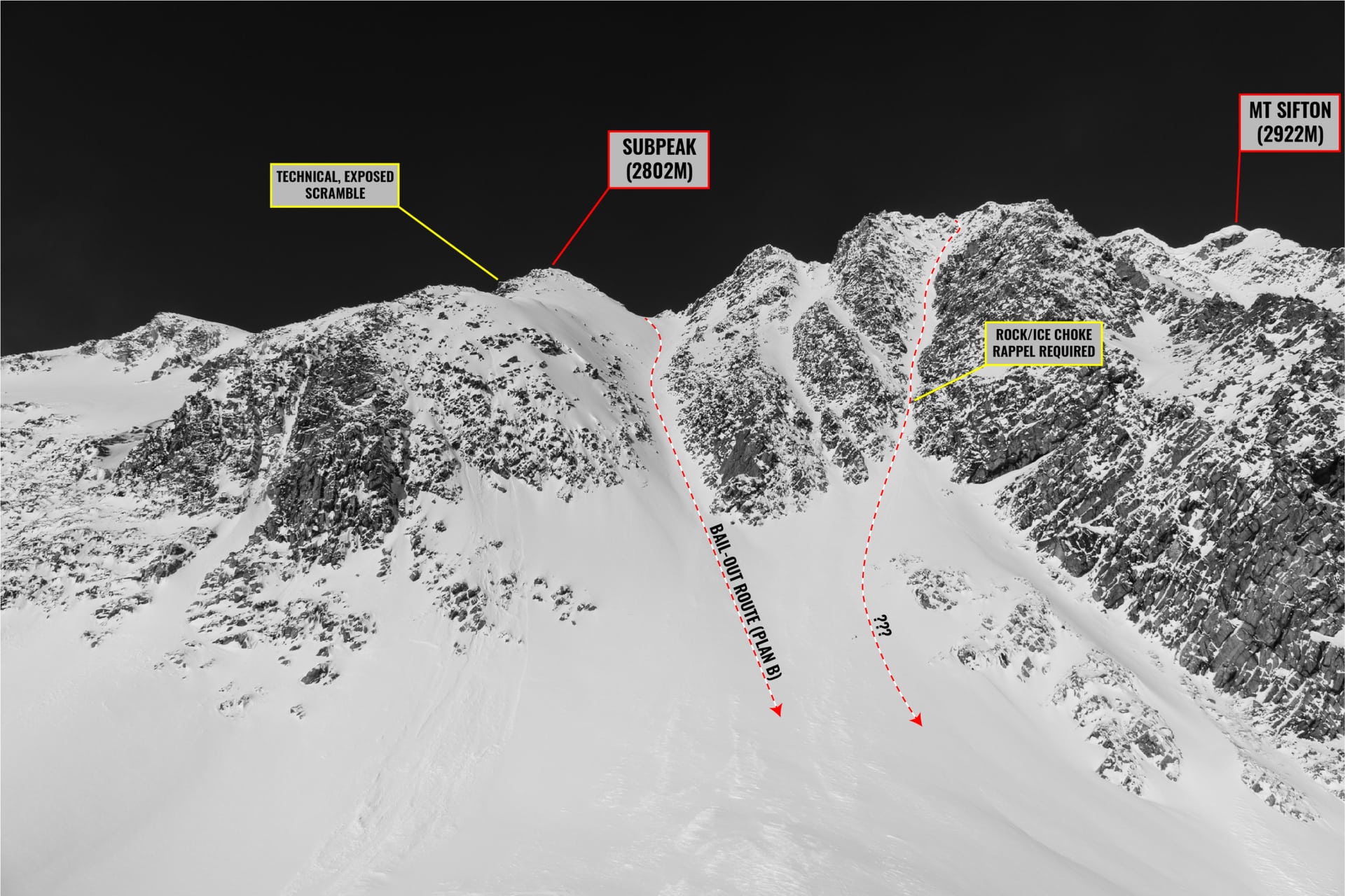
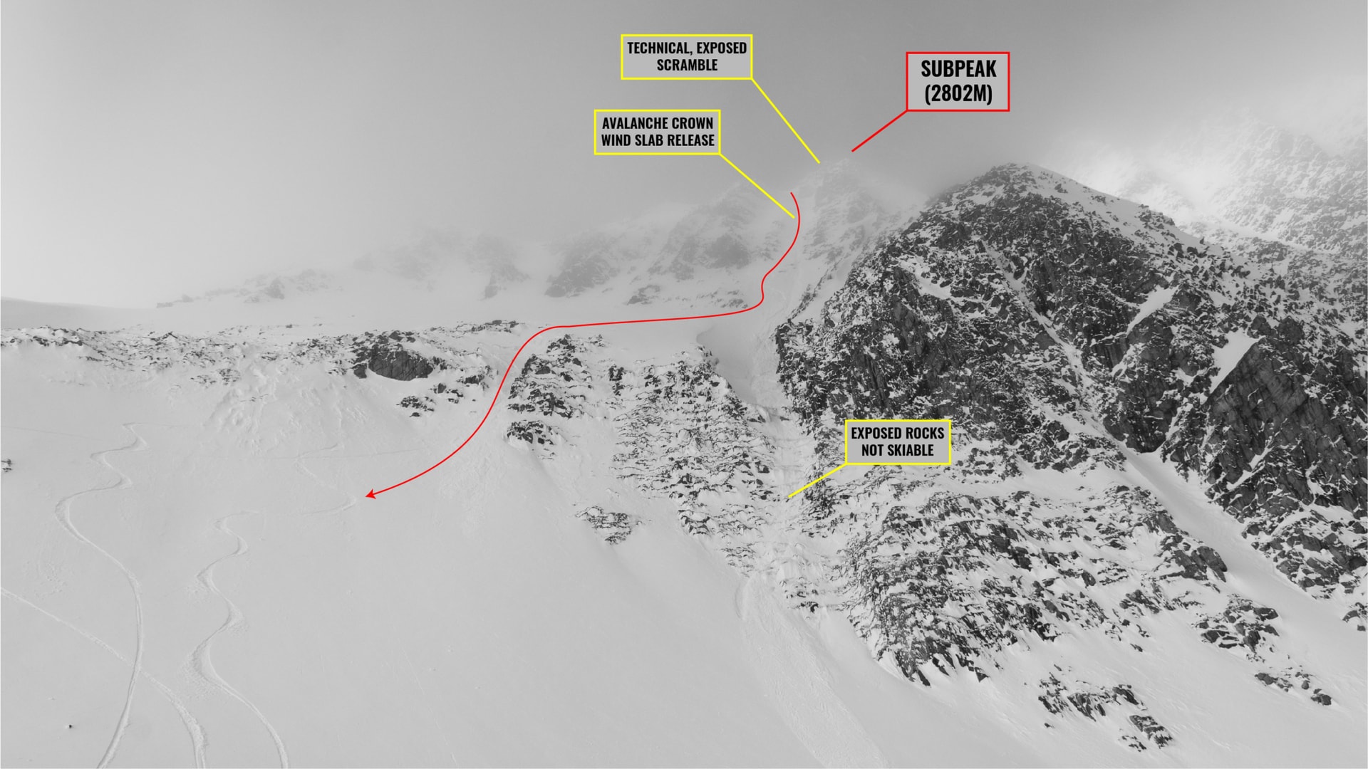
Our plan was to climb the west ridge of Mt Sifton, summit the peak, and ski down its south face through a classic couloir. Two things stood in our way: the technical scramble of the west ridge and the large cornice lying on the ridge’s crest. We opted out of booting up the couloir, even that would have been physically possible. With BC being exposed to prolonged cold, the arctic temperatures had faceted the top 50cm of the snow creating a weak layer that refused to bond to its surrounding. To make matters worse, strong winds had formed delicate wind slabs throughout the alpine. While generally small in size, a triggered avalanche would be disastrous in the Sifton South Couloir, an already uber-exposed line on a stable day.
With our plan in mind, we travelled over a series of winding moraines until we reached the Grizzly Path. From there, we bolted straight up the slope towards Mt Sifton. The Sifton South Couloir, shooting high above our heads, slowly revealed itself in the distance as we gained the toe of the Glacier. The line was ruthlessly humbling in nature, a testimony to its grandeur. How tempting was it! The cornice, visible from this distance, was sizable and would be tricky to deal with.
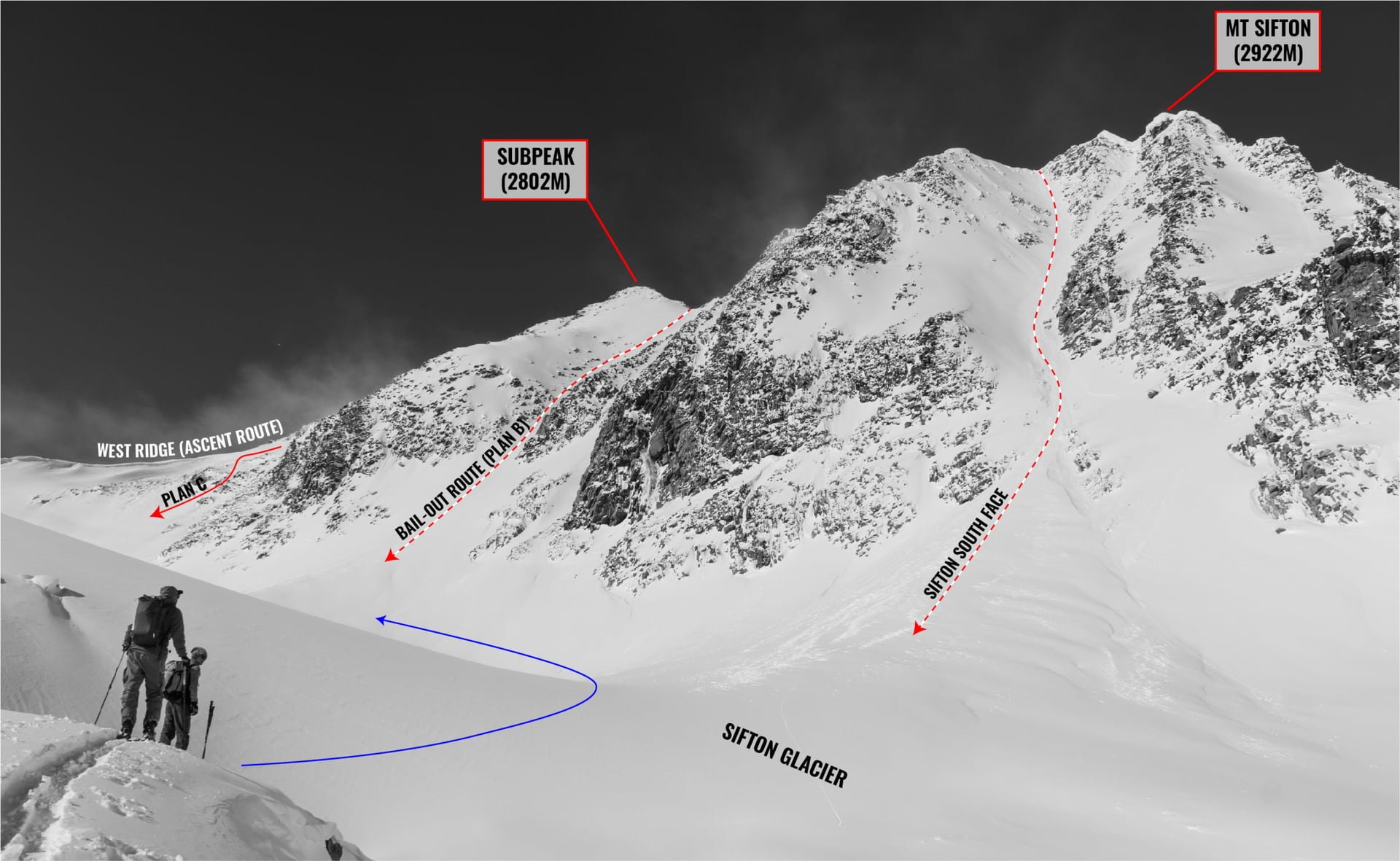
We proceed up the gentle, white blanket of the Sifton Glacier to a col at its head. An icy-cold katabatic draft rolled in. We braced against our skis, shielding our faces from the arctic blast. Time to bundle up! We picked up the pace, trying to maintain our core body temperature at a comfortable level – just the usual winter struggle. Fortunately, the ascent up the col was easy. The cornice I had observed in the past were no more. We simply walked right up the slope linking with the wind-battered west ridge.
We strapped our gear to our packs, donned the crampons, and climbed the west ridge on foot. The progress was definitely frustrating: we kept on post-holing through the rotten, facetted snow, clanking our crampons against bare rocks. My ice axe was utterly useless. After much effort, we had ascended the steepest portion of the climb. A long, up and down ridge scramble was now waiting for us.
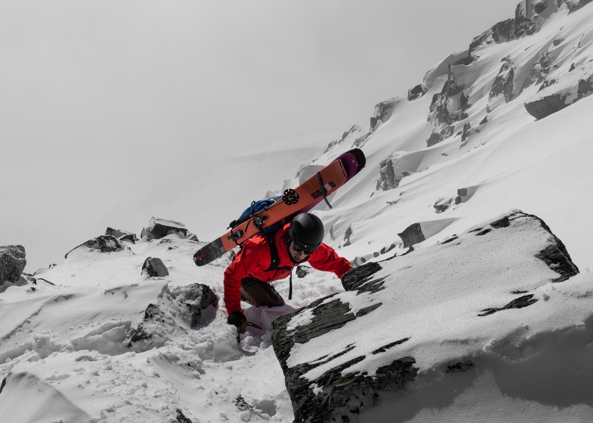
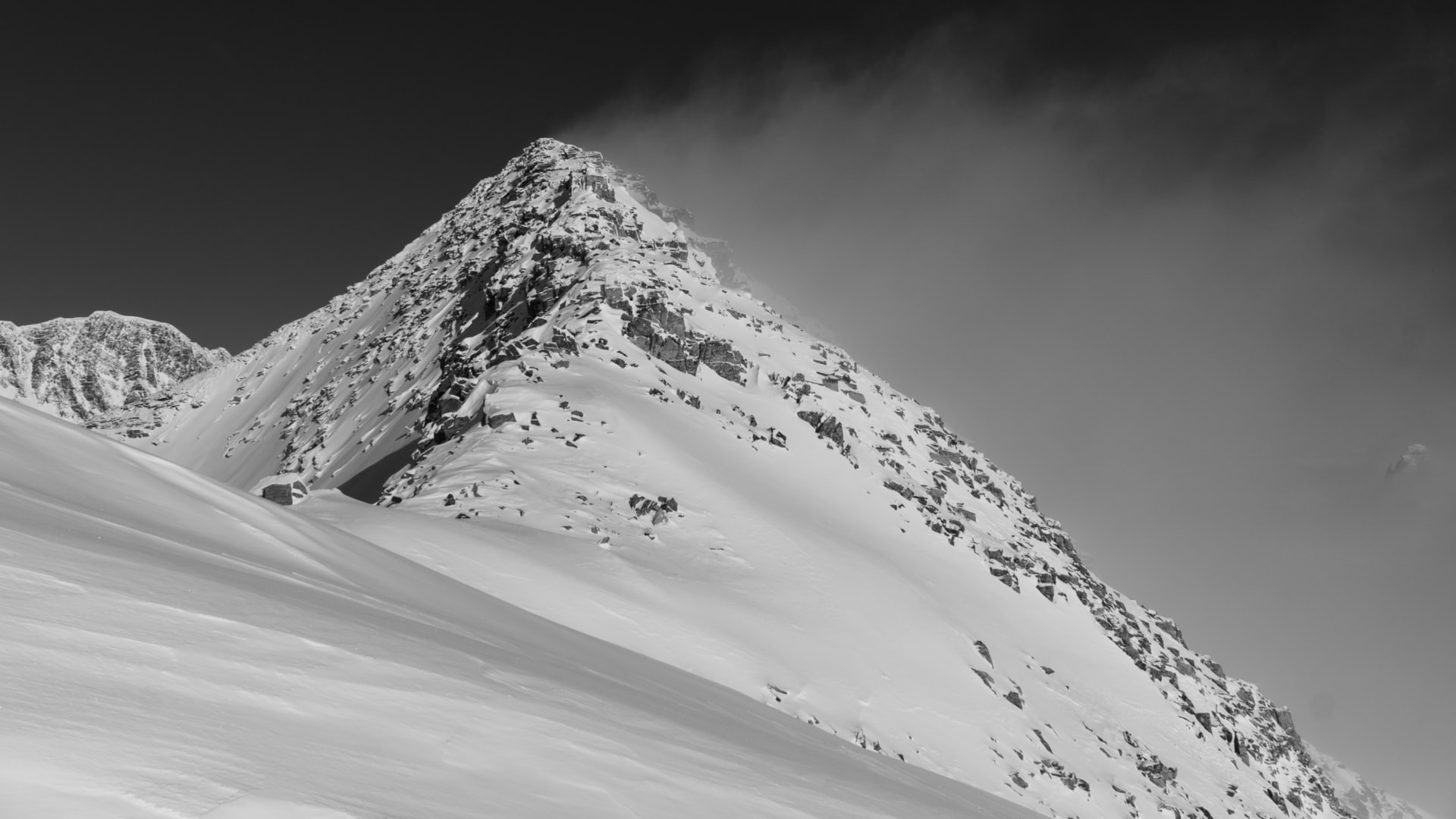
After a brief lunch break in the sunshine, we forged a path through a mix of snow, rock and ice towards our day’s objective: the Sifton South Couloir. At first, progress was a breeze, only hampered by the occasional patches of deep snow. A third of the way across the ridge, we encountered a difficult obstacle, a large subpeak. Scoped out from below, the east flank seemed manageable but the west flank, exposed and technical. We booted around its base, trying to figure out a way through. I went on up a steep, rocky gully, doing some sketchy dry tooling through faceted snow only to realize that the slope further up was lined with ribs that would require protection. Damn! Faced with an approach that was totally out of shape, we decided on dropping an unnamed couloir on the west flank of the subpeak. I comically mentioned how we hadn’t even reached our bail-out route, plan B. We were onto plan C.
In the previous days, the winds had shifted from the S/SW to the N/NE and back around. The strange loading pattern made predicting wind slabs difficult. Jeff went first ski-cutting the entrance in one swift motion. Nothing budge except some sluff. Freddy and I followed suit, leap-frogging our way down between safe spots. Freddy took a bad 10-meter tumble, bruising his hip on a rock. Fortunately, he caught himself and kept on skiing, visibly shaken by the fall. While the top third of the couloir had decent snow – at least, better than expected – lower two-thirds offered some terrible snow after an avalanche had wiped it clean, exposing rock and ice beneath. I hoped down from the 60-80cm avalanche crown onto an icy bed surface, praying for my survival. Sketchy! After a few more jump-turns, we exited the Sifton South Couloir, veered right above the huge cliff band and skied down a small chute back onto the Sifton Glacier. I breathe a sigh of relief.
Stoked to have complete this gnarly line, we skied down the wind-affected snow of the Sifton Glacier and through the Grizzly Path (below and east of the Grizzly Shoulder). This route is typically tracked out by folks performing the Little Sifton Traverse, a popular tour at Rogers Pass. The snow was so cold, it wouldn’t glide at all. Our exit was a lot of work. All in all, the day didn’t go according to plan. Who cares! We claimed a rare line, got a kick out of it and skied some half-decent powder. We’ll just have to spend some more time around Mt Sifton to conquer the true South Couloir (or South Face). Not a bad alternative!

Route Info
For more beta on my adventures, check out the Route Map. This online map interface is a repository of Beyond Our Peak’s published ski touring and mountaineering routes. It’s the best way to browse through trip reports. Give it a shot!