Fred and I planned on completing a traverse from Uto Peak to Eagle Peak We would hike up the Sir Donald Trail to its famous col, ascend the southwest ridge of Uto Peak, traverse from Uto to Eagle Peak and scramble down the chossy southwest ridge of Eagle Peak back to the Avalanche Crest Trail.
Report from September 3rd, 2019
After a short hour drive to Rogers Pass from Revelstoke, Fred and I stepped out of my CRV and were greeted by the smell of fresh pine and a cool morning breeze. We organized our small 25-liter packs having decided to go fast and light on our ambitious mission.

The morning hike was phenomenal. Temperatures were hovering just below the 20C mark which allowed us to move at a brisk pace. Fred bravely carried our 50-meter 7.5mm rope up the Sir Donald Trail.

After less than two hours, we reached the Sir Donald campsite, basically, a small clearing surrounded by boulders and a plastic toilet. We found a small pond 100 meters west of the campsite where we filled up our water bottles and enjoyed the surrounding vista.

After a short break, we proceeded up a scree slope to the col between Mt Sir Donald and Uto Peak. Fred and I aren’t very fond of scree slopes after too many twisted ankles, but this specific trail was in good shape. After all, climbers use it day after day in the summer to complete one of Rogers Pass’ most popular climbing route, the northwest ridge of Mt Sir Donald.

As we reached the top of the col, we gazed at our first objective, Uto Peak rising 2927 meters above sea level. From our angle, the route seemed pretty complex. It revealed its true nature once we found ourselves clinging to the rock slabs with potentially fatal falls below us.

The rock was solid, blocky quartzite, the kind that provides ample friction and huge jugs. Our route led us through a collection of 4th class scrambles with thrilling fifth class pitches consisting of exposed slabs and corners.

We soloed the entire climb, in part due to the added confidence of wearing fitted rock shoes. In addition, the rock quality was supreme and holds were plentiful. The exposure made this classic climb an epic. We bolted passed a couple of giddy Albertan climbers placing protection.

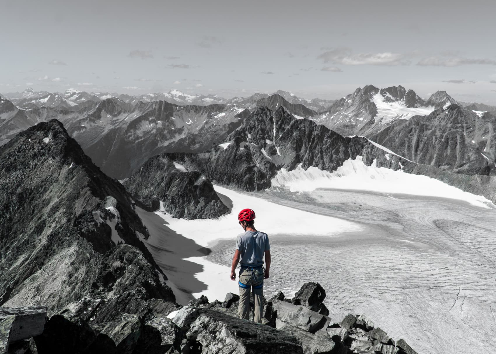
After only two hours of climbing, we summited Uto Peak at an elevation of 2927m. We gazed at the ridge leading to Eagle Peak, a long way to go. It consisted of 3rd and 4th-class scrambles and a few sketchy pitches with rappel anchors. To speed things up, we choose not to rappel as we felt comfortable on the steep face. As I heard from friends, the rock quality wasn’t as good and we constantly had to double-check our holds after a few close-calls further down the ridge.

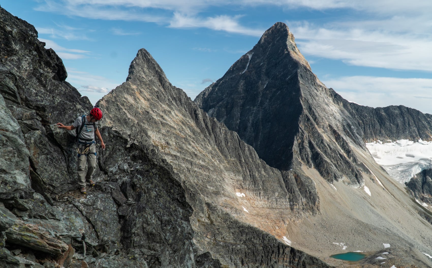
As we approached Eagle Peak from the south, our progress grinded to a halt. We were blocked by a mighty obstacle, a large talus hill that had to be circumvented.

With careful route finding, we downclimbed a super-exposed ledge system, passing below the talus hill and watching out for rockfall from above. In retrospect, roping up would have been the safe decision.
Exhausted from the long climb, we crawled up yet another scree slope leading to Eagle Peak. We gained the summit at about 4PM and snacked on our usual trail mix.After far to short of a break, we headed down the SW ridge past “The Eagle”, a prominent rock formation in the animal’s shape. We didn’t dare to sit on the edge. We already had our fair share of exposure for the day.

As a hyper-saturated pink glow engulfed the mountaintops, we found a chute skier’s right of the ridge which led to a talus field 100 meters below the Avalanche Crest Trail. Pressed for time, we choose to follow this path, preferring to avoid scrambling further down the ridge into what seemed like a solid bushwack. Around 8 PM, the last glimmer of daylight disappeared behind the mountains.
The chute was much steeper than expected. We descended the entire 150-meter on all fours grasping at what little rock and vegetation remained in the chute. I checked every single hold thrice and cursed every now and then when my foot would slip. A fall would have been fatal. By the time we gained the talus field, it was nightfall.
After stumbling around the precarious rock debris, we paved way up a side-hill groaning as we blindly stepped in an unexpected glacial stream. We could barely make out the trail in the distance. At 9:00 PM sharp, we made it back to the car. Total elapsed time: 13 hours in paradise.
Statistics
| Peak Elevation | 2927m |
| Vertical Gain/Loss | 2090m |
| Distance Traveled | 14.5km |
| Duration | 13h |
For more beta on my adventures, check out the Route Map. This online map interface is a repository of my ski touring and mountaineering adventures. Simply follow the rough trace!