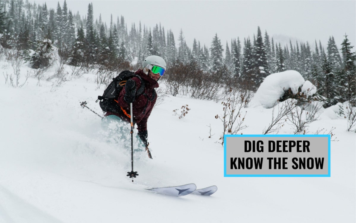
November 1st. You peer through the rain streaming down your bedroom window. It might be raining down here but it’s dumping up there. You pull out your touring skis (or snowboard), waxed the day before in preparation for your first shred of the year, and cover your body with Goretex. On the way out, you flip the sign hanging on your front door. It’s written: “Gone Skiing”. As the November snow accumulates above treeline, the avalanche hazard grows considerably. It’s important to understand how the early season snowpack behaves and how it affects the rest of your winter.
Related: How To Choose An Avalanche Transceiver / Beacon
Disclaimer: This article is merely informational and is by no means a substitute for proper avalanche training such as an AST-1 course. This is about snow science, not avalanche awareness. Get the training before heading out in the backcountry. It’s crucial!
Early Season Snowpack and Weather Characteristics
The snowpack is a delicate beast during the early season months, consisting of October and November. With temperatures swinging on both ends of the thermometer, all it takes is one degree either south or north of the melting point (0°C/32°F) to completely alter the snowpack’s nature and affect your region’s avalanche activity.
Cold-Warm Transition
It’s common to have a cold, moist storm cycle dumping 40cm of snow on your local slopes only to leave in its wake skyrocketing temperatures. The rapid warming trend kickstarts the snowpack’s transition from dry to wet, weakening the bond between layers, and triggering a sudden spike in avalanche activity. The faster the transition is from cold to warm, the more unstable your snowpack will be in the short term. However, in the long run, rising temperatures near 0°C only strengthen the bond between layers.
Warm-Cold Transition
On the other end of the spectrum, the transition from warm to cold refreezes the snowpack’s surface producing a thick crust that may persist throughout the season. As it gets buried under new snow, the crust provides an ideal bed surface for subsequent avalanches as it does not bond well to its adjacent layers.
Shallow Snowpack
Shallow snowpack depths compound the effects of warming or cooling temperatures due to their steeper temperature gradient. More specifically, the snow grain’s metamorphosis (changes in shape) happens way faster in shallow snowpacks. In layman’s terms, thin snow reacts to temperature changes Generally speaking, a shallow snowpack, much faster since heat travels through it at a much faster rate. Generally speaking, a shallow snowpack, such as the one found in the Rockies, is a whole lot more delicate when temperatures start swinging on both ends of the thermometer than a deeper snowpack, such as the one found in the Coast Mountains.
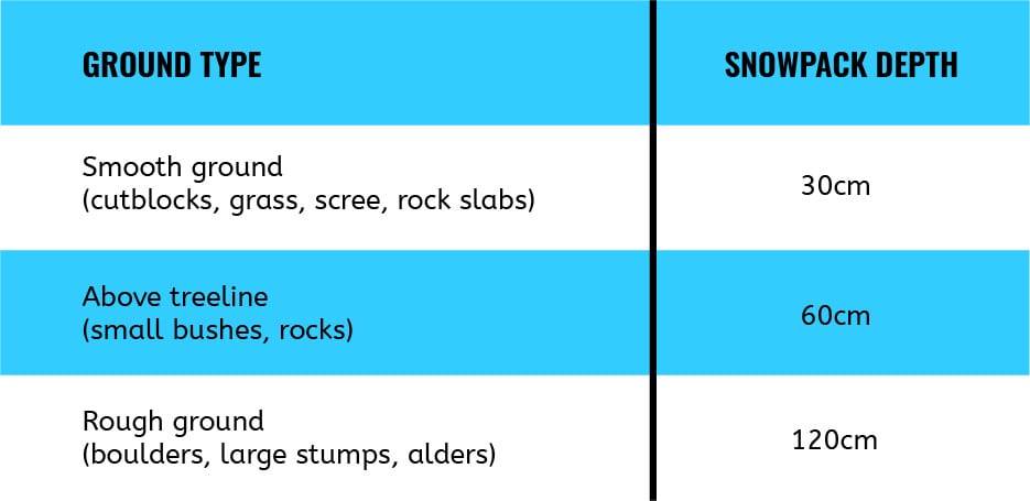
Ground Roughness
An important term when talking about early season snowpack is ground roughness. Rocks, bushes, and trees anchor down the snowpack during the early season which prevents avalanches from happening. Ground roughness refers to how much of those anchors are present on a given slope as well as how big they are. It affects the amount of snow required for an avalanche to run its course. On rough ground, the snowpack must first be deep enough to cover those anchors before there’s any chance of avalanche activity. Here’s a general guideline (provided by Avalanche Canada) on snowpack depth required for avalanche activity:
Early Season Avalanche Problems
The combination of a thin snowpack, swinging temperatures, and stormy weather creates a few key avalanche problems, either in the form of a weak layer (snow grains that don’t bond well together) or a bed surface (slippery sliding interface).
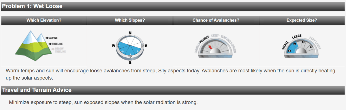
Surface Warming
As the snow surface approaches its melting point due to solar radiation or warming temperature, it progressively turns into water. The increased water content breaks down the bonds between snow grains (otherwise known as snow crystals), weakening the snowpack. Meltwater then trickles down the snowpack and lubricates the interface between layers. From the surface, snow will be wet and avalanche activity will increase dramatically. This is the number one problem affecting the early season snowpack.
Melt-Freeze Crust
Melt-freeze crusts are formed by temperatures rising above the melting point followed by a re-freezing of the surface snow once temperatures dip back below the melting point. A melt-freeze crust becomes the perfect bed surface, or sliding interface once buried under subsequent snowfall. Over time, a buried melt-freeze crust may foster the formation of facets (sugar snow), a common weak layer found within the snowpack. Otherwise, it may “heal” and break down into stable, rounded grains.
Rain Crust
Sadly, it’s common for freezing levels to rise above the valley bottoms and see rain blanketing that precious powder. Over time, rainwater will saturate the snow’s surface. Once a cold-weather cycle rolls in and temperatures dip below freezing, the surface, now saturated with water, forms an icy crust (usually bulletproof). This crust becomes the perfect bed surface, or sliding interface once buried under subsequent snowfall.
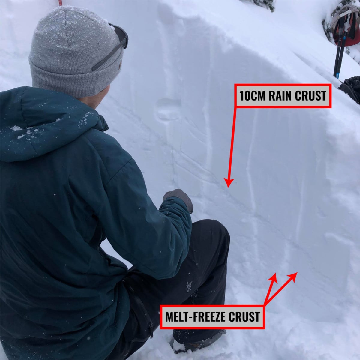
How do you spot the difference between crusts? Rain crusts are shinier than melt-freeze crusts. They glisten in the sun. You’ll also spot narrow channels, called runnels, through which the water percolates downslope. Rain crusts don’t “heal” as well as melt-freeze crusts once buried and may lead to a persistent avalanche problem as the season evolves.
Sun Crust
Sun crusts are a category of melt-freeze crusts whereby surface warming is provided by intense solar radiation. They will only be found in steep solar aspects (commonly south and west-facing slopes, sometimes east-facing). As with any crusts, they become a bed surface once buried.
Basal Facets
Basal facets and depth hoar are types of snow grains that don’t bond well together. They are found at the base of a snowpack. Basal facets and depth hoar are likeliest to form in a thin early season snowpack exposed to cold weather where you’ll find a steep temperature gradient. This is a situation where digging a snow profile is so crucial: it’s the only way to detect them. You’ll spot them as square or rectangular crystals with defined sharp edges. They’ll feel loose to the touch, akin to sugar crystals. Later in the season, basal facets and depth hoar become a persistent weak layer. Such a problem may trigger low probability, high consequence avalanches that step down to the ground. Those ones are particularly unpredictable. Beware!
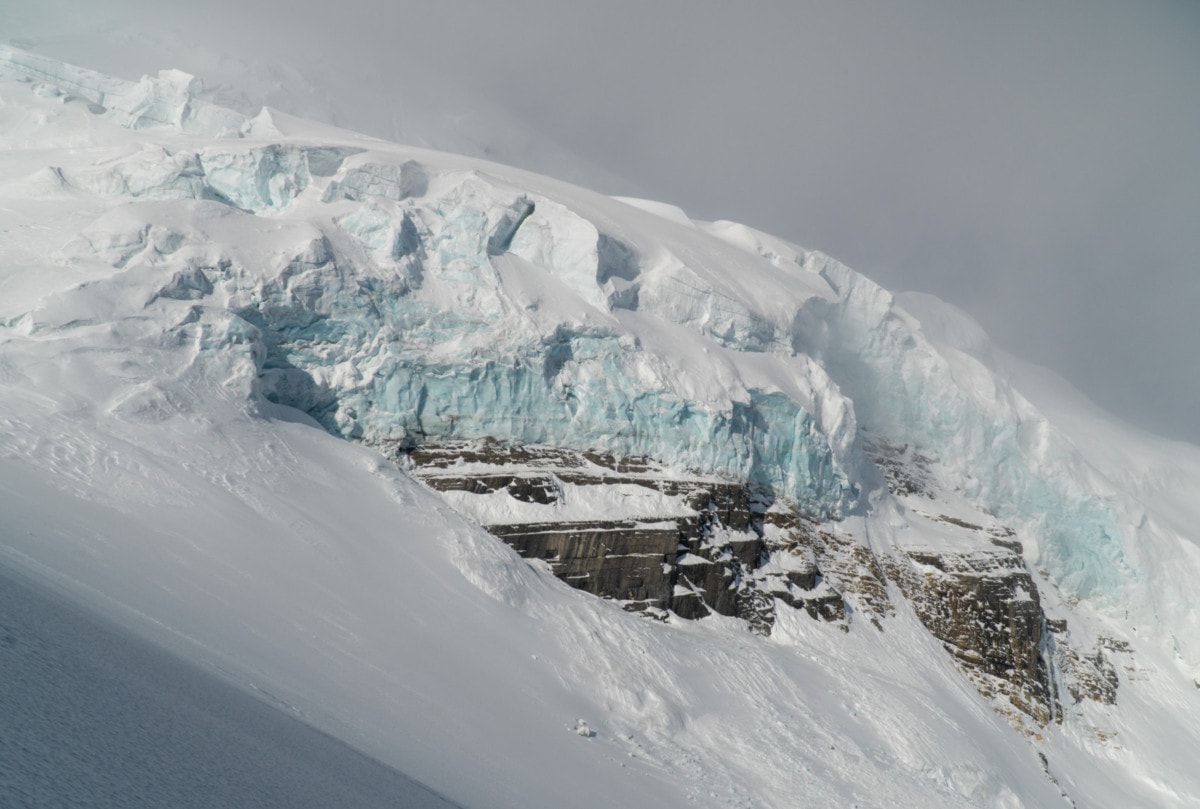
Glacier Ice
Glacier ice is another perfect bed surface. As summer transitions into fall, the first few snowfalls do not bond well to the ice. Since glaciers are found at higher elevations where winds are stronger, it’s common to see wind slabs forming on top of glacier ice. It can take as little as 20cm of stiff snow to start seeing some avalanche activity. In any case, I wouldn’t recommend skiing on glaciers with a thin early season snowpack for many other reasons – think crevasses and bergschrunds.