After two and a half months of endless storm cycles burying the BC Interior region with snow, we finally got the lasting high-pressure system we deserved. Blue skies, sunshine and an all-time stable snowpack were on the menu… along with some exposed ski-mountaineering. The goal: skiing the Northwest Couloir of Avalanche Mountain, a peak which I had already climbed in the summer of 2019. While the smoking hot temps changed our plans, we skied an unnamed couloir and had a heck of a day exploring the technical steeps of Rogers Pass.
This route is located within a Winter Restricted Area (WRA) governed by the Winter Permit System. Please check the WRA status before travelling through it.
Related: Avalanche Mountain Southwest Ridge: High Above The Asulkan

Report from February 23, 2020
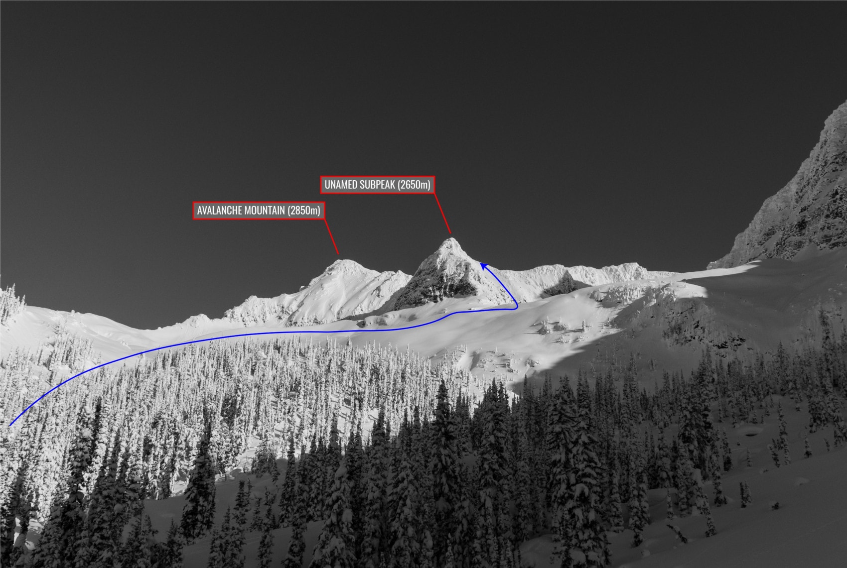
We stepped out of the Tacoma and were greeted by blue skies all around. I looked at my mountain partners, Laurent, Jayden, and Phil. You could sense the energy that day: they were all equally stoked to make the most of this clement weather pattern that should last for a few days. High solar output and light winds consolidated our snowpack, meaning we could ski routes that would otherwise be treacherous in adverse avalanche conditions. It was time for some big alpine lines. The plan: ski the Northwest Couloir of Avalanche Mountain (2861m), accessed by traversing the peak along the Avalanche-Eagle ridge, located above the Avalanche Bowl. This is an uncommon route. Most prefer to boot directly up the couloir after crossing the Avalanche North Glacier, a straight-forward journey.
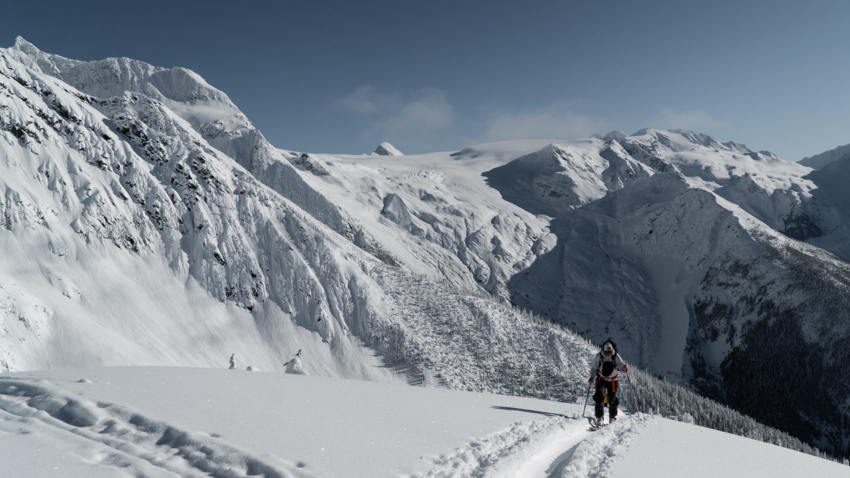
We headed up the Avalanche Crest established uptrack. Too many kick-turns later, we gained the bottom of the southwest-facing Avalanche Bowl at the end of which the rime-crusted slopes of Avalanche Mountain and Eagle Peak stand proud. Skiing Avalanche Mountain meant navigating the rolling moraines of its bowl.
The transition from the shaded treeline slopes to the sunny alpine bowl was a thermal shock. We stripped down to our baselayer – Jay went shirtless. Spring really screws with my senses. I could feel the sun burning my neck. Yet, I could still smell the cold pure mountain air rushing through my nostrils at every breath. What a pleasant combination!

I turned around to check on Phil, casually toying with his two-pound telephoto lens, and was greeted by wonderful views of the Illecillewaet Valley. I already had my next mission in mind, a multi-day camping trip on the Illecillewaet Glacier. Those distant peaks are seldom skied and forever tantalizing.
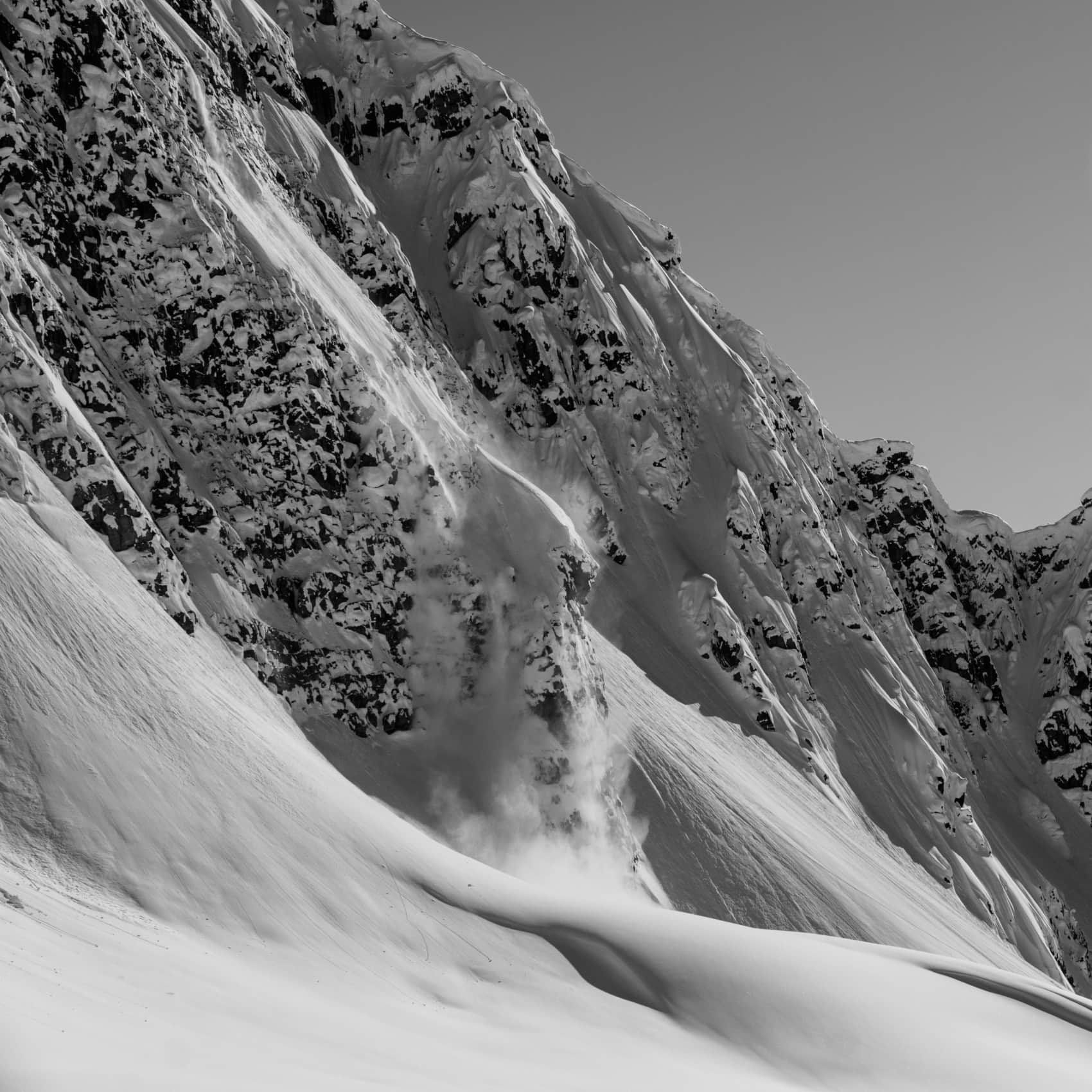
On the way up, I noticed pinwheeling on the sunny slopes of Eagle Peak, evidence of a dangerously warm snowpack. We stopped for lunch and discussed our options. The high solar output was a huge influence on our avalanche decision-making. Time was of the essence. We had to move fast before the snowpack would reach its tipping point.
Snow Fact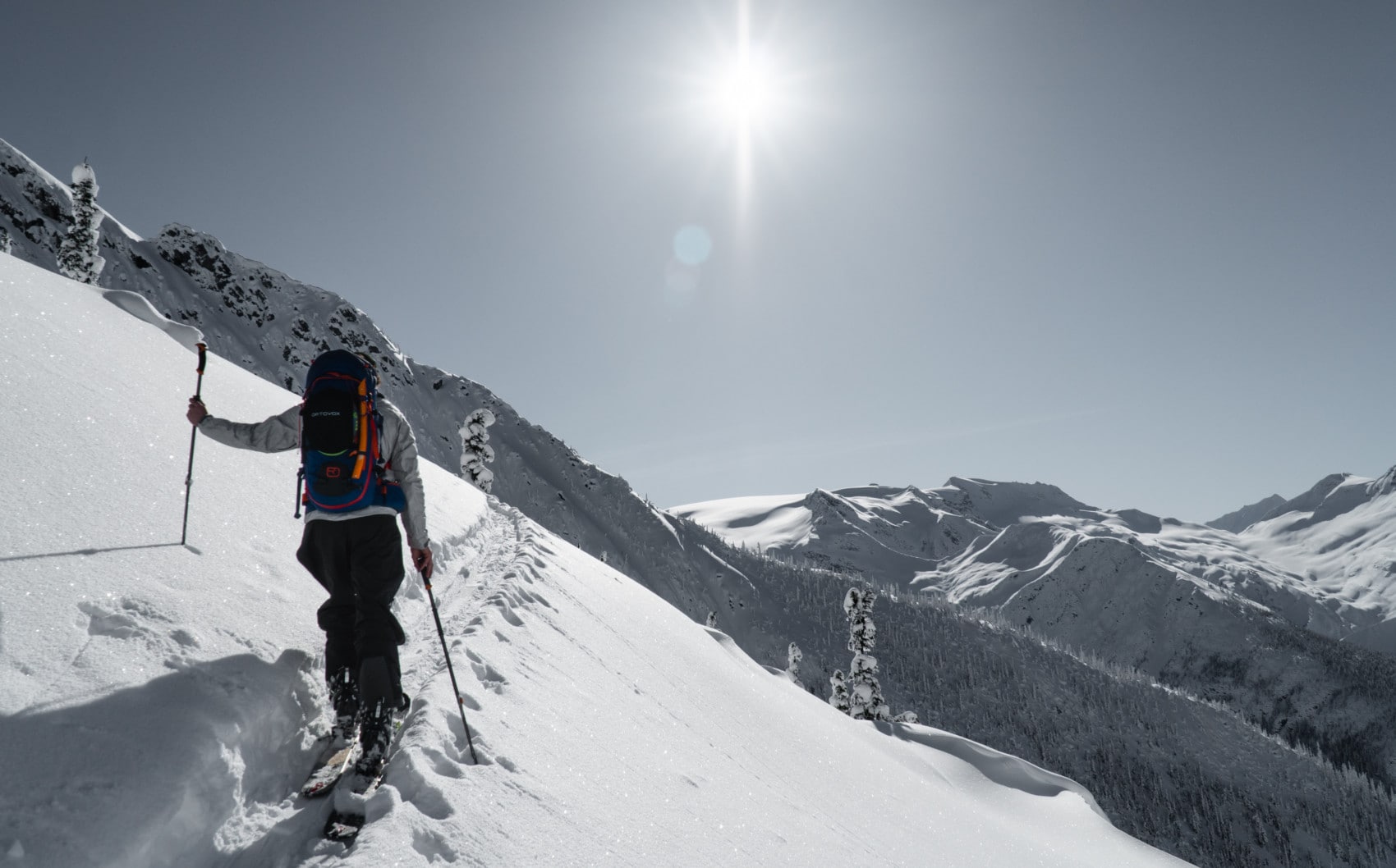
We arrived at the foot of the subpeak by noon. The sun was scorching the surface and snow was sticking to our skins, slowing down our progress. Within the span of a minute, we observed five distinct dry loose avalanches (sluff) from the steep slopes surrounding the alpine bowl. We gazed at our route, a 45-degree, 200-meter long couloir leading up to the Avalanche-Eagle ridge. After much debate, we decided not to boot up the couloir. The consequence of a slab avalanche burying our party was simply too high. We would be funneled up the chute all at once for at least an hour. Additionally, heavy sluffing from above could push us into rocks and cliffs bordering the chute. The stakes were too high. Skiing Avalanche Mountain would have to be postponed to another sunny day.
As we were about to turn back, Jayden spotted a thin chute to our left, encased within the subpeak’s nose. While the overhead hazard was still present, the start zone was much narrower (a resulting avalanche would have a smaller size) and much better supported. Slab avalanches, our biggest threat, were less likely. However, we weren’t 100% positive the chute would link up with the ridge. Since we were all comfortable with the exposure, we strapped our skis to our backpacks and began the exploration. This is what mountain adventures are all about!
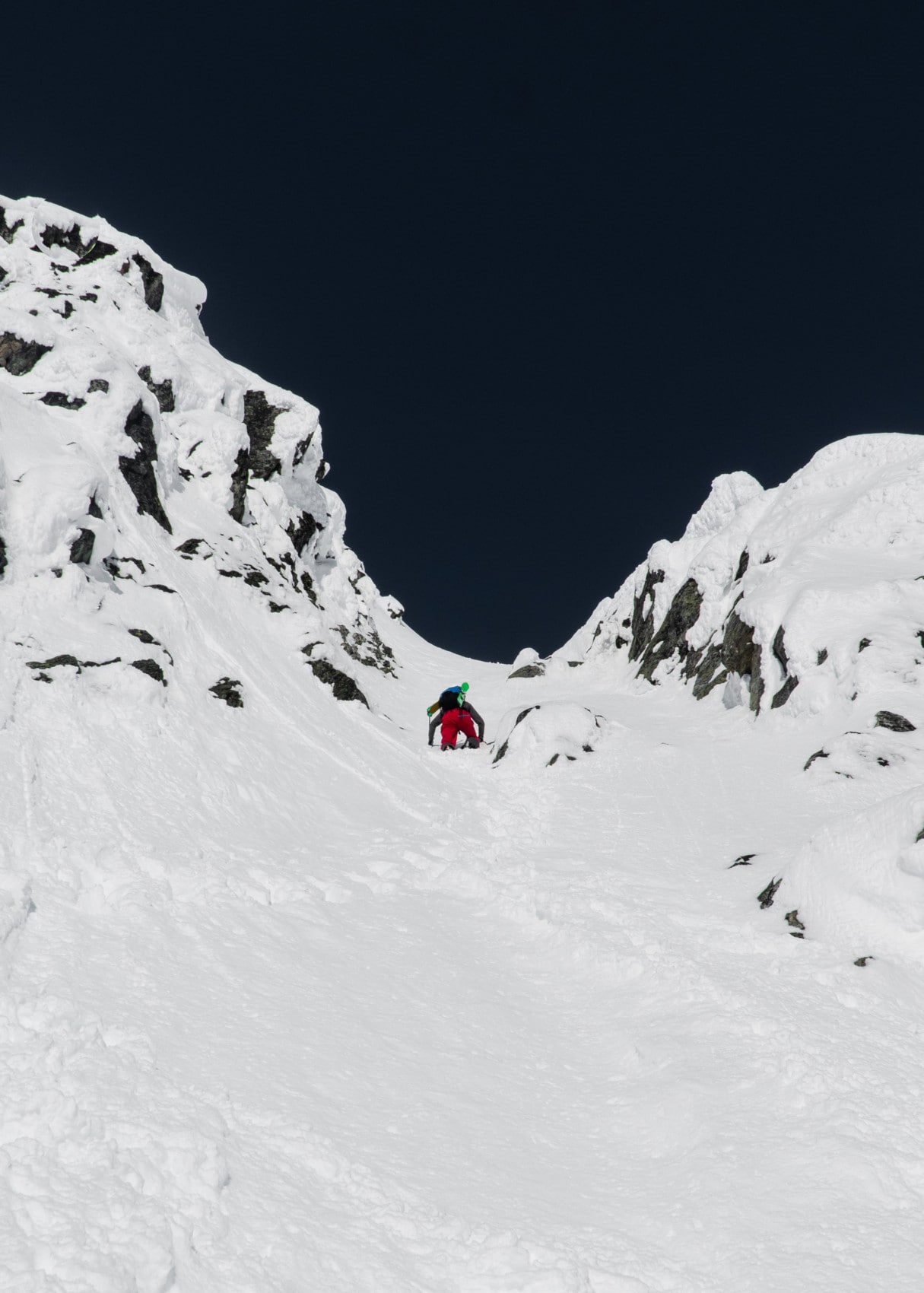
The snow was thin judging from all the rocks we kicked in. Jayden bolted up the chute in no time until we reached a rather exposed section above cliffs. We regrouped at this point, sheltered by a large boulder. The couloir changed aspect, from south to southeast. As expected, the snow would be a little cooler there. We proceed up the next section without crampons.
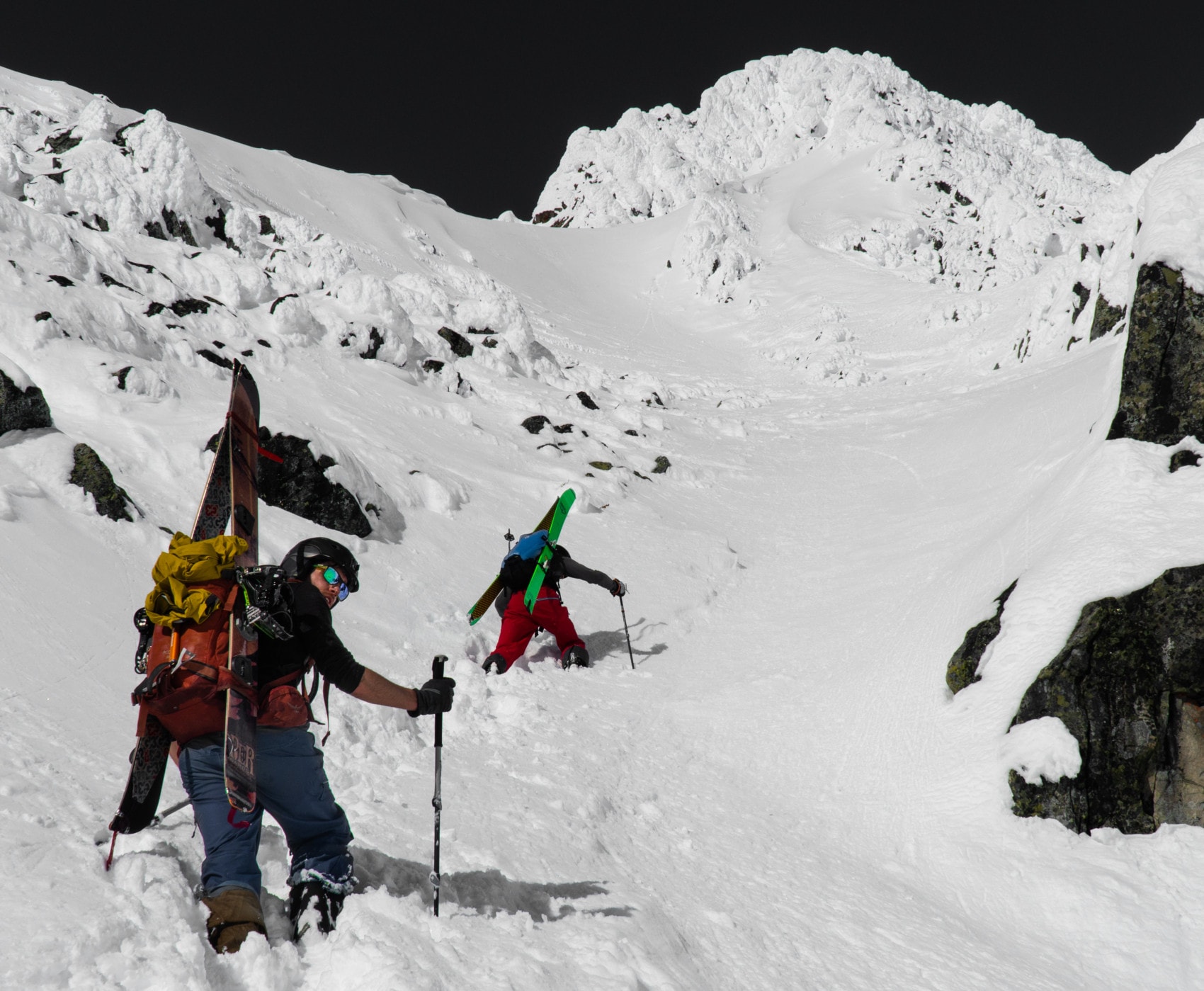
45 minutes later, we topped out. Laurent and I led the bootpack looking for a way out of the couloir onto the ridge overhead. We circumnavigated a rocky rib, climber’s right of the couloir, with a few cruxy moves. The vertigo was hitting me. To much frustration, the rib terminated into steep impassable cliffs. There was no way out. Since we couldn’t stay in this couloir forever, our next move was clear. Escape the maw!
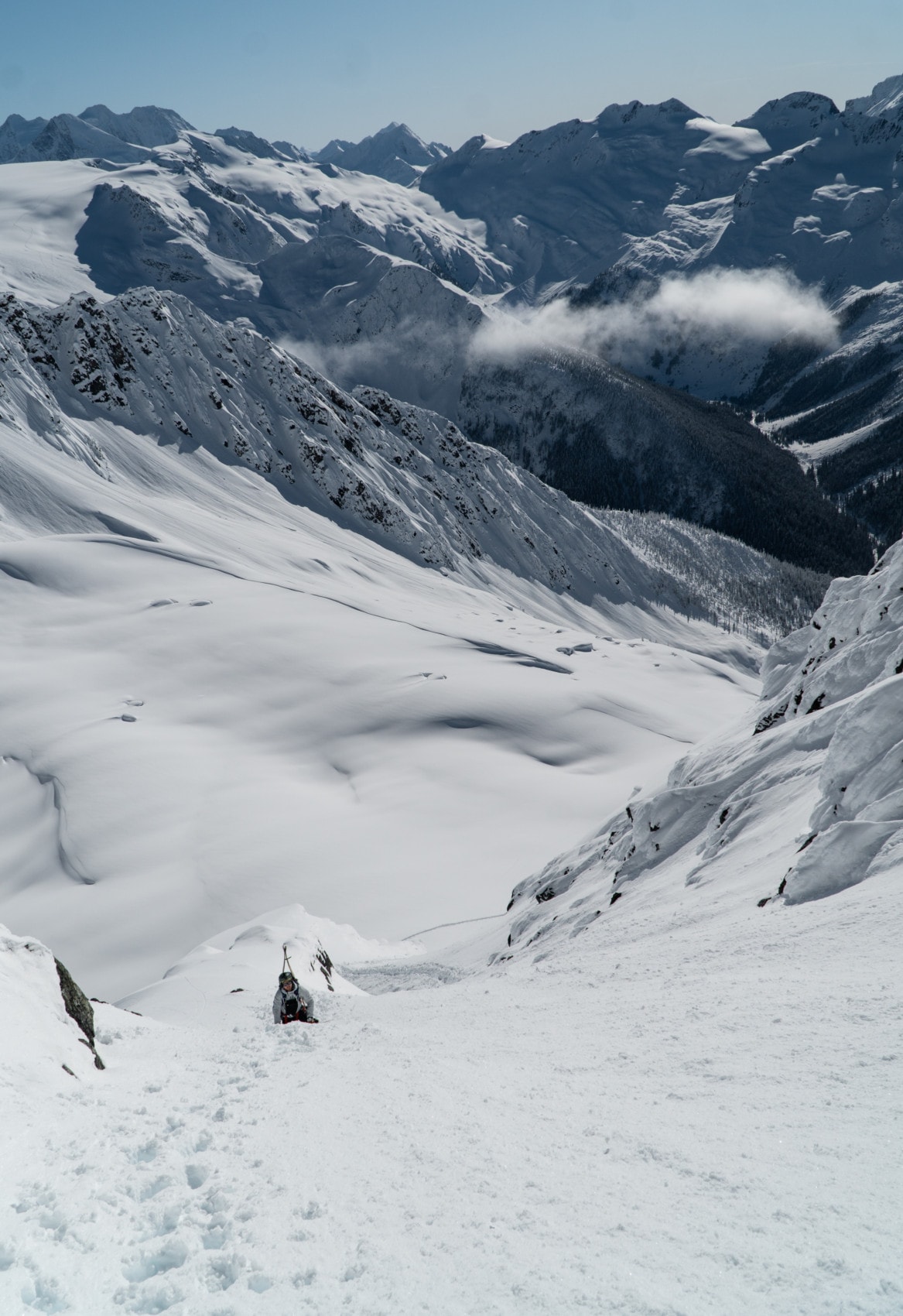
We quickly transitioned for skiing, making sure I secured my pack to my buried ice axe. A fall from my perch would be fatal. I pushed the thought aside and visualized every turn down the slope, a technique I was taught in Chamonix when skiing big alpine lines. I took several deep breaths to control my fear. I was ready.
After our first descent, we pressed on towards our backup exit, Avalanche Crest. We skied the untouched rolling moraines of the Avalanche Bowl and toured up the imposing Avalanche Crest ridge.
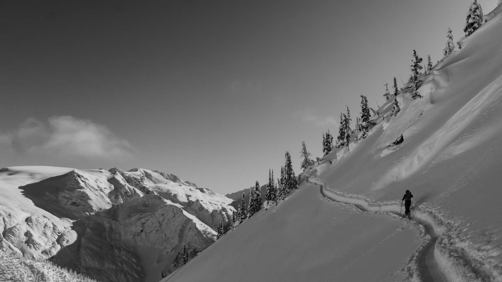
On the way up, I stumbled across friends, Kaitlin, Em, and Arnaud. What a funny coincidence! We looked down at the Avalanche Crest southwest slope, an uninterrupted 1200-meter straight shooter of a run. This was going to be glorious. Not bad for a backup.
While we didn’t achieve our goal, we were quite happy with how the day went. Our decision-making was spot-on. We kept the risk within our tolerance, found some at times gnarly, at times powdery skiing, and made it back to the truck in one piece. To this day, the Northwest Couloir remains high on my tick list, waiting patiently for the next high-pressure system to roll in.
Statistics
| Peak Elevation | 2650m |
| Vertical Gain/Loss | 1650m |
| Distance Traveled | 10.5km |
| Duration | 8h |
For more beta on my adventures, check out the Route Map. This google map interface is a repository of some of my ski touring, mountaineering and hiking adventures. It includes a loose GPS trace for your convenience.