Fred Lynn and I discussed climbing the southwest ridge of Avalanche Mountain on our way down Mt Begbie a few days ago. It didn’t take much convincing to get photographer Megan Voigt on board. While she didn’t count on summiting the 2861m peak, she would happily come along for the hike to our basecamp at a planned elevation of 2100m.
Related Article: Skiing Avalanche Mountain, Rogers Pass: The Burn

Report from July 30, 2019
With two consecutive days of clear weather, we felt blessed. It doesn’t happen often enough in Glacier National Park. Interestingly, this mountainous area is situated at the confluence of coastal and continental air masses. The sheer height of the surrounding peaks forces the humid air upwards, rapidly cooling them down. The result: constant heavy downpours in the summer and an overwhelming amount of snow in the winter. Yay!

I quickly packed my overnight bag after work. I keep it always half-packed allowing me to leave Revelstoke at a moment’s notice. The crew drove east on the TransCanada Highway. After multiple stops due to it being prime orange cone season, we left the Illecillewaet Campground parking lot at 3:15 PM. The Avalanche Crest hiking trail was pretty steep but thankfully short. We got really stoked the moment we reached the alpine meadows above which Eagle Peak was looming. Fred and I were already planning its ascent on our following days off.

While Megan was catching up to us, we searched for the perfect basecamp. It didn’t take long for us to find two nearly flat spots on top of a lateral moraine shaped eons ago by the retreating glacier. We couldn’t believe how incredible the spot was. We were standing next to this milky turquoise runoff, with the glaciated Asulkan Valley as our backdrop. We fell asleep to the calming sound of the stream running by us and marmots frolicking under rocks.
The next morning, we woke up at 4:30 AM intending to climb the Avalanche Crest ridge to witness a dramatic sunrise. It would also be the start of our ascent up the peak. We hadn’t had breakfast yet, I was hungry: the short climb up a scree field to the ridge was slower than usual. In the end, we were rewarded with a stunning sunrise basking the valley in a faint purple glow.

With our hunger satisfied by a hearty breakfast of triple-stacked PB&J sandwiches, Megan headed back to the campsite to get some more sleep, while Fred and I geared up for the coming ascent up the western ridge.

We simul-climbed up the Class 3 scramble with intermittent Class 4 stints. We improvised a belay by having the lead snake my 60m, 8.1mm rope around jagged rocks. The follower would then free the rope as he progressed while the leader belayed from an improvised anchor off a sturdy boulder. While it isn’t the safest climbing technique, it’s definitely faster than building static anchors every 20m and cheaper than buying 100$ cams.

It took us two hours to reach the final crux, a 6 to 7 meter-high vertical face with little to no holds. After scoping out the area, we progressed climber’s right of the wall where we found a sizable crack to shimmy up. Fred volunteered to lead and successfully sent it. I followed with the safety of a top belay.

We staggered up a loose scree slope choosing to take parallel paths to avoid climber-triggered rockfalls from above. One step back, two steps forward. As the sun reached its zenith, we bagged Avalanche Mountain through its southwest ridge. We were standing at an elevation of 2861m. It was no more than 10C with a solid breeze. Sometimes I wonder if I climb peaks just to avoid the blazing heat at home, waiting in the alpine wilderness for the winter to roll in.
I scrutinized the Avalanche Glacier and the Beaver Valley below, seldom seen by climbers and skiers for its difficult access. Meanwhile, Fred was writing a note in booklet stuffed in a 15lb iron pipe. We comically wondered who dragged it up here. That’s motivation right there!

Once our minds were saturated with images of endless peaks, we jumped off the summit. Preferring to downclimb a different route, we headed down the south ridge towards Eagle Peak.
We traversed a scree slope that terminated with precarious cliffs. Due to the exposure, we slowed our pace ensuring we had good footholds over the loose pebbles. After getting cliffed-out several times, the fun really began when we were forced through a steep ravine which required soloing (without belay) through two gnarly sections. Having known him for a while, I could hear a whisper of panic coming out of Fred’s usually low-key humble demeanor.
We eventually made it to camp. We packed our camping gear and promptly headed back to my trusty adventure-mobile at around 4 PM. It was already settled that we would grab an enormous pizza at the Village Idiot in Revelstoke. After all, I was still hungry after my breakfast PB&Js.
Photos

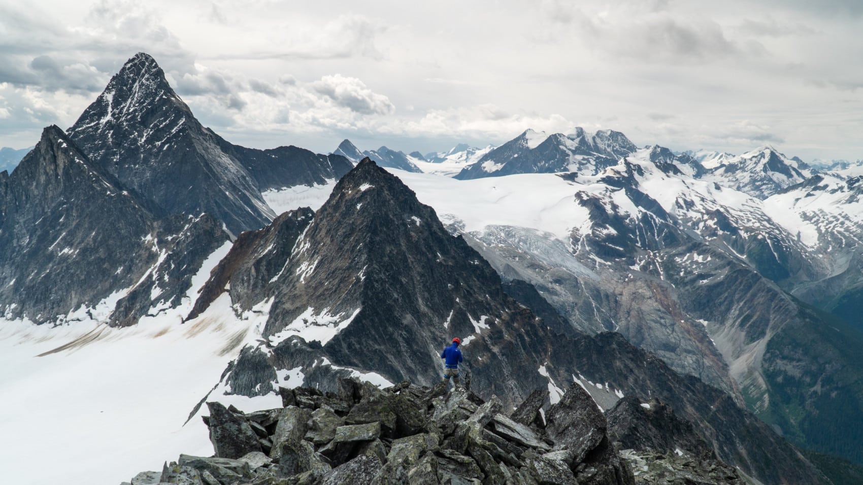
Fred traversing the ridge. Not shown is the massive cliffs below. Photo: Olivier Denis-Larocque 
Fred scrambling down Avalanche Mountain south ridge. Photo: Olivier Denis-Larocque 
Fred scoping his next step just before the scramble began. Photo: Megan Lee Voigt 
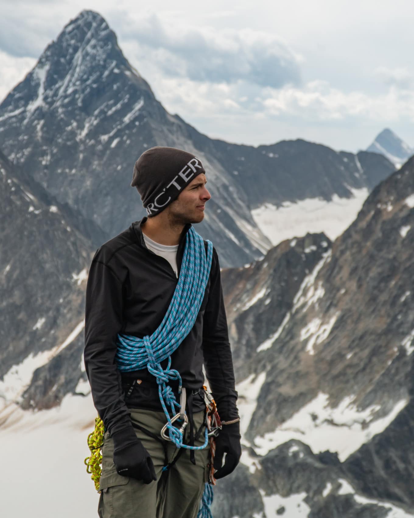
Fred playing with my 8.1mm half rope. Photo: Olivier Denis-Larocque 
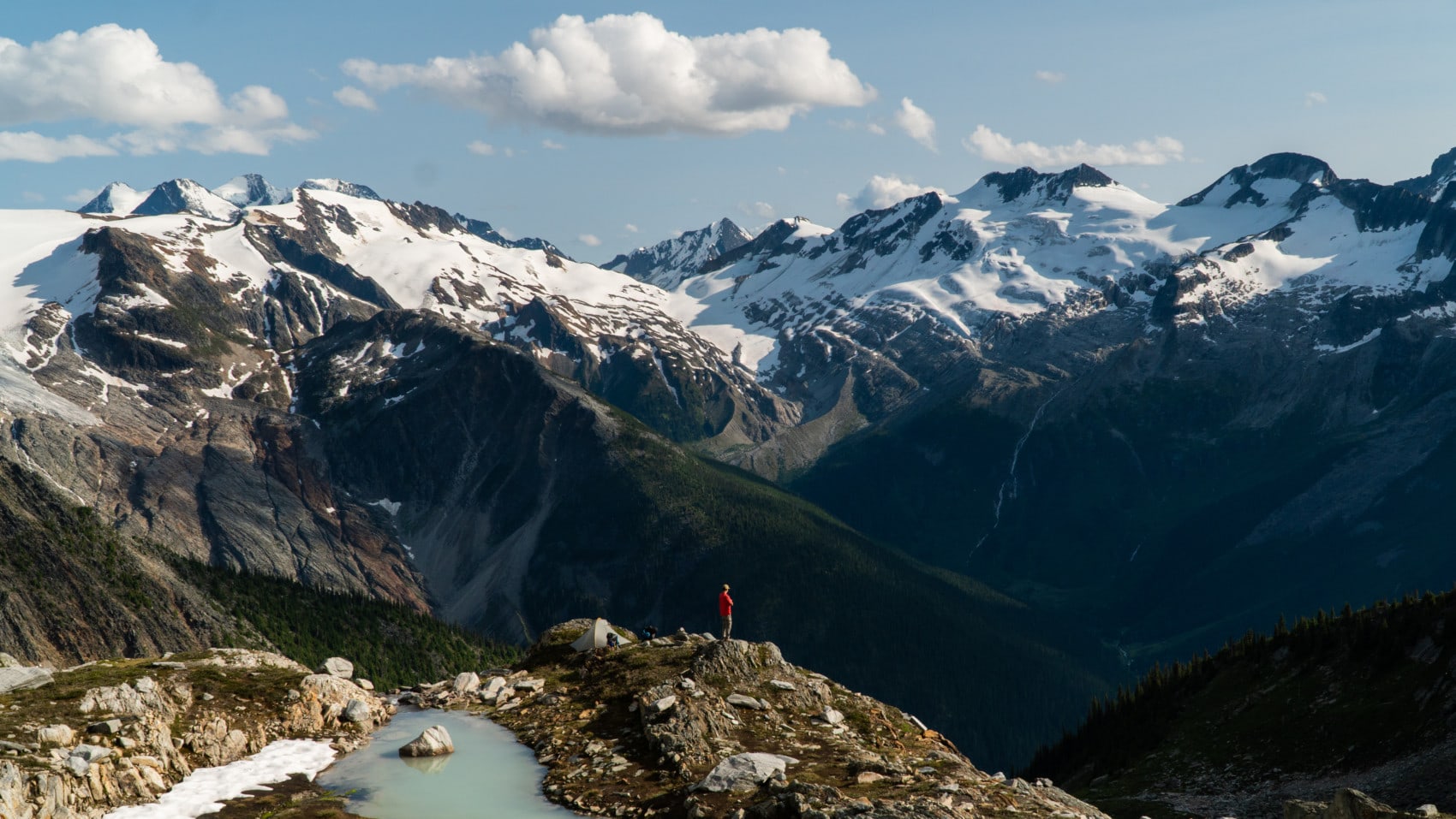
Our campsite 700m below Avalanche Mountain in the stunning meadows with friendly marmots. Photo: Olivier Denis-Larocque


Statistics
For more beta on my adventures, check out the Route Map. This online map interface is a repository of my ski touring and mountaineering adventures. Simply follow the rough trace!