After a week of torrential rain in the Interior BC, June 15th came by with a 6-hour weather window, suitable for mountain climbing. I felt it. Freddy felt it. Guillaume felt it. The summer solstice was fast approaching and it was time to haul skis up and down warming slopes. After our record winter, the SE shoulder of Grizzly Mountain, the one leading into the forested slopes of Teddy Bear Trees, still supported more than a meter of snow, one would otherwise call “soup” at this time of the year. This called for an adventure.
Related: Grizzly Couloir, Rogers Pass: 3-Day Couloir Marathon
Report from June 15th, 2020
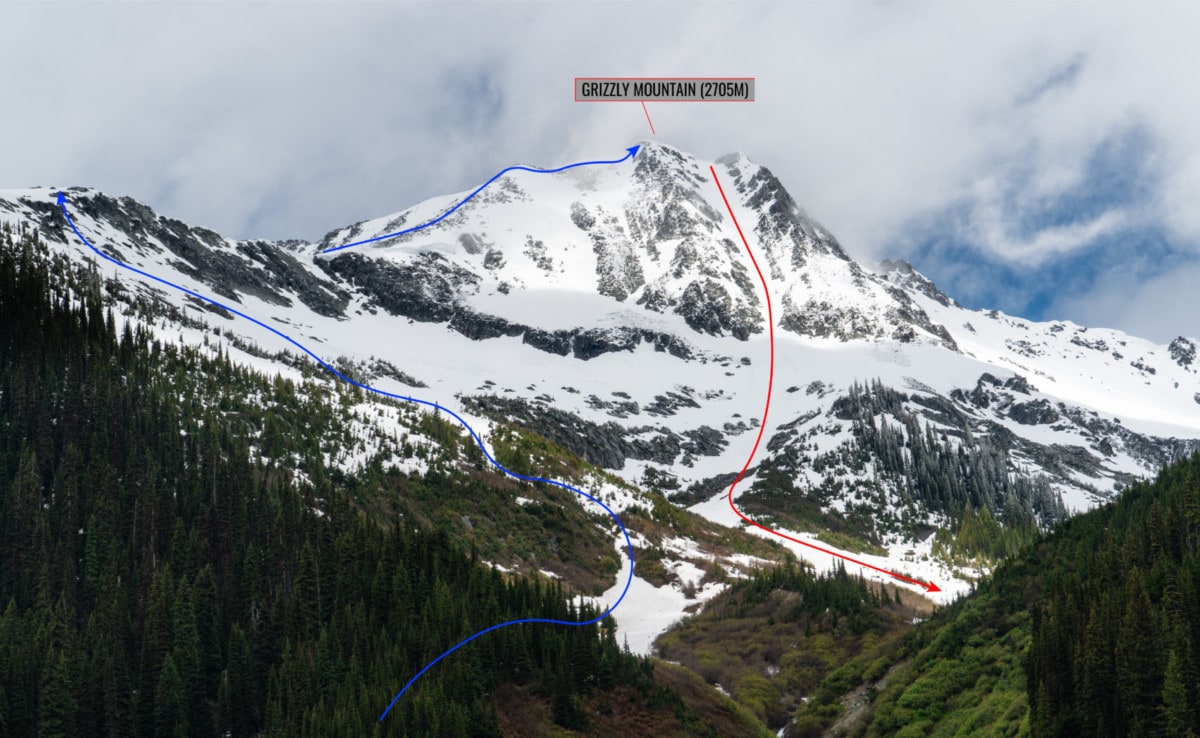
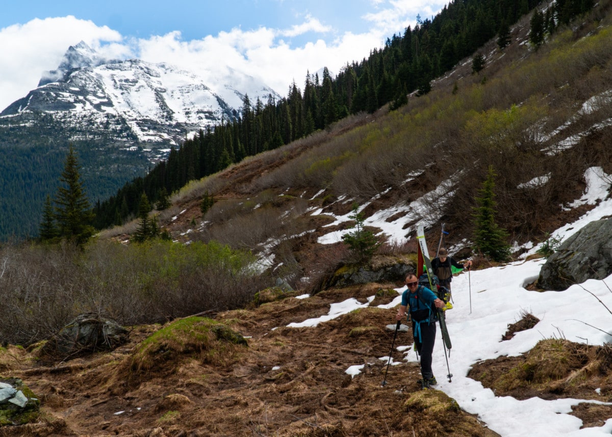
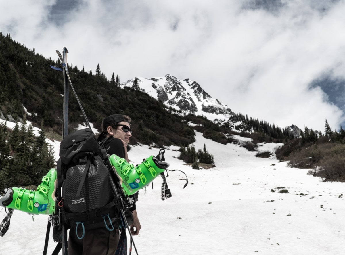
We were all equally stoked to get back in the alpine. I spent the last month either at the end of a climbing rope or on my mountain bike, both at the very bottom of a valley. I needed to chase the vert again. Since a deep snowpack was still lingering up there, we needed skis for the top half of the ascent. Limited by a short weather window, we raced up the Connaught Valley, looking north for a clear view of Grizzly Mountain, scarred by a large couloir that usually holds snow until late-July.
Looking at the foothills, we knew what was waiting for us: an impassable alder patch at the bottom of the Grizzly slide path. After all I’ve been through, I fear one thing and one thing only: ALDERS.
Alder's Nerd Fact
We circumnavigated the first alder patch by following the Balu Pass Trail until a bridge, built for crossing the raging Connaught Creek. Eventually, there was only so much terrain we could traverse before hitting the deathly patch. We fought our way through the brush. It didn’t help our skis were getting tangled in the overlapping branches. With some forced acrobatics and much frustration, we pierced through the patch. We laughed at how ridiculous a proposition this adventure was. Endless hours of bushwhacking for maybe 200m of actual skiing. And we weren’t expecting powder at all. Was it worth it?
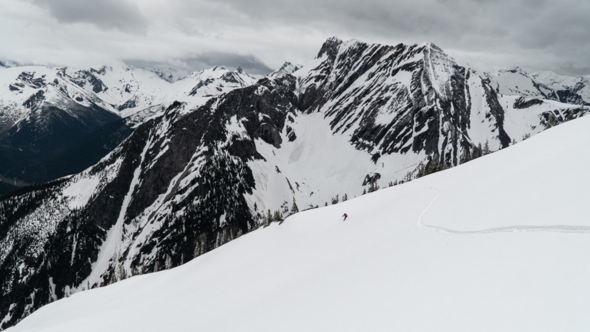
Once the suffer-fest was over, we sat down for a second and glanced at Grizzly Couloir, which I skied in December with Cedrik. We considered our options. The snow was getting heavy, dangerously heavy. It was nearing midday and the sun was beaming on the slopes. Cornices and glide cracks above us were now a serious threat. After talking it through, we plotted our route in a way that would avoid most of the hazards.
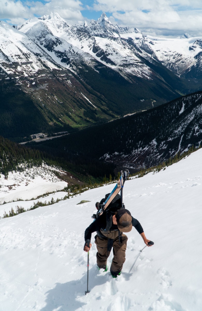
We hopped on our skis and headed up the shoulder. With the solstice sun beaming on the south-facing slope, the snow was quickly turning into soup, the kind that makes touring impossible, whereas your ski (and skin) just can’t hold an edge. We resorted to booting the entire approach. I wore my crampons because bump the gnar-level up a notch.
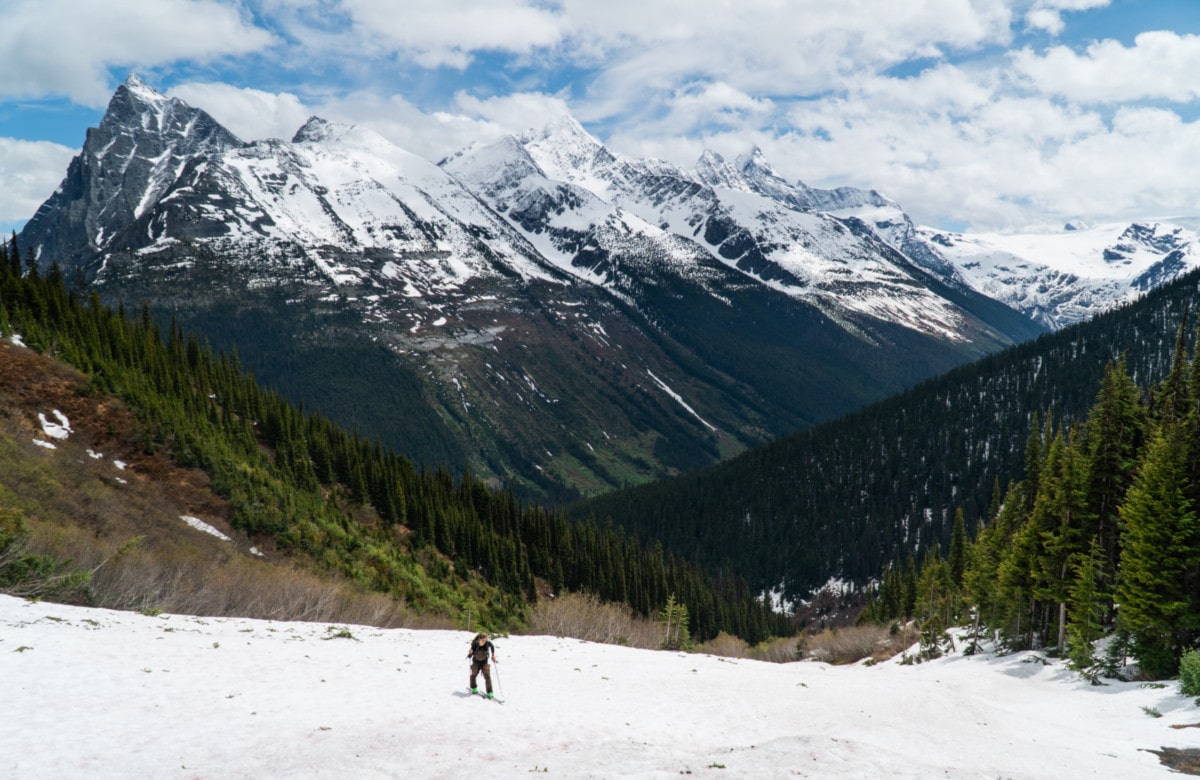
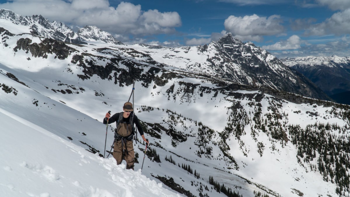
It had been a while since my last mountain climb. The heat and elevation made the climb grueling. I had to take breaks every few steps from fear of overheating in my thermals. To make matters worst, we were post-holing for most of the approach. After far too much effort, we connected with the crest of the shoulder of Grizzly Mountain (above Teddy Bear Trees), leading to the summit of Grizzly Mountain, from which we would ski its famous couloir.
By the time we gained the ridge, we were spent. The bushwhack and the heavy snow defeated us. With temps hovering around the teens, we felt it was time to turn back. Grizzly Couloir no longer had the right conditions for a safe descent. I was content. For what it’s worth, I came to see the alpine and that’s exactly what this trip accomplished. On top of that, the next storm cycle was just about to roll in, judging from the evil clouds progressively engulfing Cheops Mountain on the opposite side of the Connaught Valley.
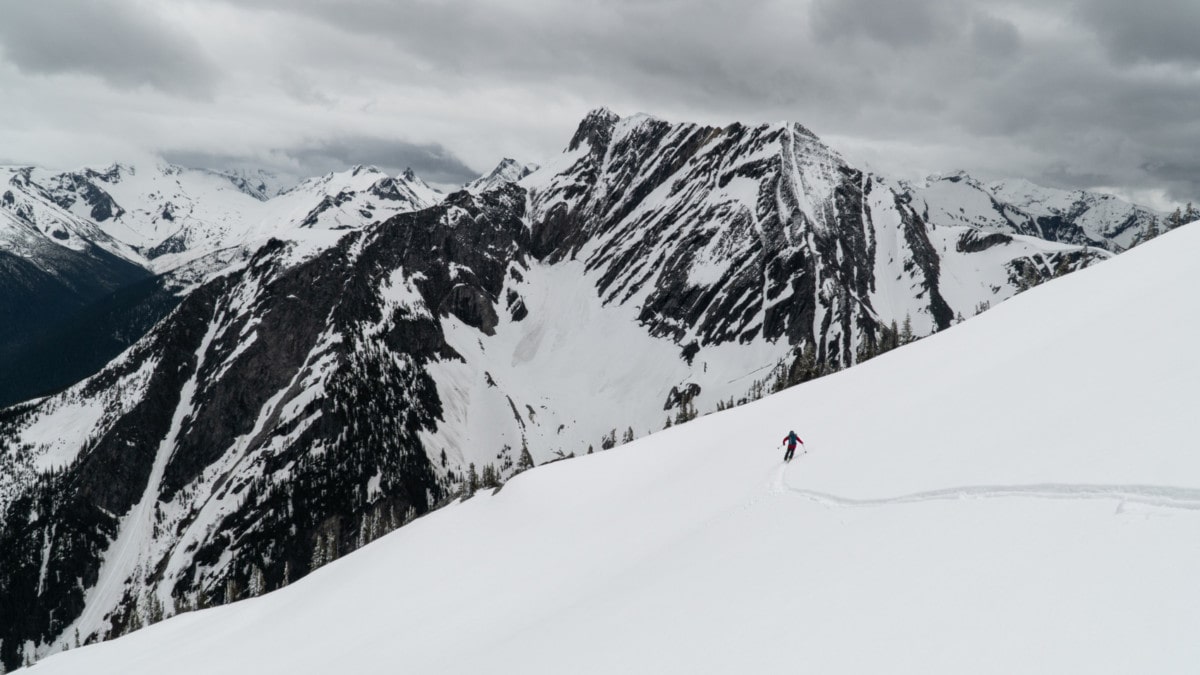
We stored our skins in our packs and clipped in our bindings. What a great feeling! Skiing the slope, however, was not. Slow, wet, and sticky like living life in slow-mo. I just couldn’t stay on top of my skis as the snow was unexpectedly latching on to my bases. Wax would have been a good idea for this one. Regardless, it’s the best we could have hoped from summer solstice skiing.
Once the snow turned to alders, we strapped our skis to our back and ducked into the forest across the drainage from where we hiked up. We picked our way through waterfalls, skied over moss and dirt, and ran down the world’s gnarliest forested slope skier’s right of the common backcountry skiing run called Rogers Run. This is the “true” Grizzly Shoulder run (with capital “S”). The tense hours of never knowing whether or not the wet slope would hold our weight terminated at a sparse alder patch. We skirted its entire length while remaining in the forest in hopes of reaching a bridge that’s usually part of the winter approach for ski tourers and splitboarders alike. With the help of the Gaia GPS App, we giddily walked back to the car.
While we didn’t reach our original objective, I was more than happy to have spent a whole day in Rogers Pass with good friends, amidst my favorite mountain range. Sometimes, it’s not about the objective but the experience.
Statistics
| Peak Elevation | 2457m |
| Vertical Gain/Loss | 1200m |
| Distance Traveled | 8km |
| Duration | 7h |
For more beta on my adventures, check out the Route Map. This google map interface is a repository of some of my ski touring, mountaineering and hiking adventures. It includes a loose GPS trace for your convenience.
You guys went up Teddy Bear ridge and down Grizzly Shoulder, not Rogers Run. Just saying. Also, to get a southeast facing line in decent conditions at this time of year, not talking about the horrendous runnel there must be in the couloir, you would have had to start heading up before sunrise. Good effort!
Hi Michel, thanks for the input! We climbed on the border of Teddy Bear Trees and onto the SE shoulder (with a small “s”) spanning directly down from the summit of Grizzly Mountain. I do understand most refer to the Grizzly Shoulder as the one leading to Little Sifton. I’ll clear that up in the article. Again, thanks for pitching in!!