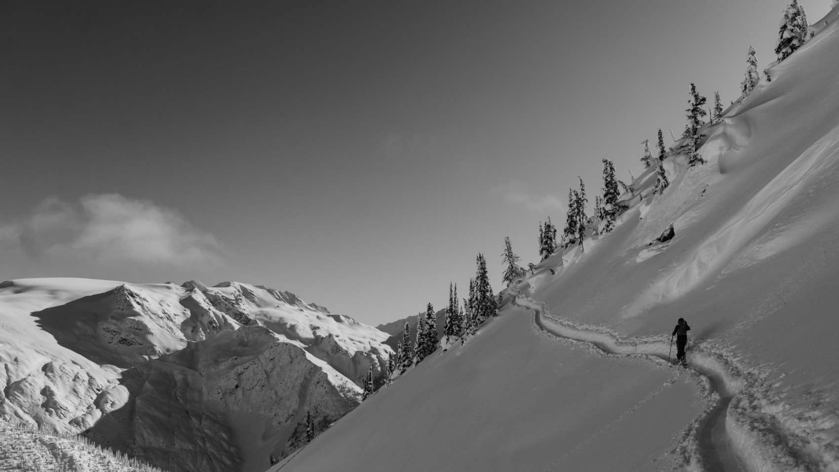
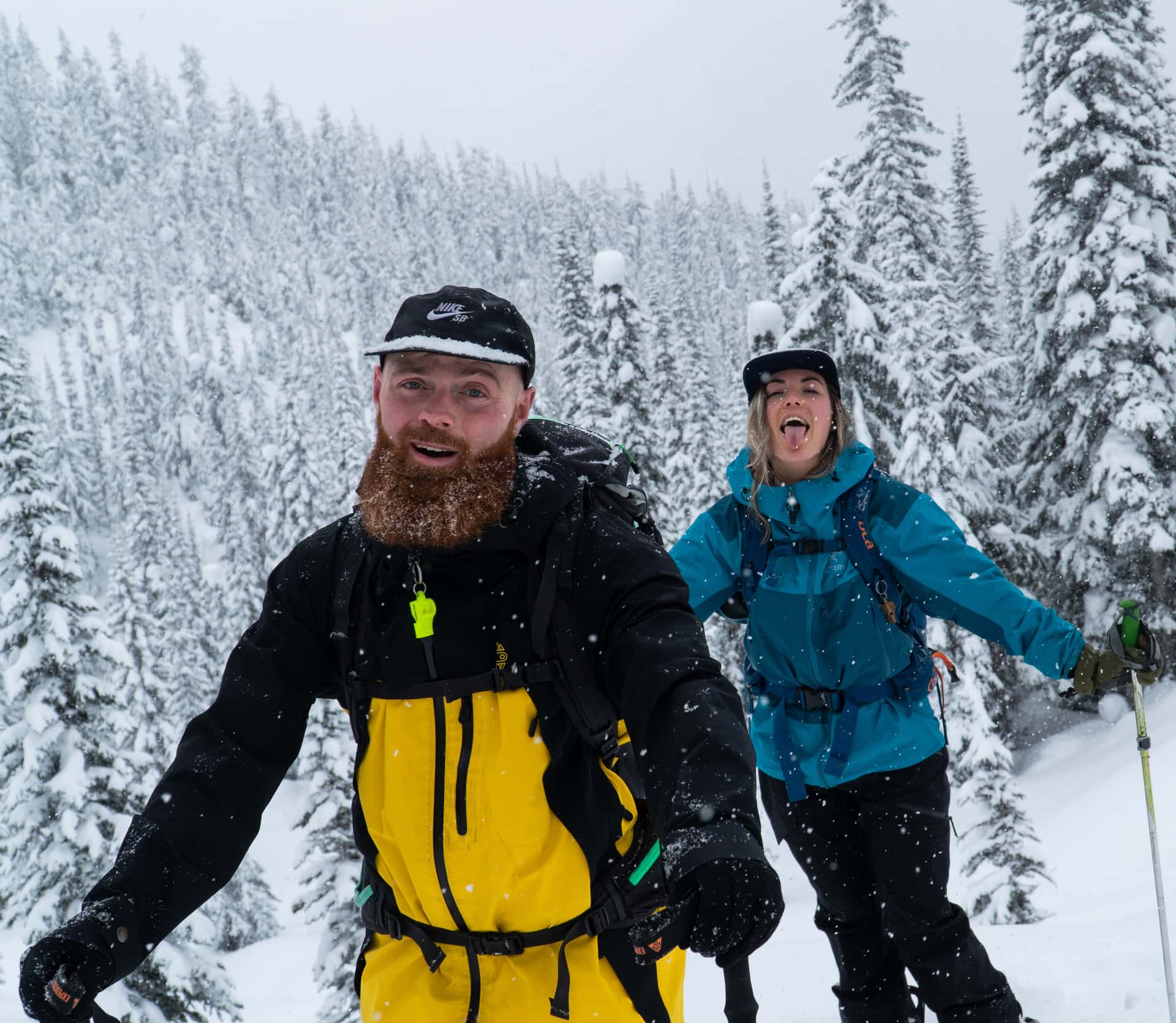
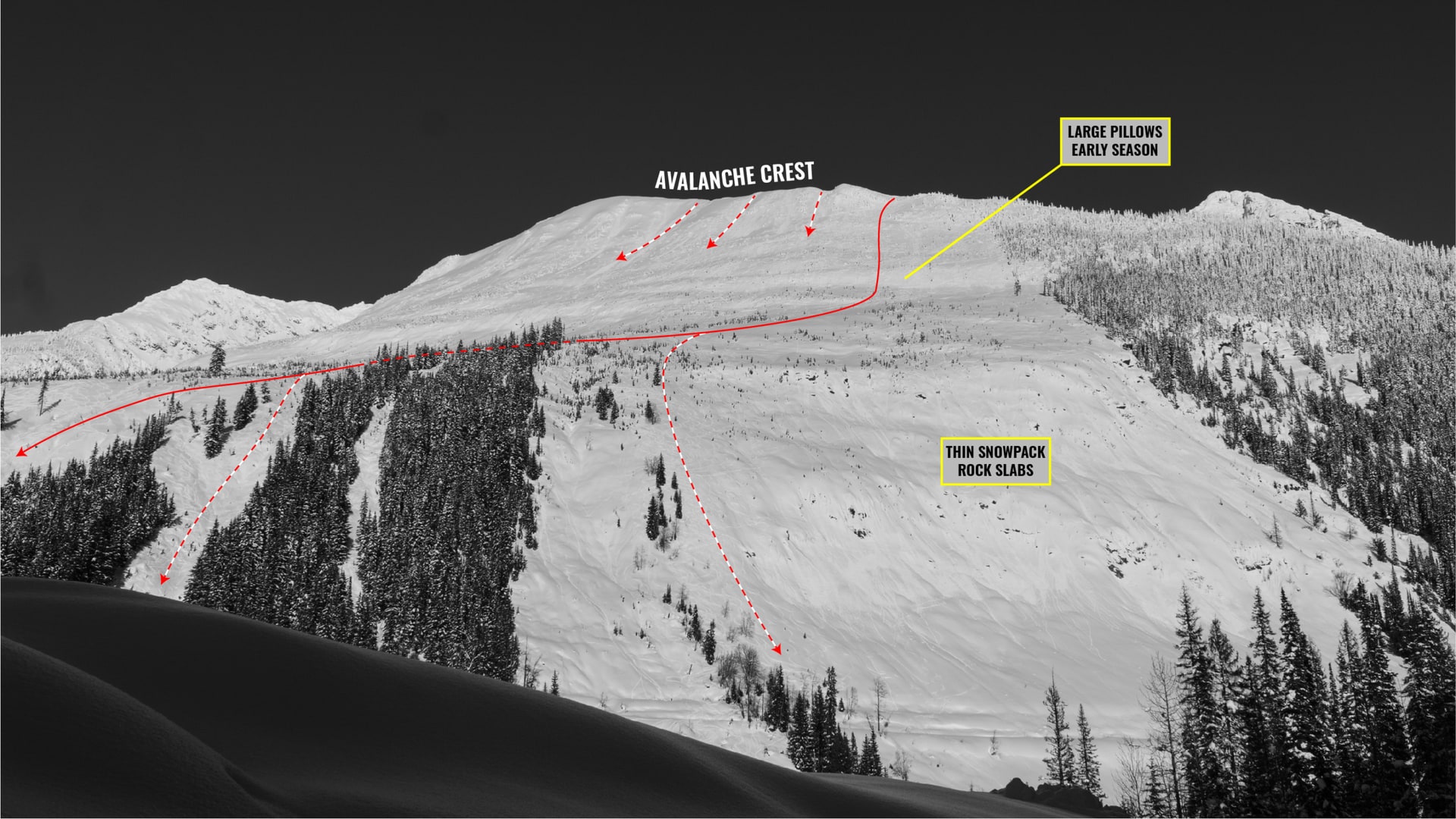
Skiing Avalanche Crest is quite simply a treat. Some may even argue it’s the top run at Rogers Pass. In fact, many do: it’s one of the most popular ski tours in Glacier National Park. From the ridge’s high side, it’s a 1200-meter uninterrupted ski, straight down to the Trans-Canada Highway, spitting you 100 meters from the Illecillewaet parking lot. It couldn’t be more convenient! The SW slope is as vast as it comes, always offering fresh tracks to the keen adventurer. Just make sure to hit it before it soaks up too much heat: the steep slope sees the sun for most of the day, heavily altering the snow quality and heightening the avalanche hazard. The one route that might top it off would be the North Face of Mt Green. If it wasn’t already enough to convince you, the ascent is breezy, following the gentle grade of the Avalanche Crest summer trail. My latest outing skiing Avalanche Crest was completed with splitboarders, Izzy and Simon. Note: Just to be clear, this article was written using content from distinct days spent exploring the route’s options.
This route is located within a Winter Restricted Area (WRA) governed by the Winter Permit System. Please check the WRA status before travelling through it.
Related: Skiing Avalanche Mountain, Rogers Pass: The Burn
Report from February 4, 2021
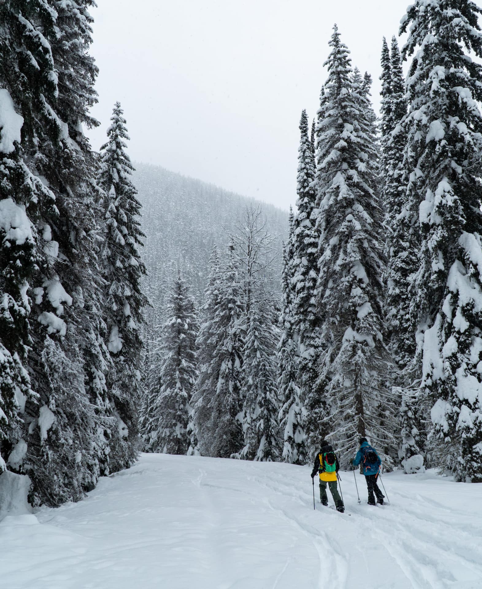
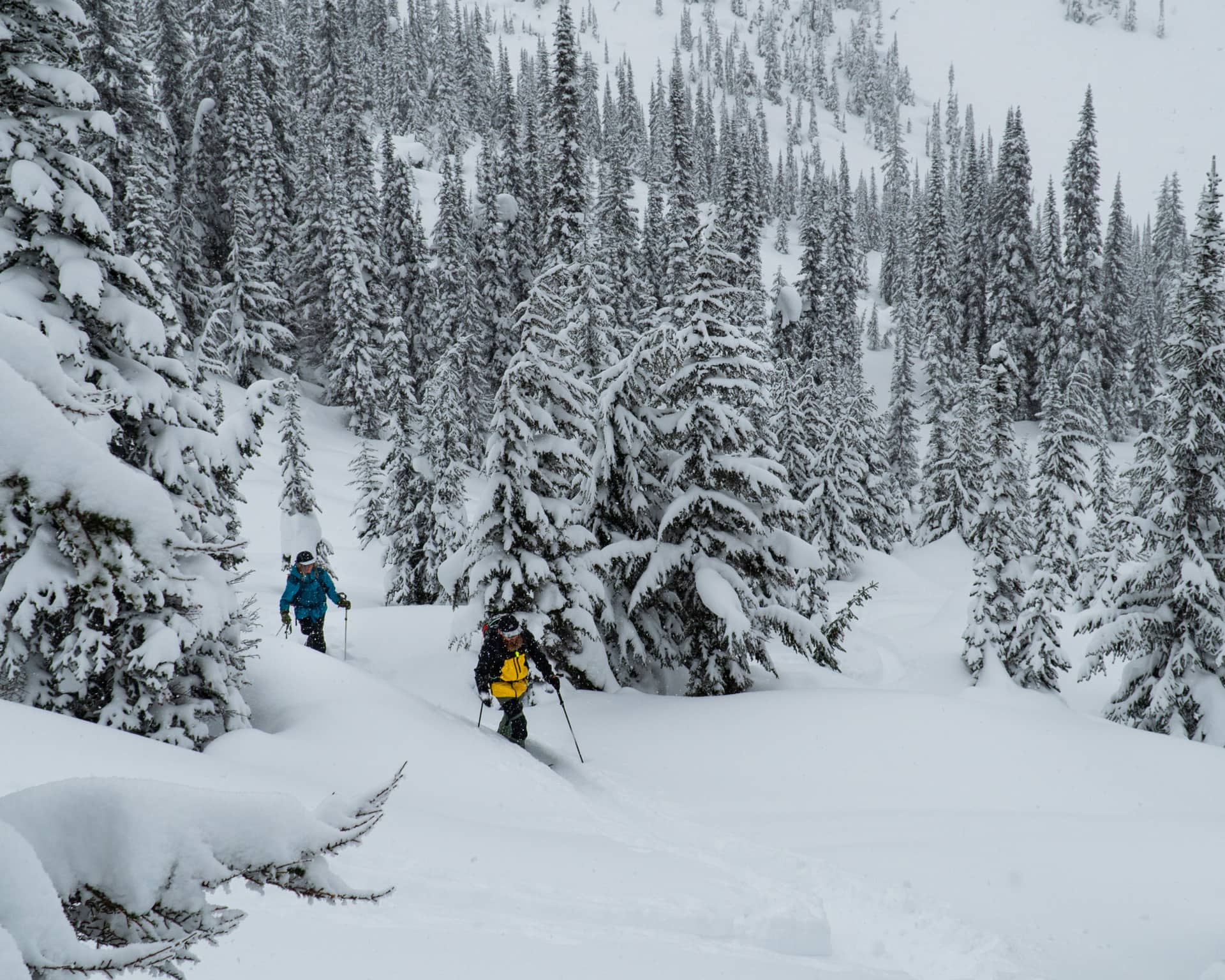
We began our day touring up the gentle railroad grade which originates from the Illecillewaet parking lot. I fell in love with this easy walk in the park – pun intended. Not only is it a great way to warm up the legs, but it’s also one of the few sheltered access routes where you don’t have to keep your head on a swivel: the avalanche hazard is non-existent.
At the intersection of the railroad grade and the A. O. Wheeler Hut, we veered off left on the Avalanche Crest trail, a summer path that would lead us up 500 meters to the base of the Avalanche Mt South Bowl. At its trailhead, a bright yellow sign warned us of the use of artillery rounds for avalanche control. In fact, we were just about to enter the Winter Restricted Area of West Rogers, governed by the Winter Permit System of Glacier National Park.
Winter Permit System Compliance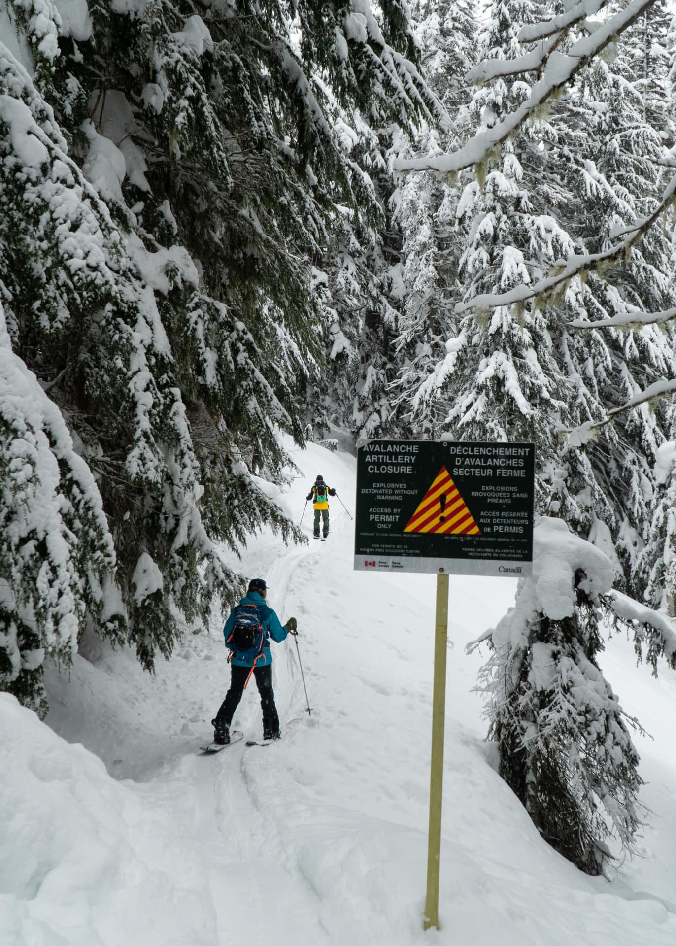
After ensuring the West Rogers WRA was open for the day, we proceeded up the trail where we found an existing track. Having been up there a few times already, I expected the uptrack to be a slick, overused mess. Fortunately, yesterday’s warm flurries had covered the icy tracks and made it a little easier for all of us, especially for rookie splitboarder, Simon.
We climbed the trail at a steady pace, only stopping every now and then to nerd out on snow science and quench our thirst. Although the slope was rather steep, the trail builders had carved a gentle path using a maze of switchbacks crisscrossing the slope. After an hour of easy climbing, the trail led us onto a bench at treeline. This feature marks the base of the Avalanche Mt South Bowl.
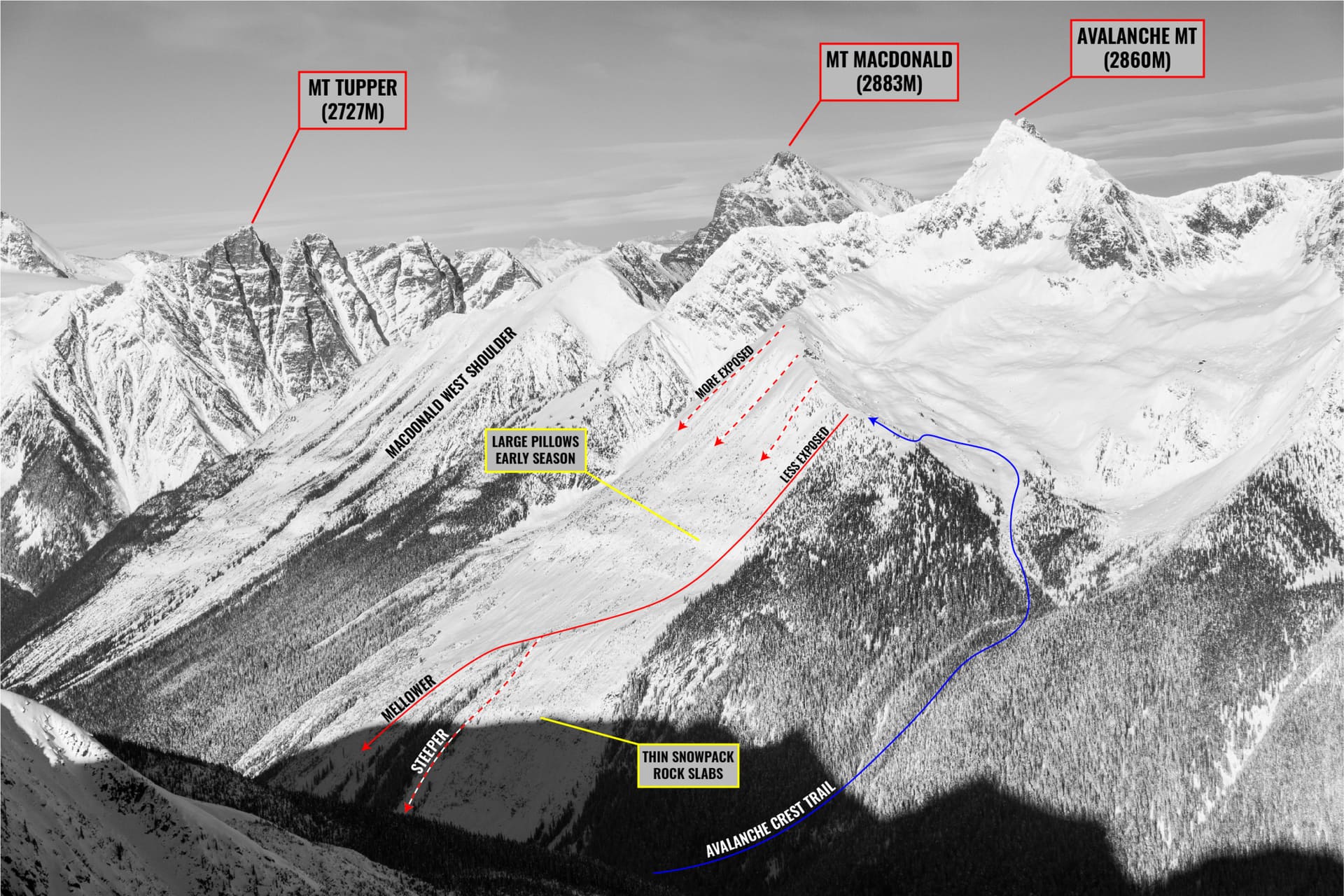
We followed a gully, looker’s left of the bowl, that tracks along the base of the Avalanche Crest, an alpine crescent-shaped ridge. Fred and I had walked up that ridge when climbing Avalanche Mountain, a couple of summers ago. As we stepped onto the treeless moraines high up in the bowl, we lost all of our visibility. With our heads in the clouds, I led the group on a traverse across the west half of the bowl in order to link up with the Avalanche Crest.
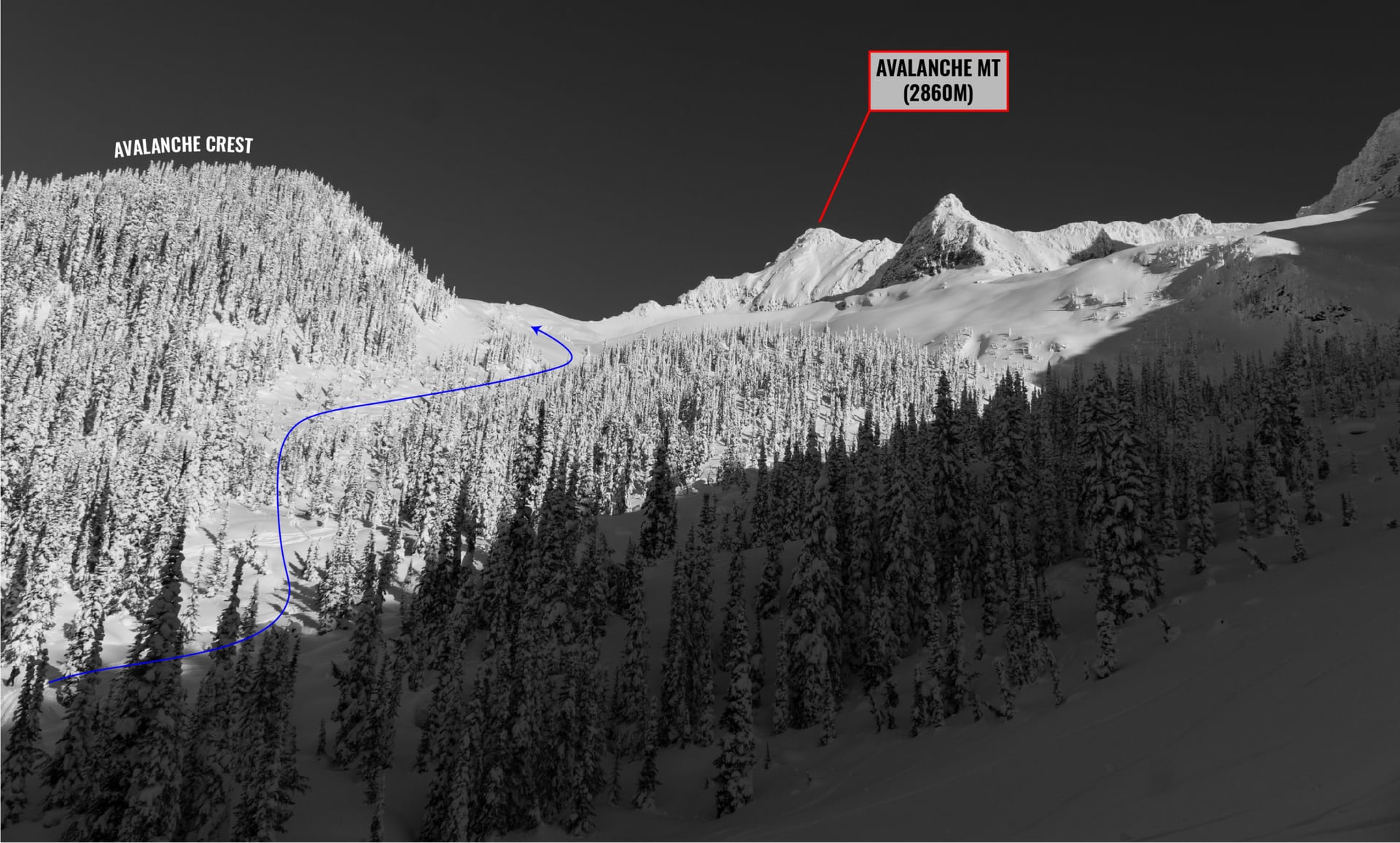
Every hundred meters, I would test the snow ahead, looking for signs of avalanche instabilities: whumpfing, shooting cracks, and slab properties. All we got was a faint, isolated whumpf on mellow terrain that didn’t worry me one bit. After a nauseating, 15-minute walk, I could only make out the Avalanche Crest, which we later gained by cutting across an exposed slope, one giant avalanche start zone. Throughout the whole process, we maintained an increased distance between ourselves to minimize our exposure to potential avalanches. It’s important to remember that we were travelling through a slide path with a whole lot of snow above our heads.
I breathe a sigh of relief as we reached the ridge, a temporary safe spot. Before dropping the SW face, we made sure to assess the stability of the upper layers of snow. After all, skiing Avalanche Crest is a committing adventure, tracing lines through unsupported convex rolls and serious overhead exposure. With much time on our hands, we dug a profile to observe the top layers. In the last few days, it had fallen more than 60cm of warm, dense snow. While natural avalanche activity had ground to a halt the night before, skier-triggered avalanches were our main threat.
Avalanche Crest Skiable Options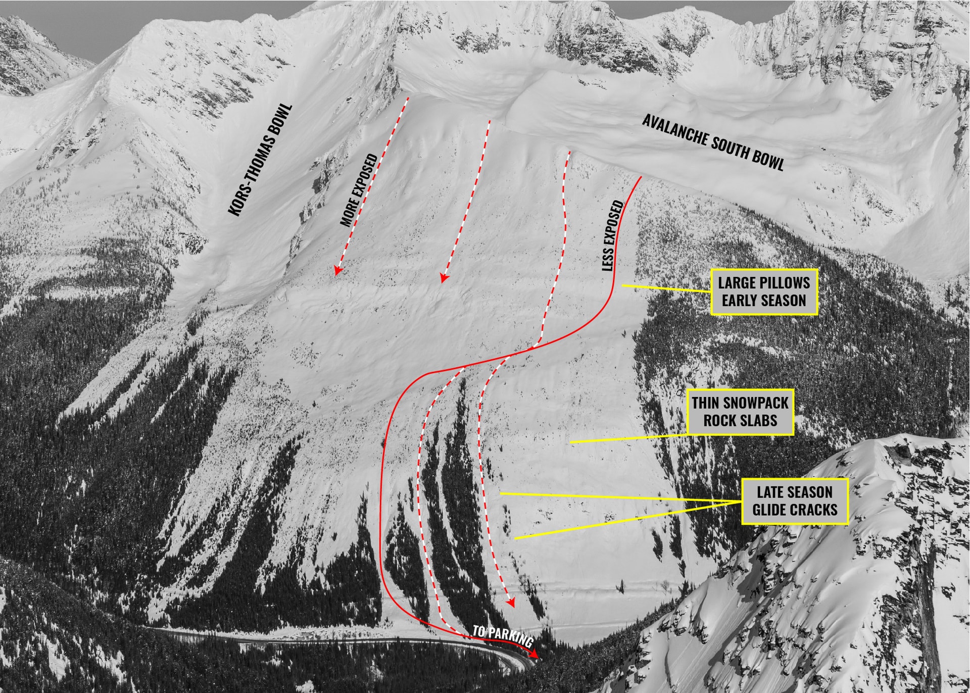
After a series of comforting observations, we transitioned for the descent. We planned on skiing from the lowest point along the Avalanche Crest (looker’s right), peppered by sparse trees. This was a more conservative alternative to a higher alpine drop-in. If it wasn’t enough to convince us, the lower lines hadn’t been poached yet, offering excellent snow quality. That day, a cooling trend had sucked all the moisture out of the snow turning it from wet goop to blower pow. We knew we were in for a treat.
I’ll let the above video, shot in February 2020, speak for itself. The route, detailed in this trip report, was similar, albeit a little lower down on the ridge, a better line in poor visibility. We ended up skiing a little under 1000 meters of waist-deep powder – arguably my powder line of the season thus far. We ducked into a featured gully to the skier’s right and finished our run a few meters from the highway. With all honesty, Avalanche Crest might be one of Rogers Pass’ top ski runs!
Statistics
| Peak Elevation | 2200m |
| Vertical Gain/Loss | 1000m |
| Distance Traveled | 8km |
| Duration | 4h |
For more beta on my adventures, check out the Route Map. This online map interface is a repository of my ski touring and mountaineering adventures. Simply follow the rough trace!