The stars lined up. The clouds were sitting high in the skies, the avalanche hazard was known and the plan was set. We headed out in the rugged terrain of Rogers Pass to traverse the Sapphire Col, an alpine pass nestled between Mt Jupiter (2796m) and the Dome (2736m). The mission involved traveling over two lightly crevassed glaciers, the Lily and Asulkan glacier, as well as crossing both the Loop Brook and Asulkan Valley on skis. Little did we know, we would break trail through deep snow for most of the trip’s length, spanning 19km and 1600 vertical meters. Nine hours later, we achieved our goal.
This route is located within a Winter Restricted Area (WRA) governed by the Winter Permit System. Please check the WRA status before travelling through it.
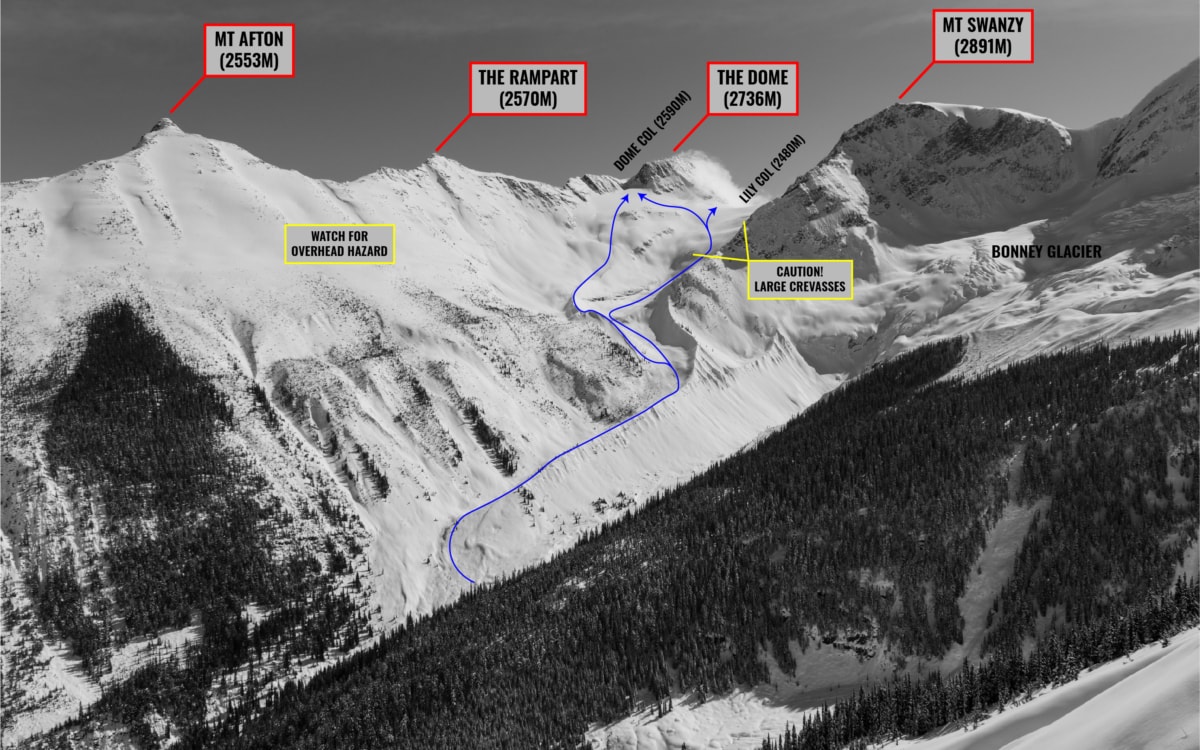
Related: Dome Col Traverse: Glacier Skiing At Its Finest
Report from March 1, 2020
The positive energy was palpable. Laurent and I been aching to get our head in the clouds for a long time and get a good look at the Icomappleux Valley, located behind the Lily and Sapphire cols. We mostly wanted to hop back on glaciated terrain, practice our rope work and sharpen alpine navigation skills, all important facets of ski-mountaineering.
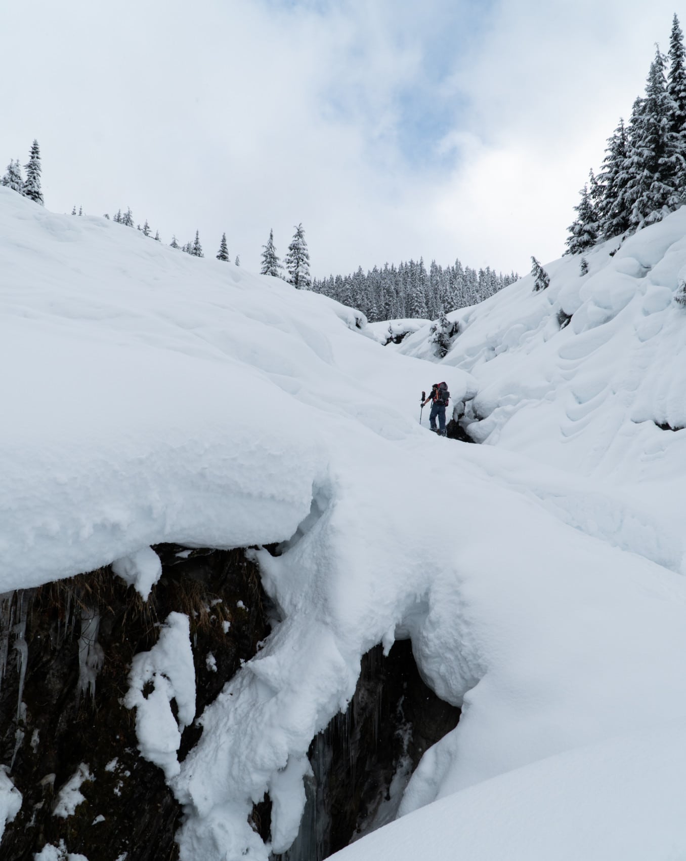
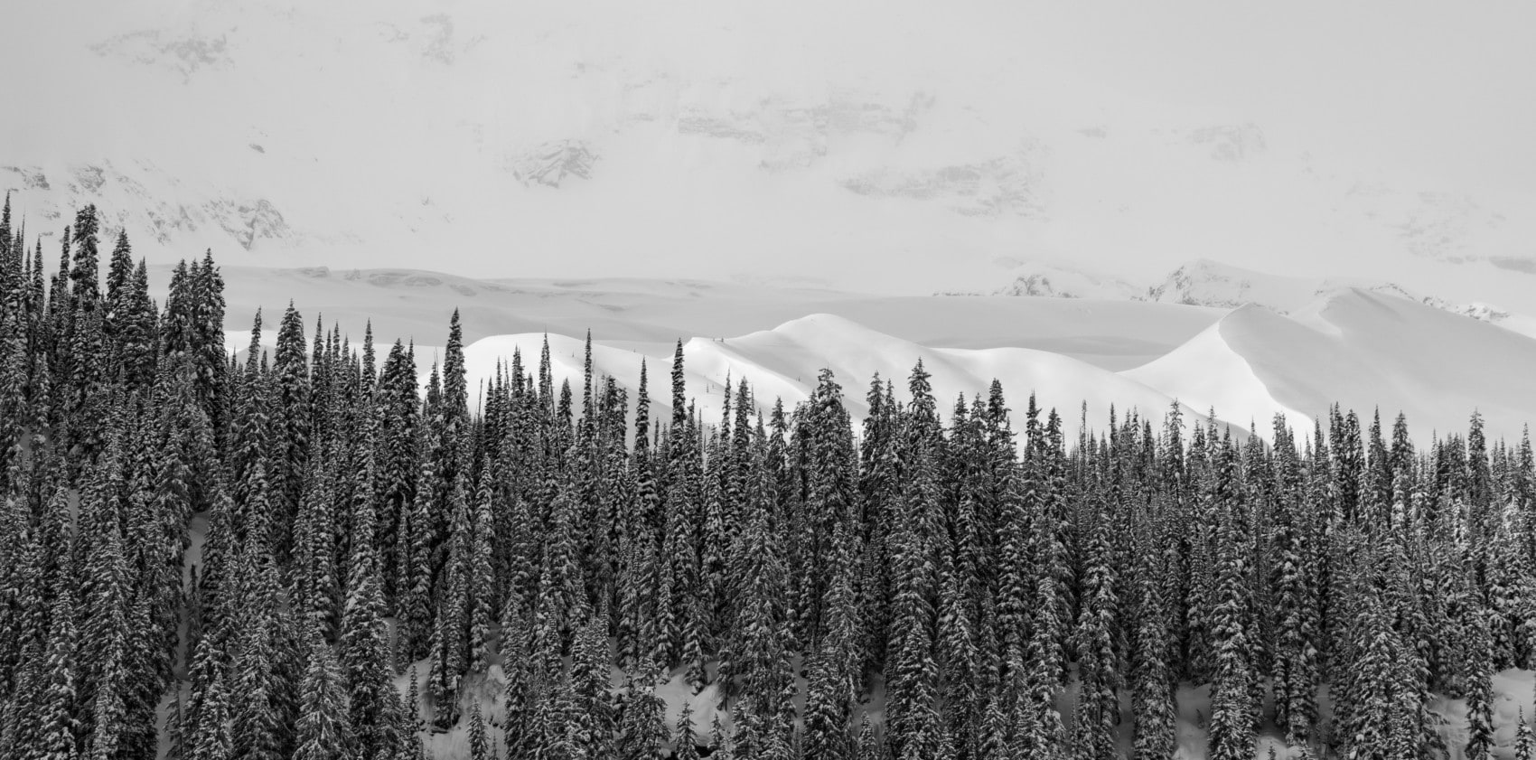
We set out early morning into the twisting canyons of the Loop Brook Valley, branching out into smaller gullies that were carved eons ago by the glacial streams of the Bonney and Green glaciers. We veered right at the Elephant Trunk and ducked into the trees, heading straight for the Lily Glacier in the shadow of Mt Swanzy (2891m). Hopping onto the Lily Glacier was the first step in the Sapphire Col Traverse.
We dug a pit at 1700m in search of a dangerous surface hoar layer buried 60cm under the surface. We planned the Sapphire Col Traverse accordingly, traveling through slopes we thought wouldn’t harbor this dangerous persistent weak layer (PWL). We plotted our route through wind-blown and solar terrain that would minimize the likelihood of surface hoar being present. Wind and solar exposure tend to either blow the crystals away or melt them down. When we had doubts about the location of the PWL, we would stick to low-angle, low-consequence terrain where slab propagation would be minimal (think heavily treed slopes).
Surface Hoar Trivia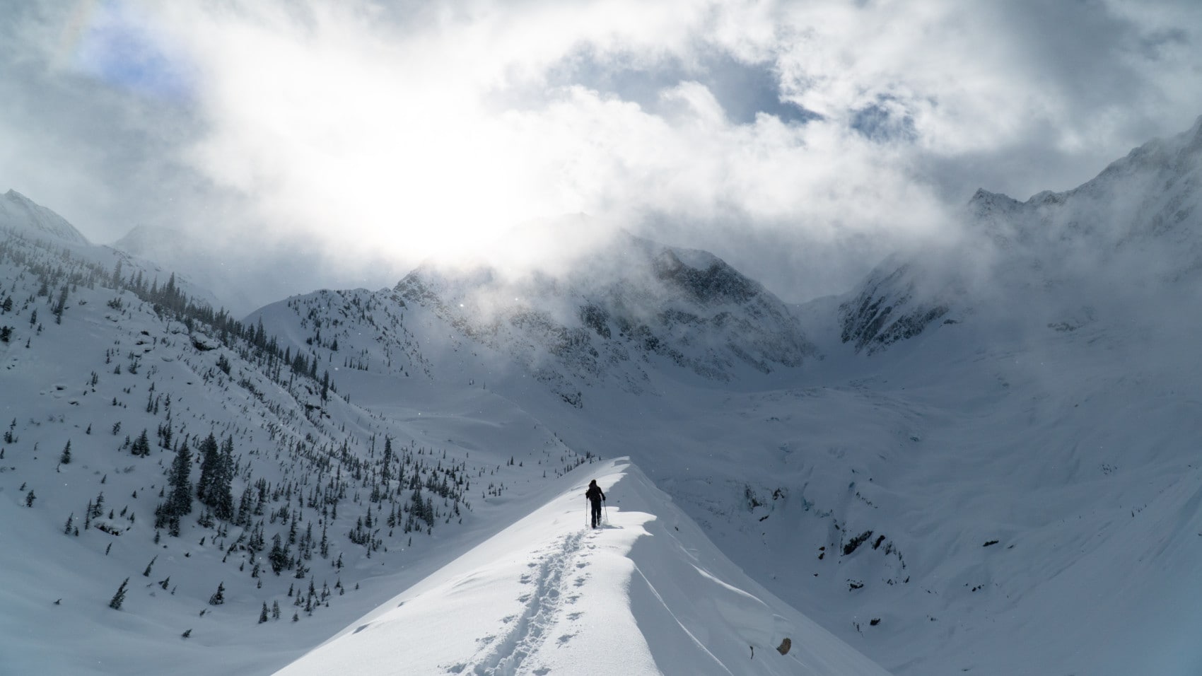
We traveled up the gently-sloping lateral moraine terminating the Lily Glacier. Mt Swanzy and Clarke Peak stood watching silently overhead, with the wispy cloud swirling around their summits as the sun pierced the thin veil. The rocky headwall of Mt Green could be seen across the valley. The sight was to die for. It reminded me of why I endure through the hard work to visit those valleys. On the right, we spotted the Bonney Moraines in the distance, a typically “short” ski touring trip in the Loop Brook Valley. Their east face was lit up, contrasting against the shadowy backdrop of Mt Bonney, the highest of the valley at 3100m, and Parsons Peak.
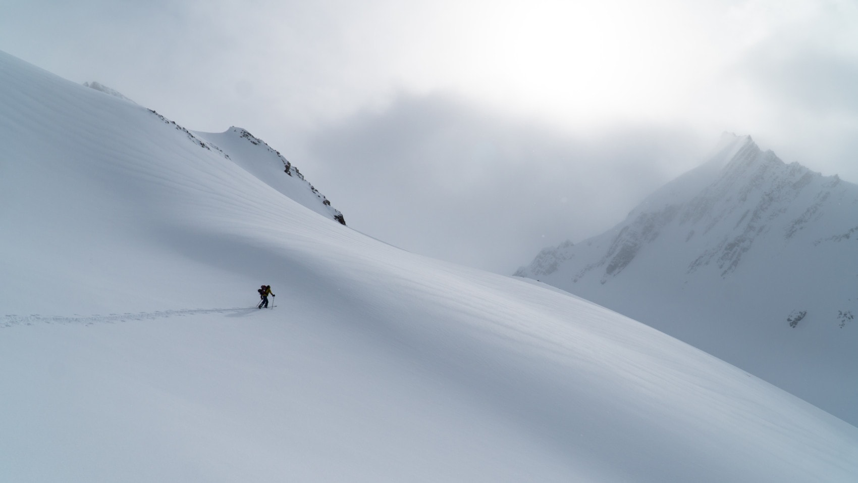
After a few hours that flew by, we emerged from treeline into the exposed alpine slopes west of the Rampart. We gazed upon the Lily Glacier, a tame glacier by European standards, with a few crevasses that can easily be circumvented. I identified old avalanche debris at the toe of the glacier that ran for a surprising length. It originated from a crown on the NE flank of Mt Swanzy, probably from a recent storm slab.
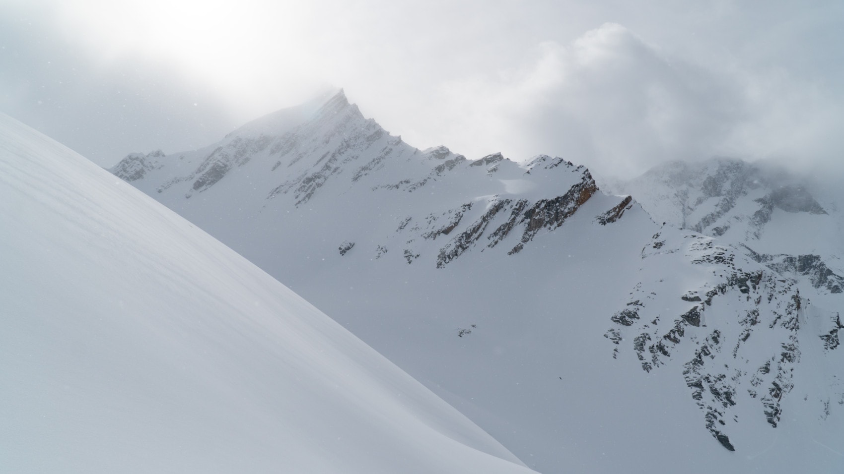
After seeing this evidence of previous natural avalanche activity, we stuck to higher ground following the base of the Rampart, instead of jumping straight on the glacier and setting a trail through the debris. Thankfully, the snow became shallower and lighter as the winds had clearly done some work on the surface. Trail-breaking was much easier.
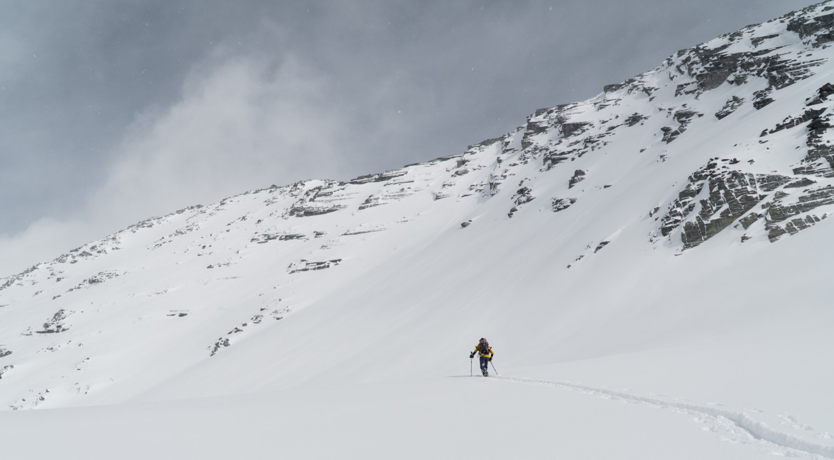
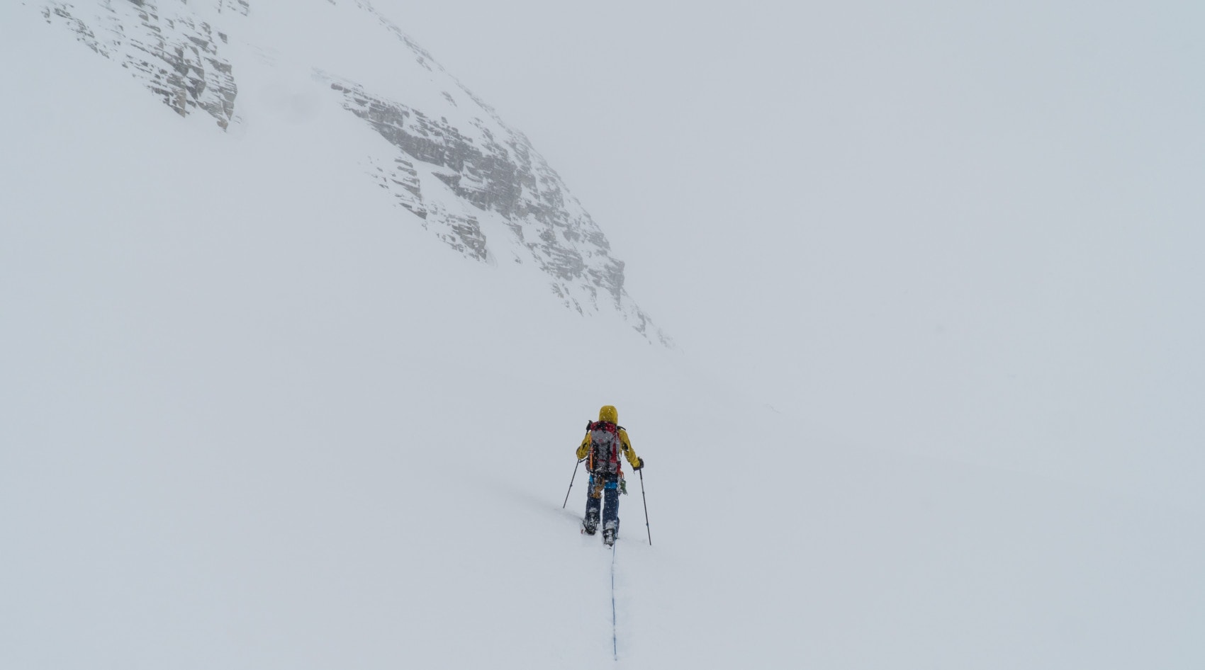
At that point, the flat light made it difficult to evaluate the terrain further up. The clouds rolled in quite quickly. I broke trail for that part, feeling the snow with my pole as I was mostly worried about unknowingly stumbling upon a wind slab. The slope was averaging the 40-degree incline requiring careful kick-turns every now and then. I took great care in carving a perfect 12-degree trail for future like-minded explorers.
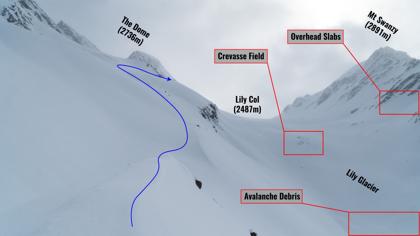
We eventually arrived at the bottom of the Dome, an elongated summit that reminded me of the dorsal fins of a stegosaurus. At the footstep of the Lily Glacier, we roped up for the remainder of the traverse, keeping a constant 12m between us. Visibility was at an all-time low. Fortunately, we could spot the rocky face of the Dome in the distance and simply walked along its base.
After 20 minutes of circumnavigating the Dome through deep snow and howling winds, we reached the base of the Sapphire Col, the traverse’s apex. I led the climb, picking my way through a series of alarming wind slabs. The exposure was serious. A mistake could have been fatal. With careful route-finding, we gained the Sapphire Col. To our relief, the Sapphire Col Hut was unlocked. With the winds almost blowing us away, we sought refuge without hesitation.
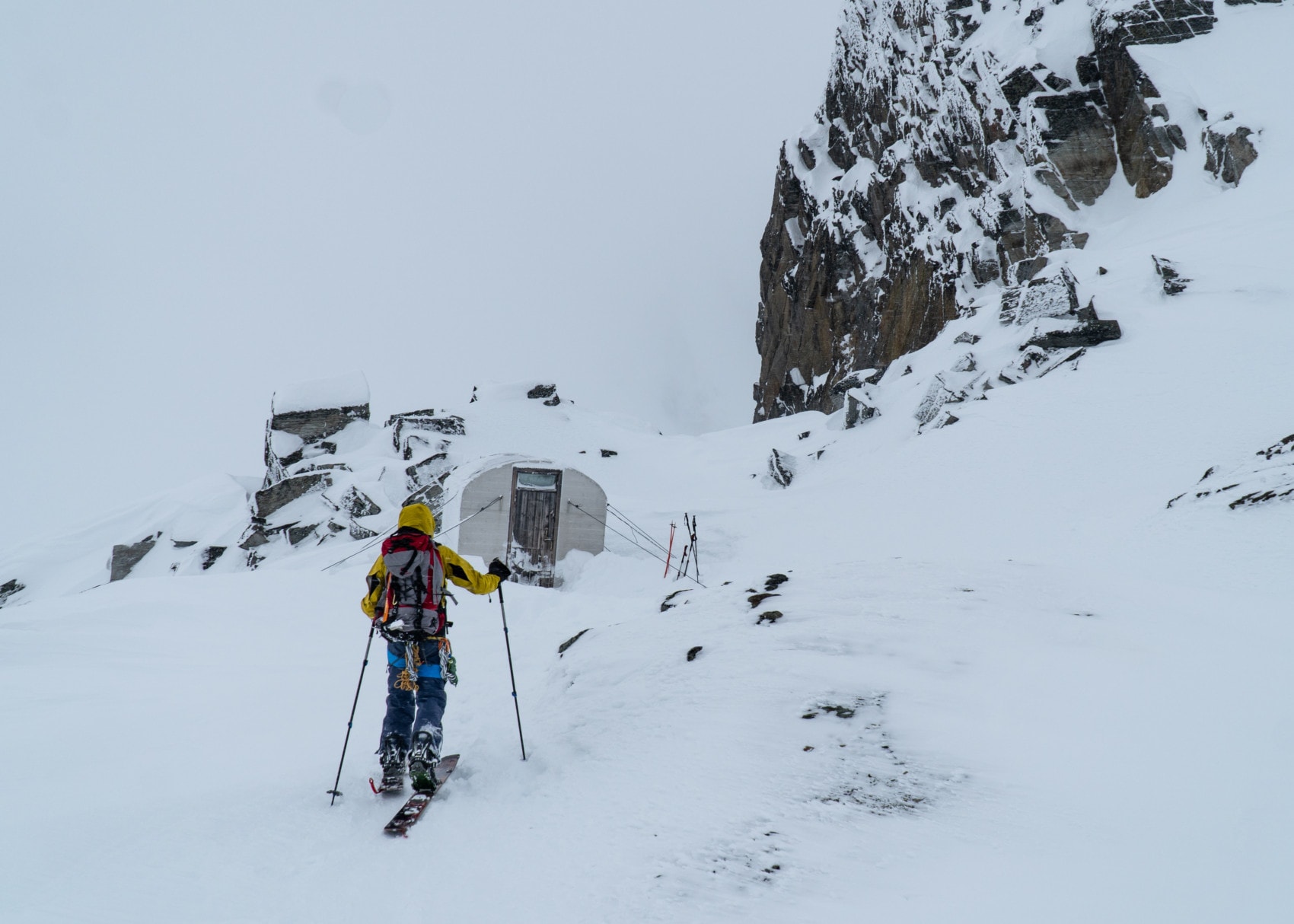
It’s in this unheated shelter that we met ACMG guide, Russ Lybarger, who was warming up in the company of his esteemed guests. Nice guy! I felt like I had a ton to discuss. Alas, time was of the essence. Laurent and I had to move. We transitioned for the descent down the Asulkan Glacier and its moraines.
After navigating the series of moraines in near whiteout conditions, we descended below the cloud ceiling and skied the Mousetrap, a towering glacial moraine below the Asulkan Glacier. Great powder! We then toured down the Asulkan Trail to the Illecillewaet parking lot where we stumbled across snowboarding legend, Jeremy Jones, and his pals. It seems like everyone is in search of the Rogers Pass experience! A long slog along the Trans-Canada highway got us back to our starting point, the Loop Brook Parking Lot. Surprisingly, both Laurent and I were still in excellent shape. I pulled out my phone and ticked the Sapphire Col traverse off my exhaustive to-do list.
Statistics
| Peak Elevation | 2600m |
| Vertical Gain/Loss | 1614m |
| Distance Traveled | 20km |
| Duration | 9h |
For more beta on my adventures, check out the Route Map. This map interface is a repository of some of my ski touring, mountaineering and hiking adventures. It includes a loose GPS trace for your convenience.