Grizzly Trees, located in Rogers Pass of Glacier National Park, is an incredible naturally gladed area, a mere 1.5km from the Rogers Pass Discovery Center (RPDC). From treeline skiing to pillow smashing, it’s got it all! They are four main slide paths that offer excellent skiing with a slope inclination from 25 to 35 degrees. Beware, the name says it all. Those paths were carved over the years by frequent avalanches, clearing trees and bushes. Take great care when travelling through those slopes in the winter. All in all, Grizzly Trees presents itself as an awesome bargain trading a quick ascent for a 650m descent that can easily be lapped in a day. Most of the uptrack is shared with popular routes, Rogers Run and Puff Daddy, forming what’s called the Grizzly Shoulder. With the former being one of Rogers Pass’ Top Runs, Grizzly Trees would be well within that realm when it comes to bang for your buck. It’s no surprise that the route is extremely popular. It’s also worth mentioning it suits intermediate ski tourers looking to get into bigger terrain as it avoids crossing major slidepaths and consists of challenging avalanche terrain (according to the Avalanche Terrain Exposure Scale – ATES). One last thing: the south-facing slope get a ton of sun during the daytime, warming up the snow surface and increasing the avalanche hazard – keep that in mind when planning your day.
This route is located within a Winter Restricted Area (WRA) governed by the Winter Permit System. Please check the WRA status before travelling through it.
Related: Rogers Run On Grizzly Shoulder: Deep Days
Report from February 3, 2021
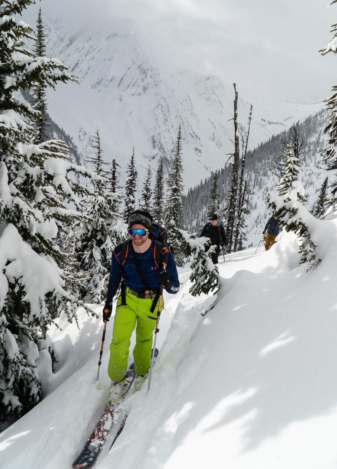
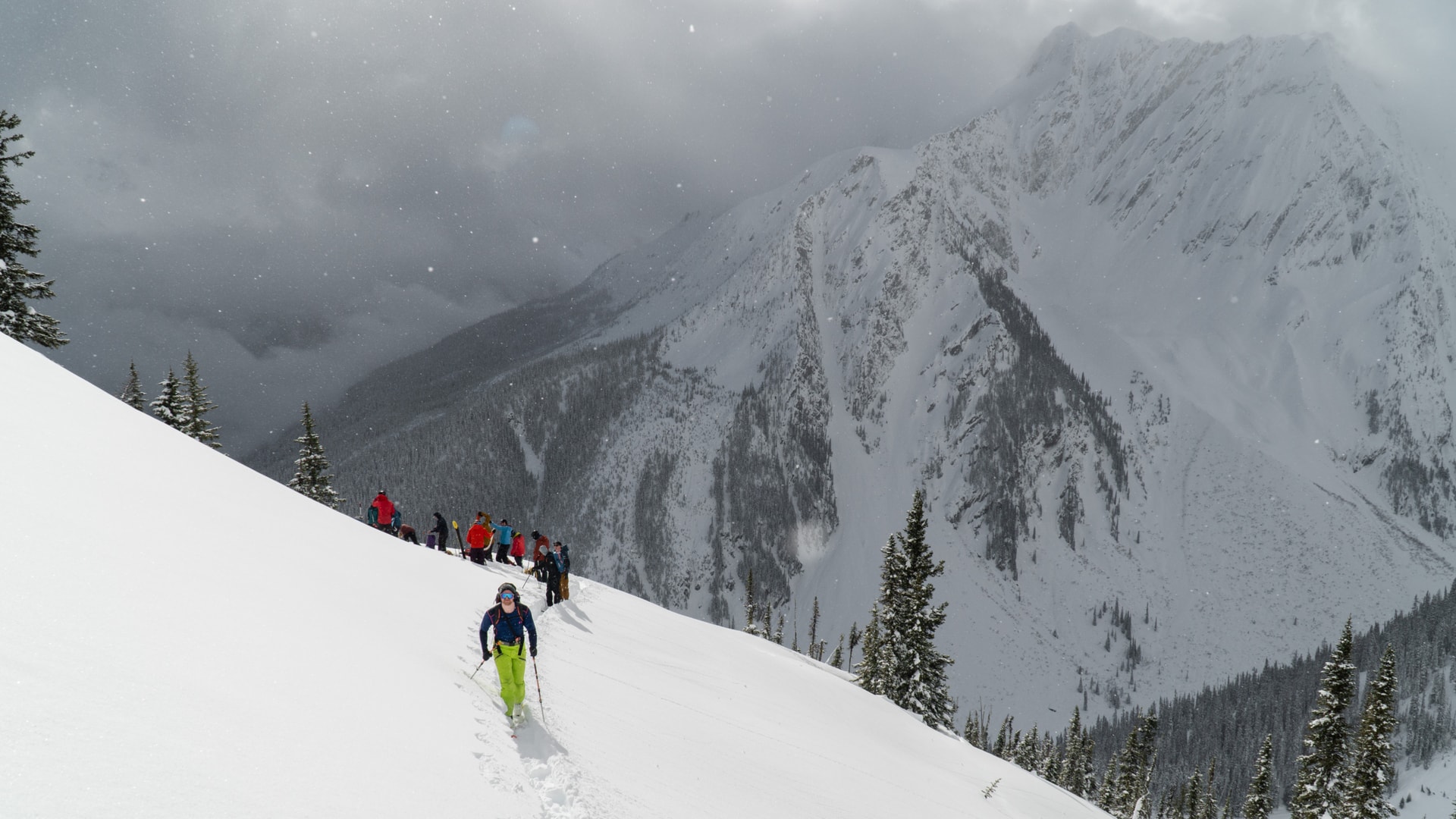
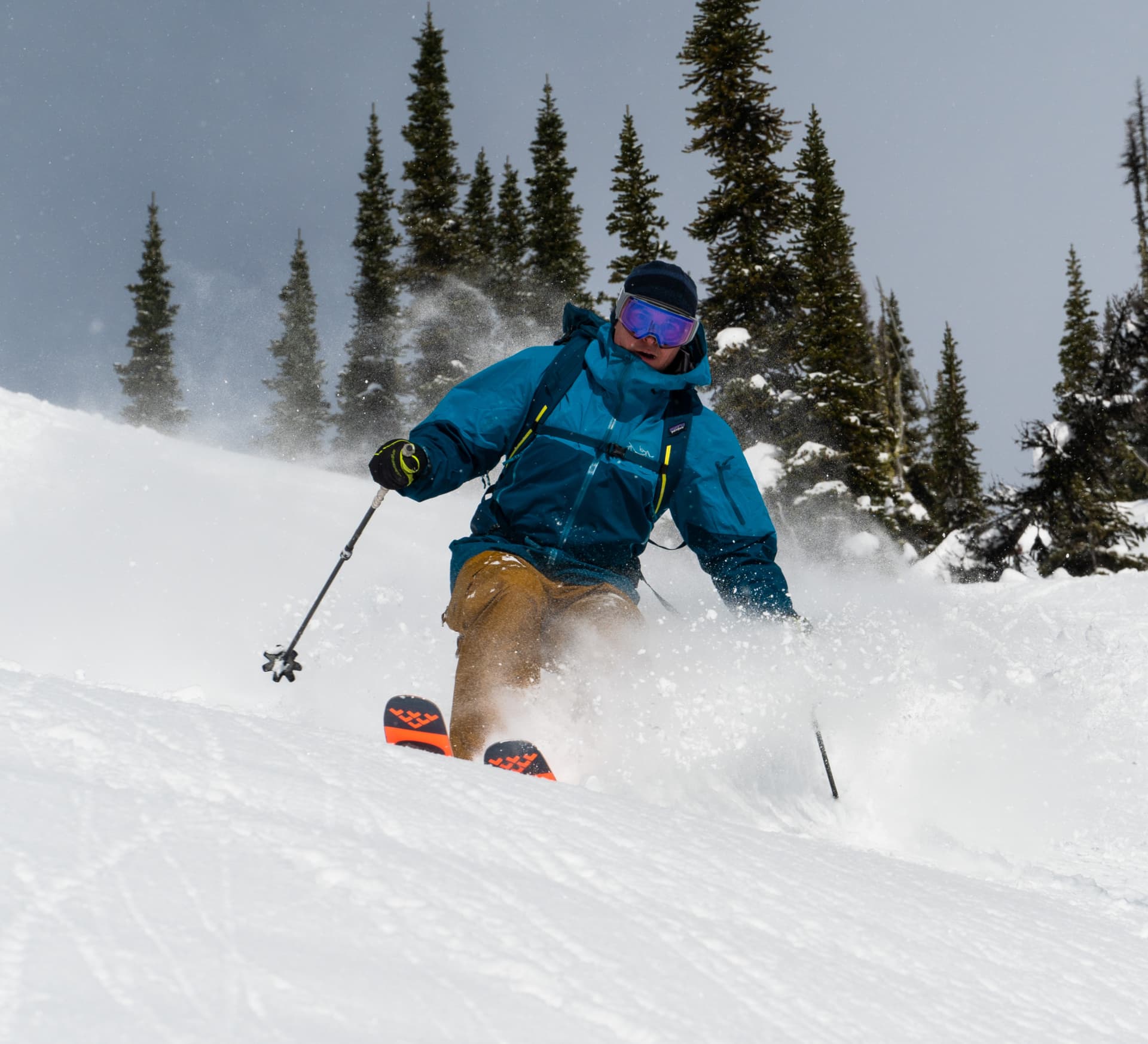
After a quick gear-up in front of the RPDC, Jeff, Joey, Bryn and I quickly slid up the Connaught Valley passing the WRA signs reminding us of the permit system. Often enough, Park Wardens hang out at the East Rogers WRA border to check permits and ensure no one enters the area when closed. We took the winter uptrack that follows the north bank of Connaught Creek, weaving through alders and tight trees – it’s no problem with a deep snowpack. We climbed the east side of the Grizzly Slidepath, an active avalanche path, and ducked into the trees of the Grizzly Shoulder to minimize our exposure to the enormous slidepath.
I was pushing the pace to catch up with large guided groups. It was imperative to beat them to the top as they would disturb the white blanket waiting for us on the descent. Fortunately, as with most guided groups, they were horrendously slow. By midway up the shoulder, we had already taken the lead, now trail-breaking through progressively wetter snow. The sun had pierced the rolling clouds, just enough time to melt the snow’s surface.
The top of Grizzly Trees is a large planar, open slope that poses a serious hazard. We chose to stick to the crest of the shoulder and stay away from the slope. I took the liberty of moving away from the shoulder into the edge of the slope (from a safe spot) to jump on a convex roll a few times and test for snowpack instabilities. Nothing budged, only minor sluffing. Great!
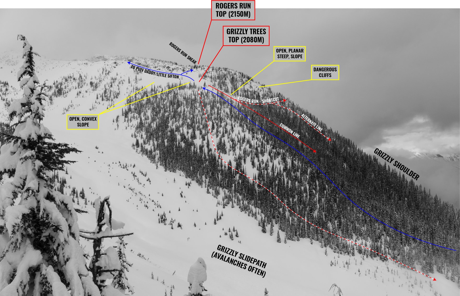
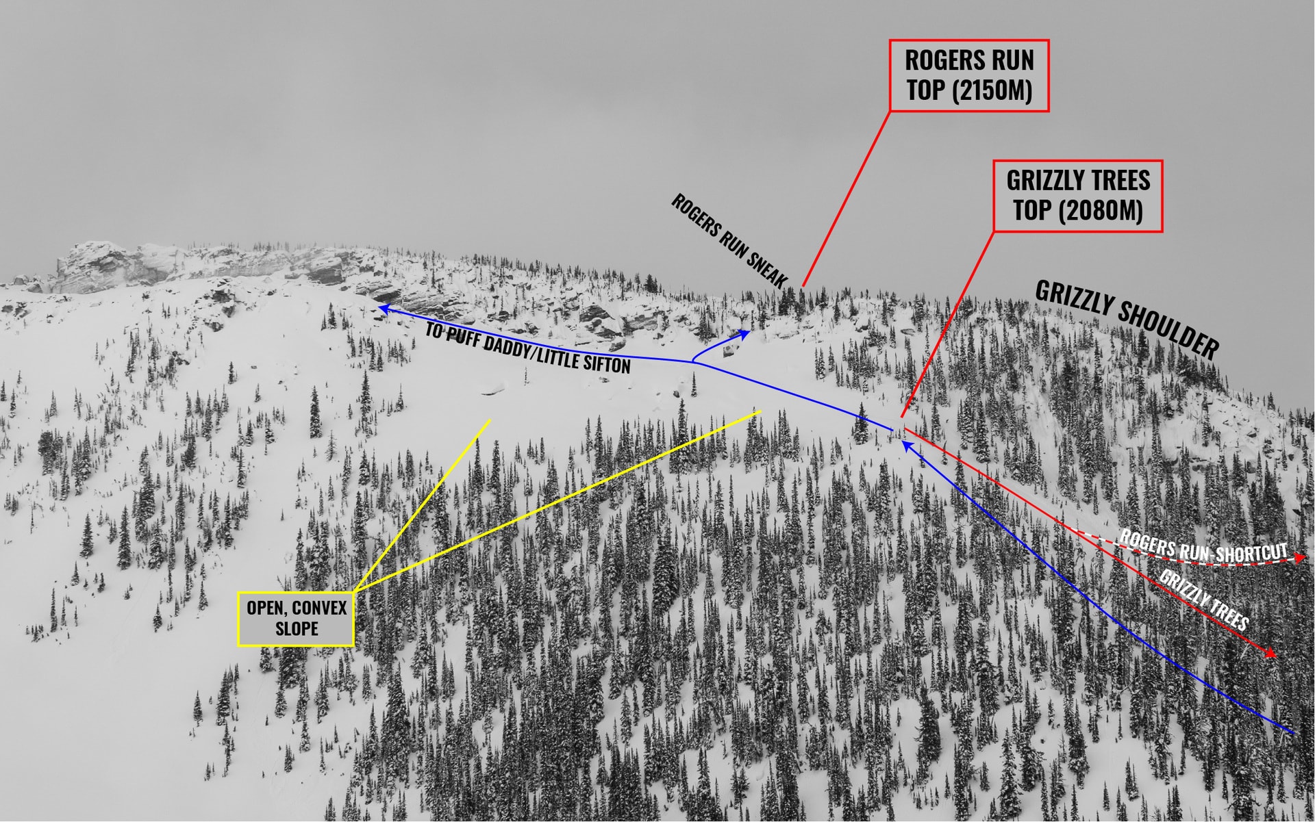
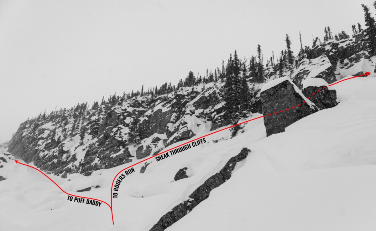
After a brief ascent through the trees, we gained the top of the main open treeline slope at 2080m. We pushed forward in an attempt to gain the true ridge to ski our original plan, Rogers Run. In my opinion, it’s a higher quality run, offering an 850m descent through burnt trees, pillows and open slidepaths. If the avalanche hazard is within my tolerance, I’d almost always go for Rogers Run or Puff Daddy first.
Within a few careful strides in the barren SW-facing terrain, a 10m long crack shot out of my skis and triggered a 50cm deep storm slab that held on to some nearby trees in a delicate balance. Okay, we saw here three pretty obvious red flags:
- Shooting cracks
- Rapid warming (moist/wet surface snow and pinwheeling)
- Visible avalanche activity
With the prolonged solar exposure, it was time to turn around. We happily settled for a more conservative run through Grizzly Trees instead, being well ahead of the crowds.
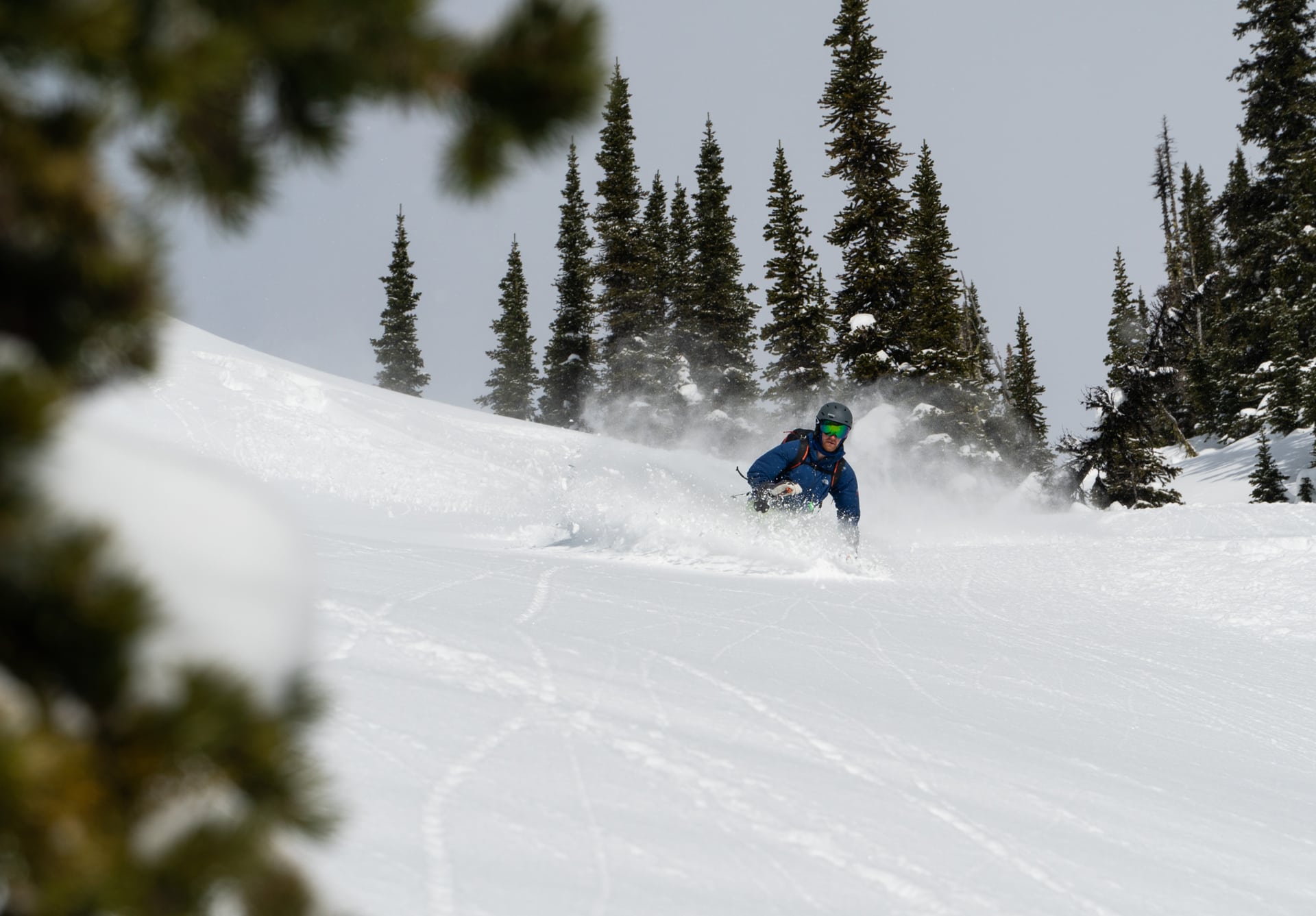
We quickly consulted my terrain picture, taken from the NRC parking lot earlier in the season. We had four options all within the open slopes. Lines within the trees might be too tight to ski easily. As we wanted to go fast, we opted for the most obvious fall-line path as it remained untouched (the most common line).
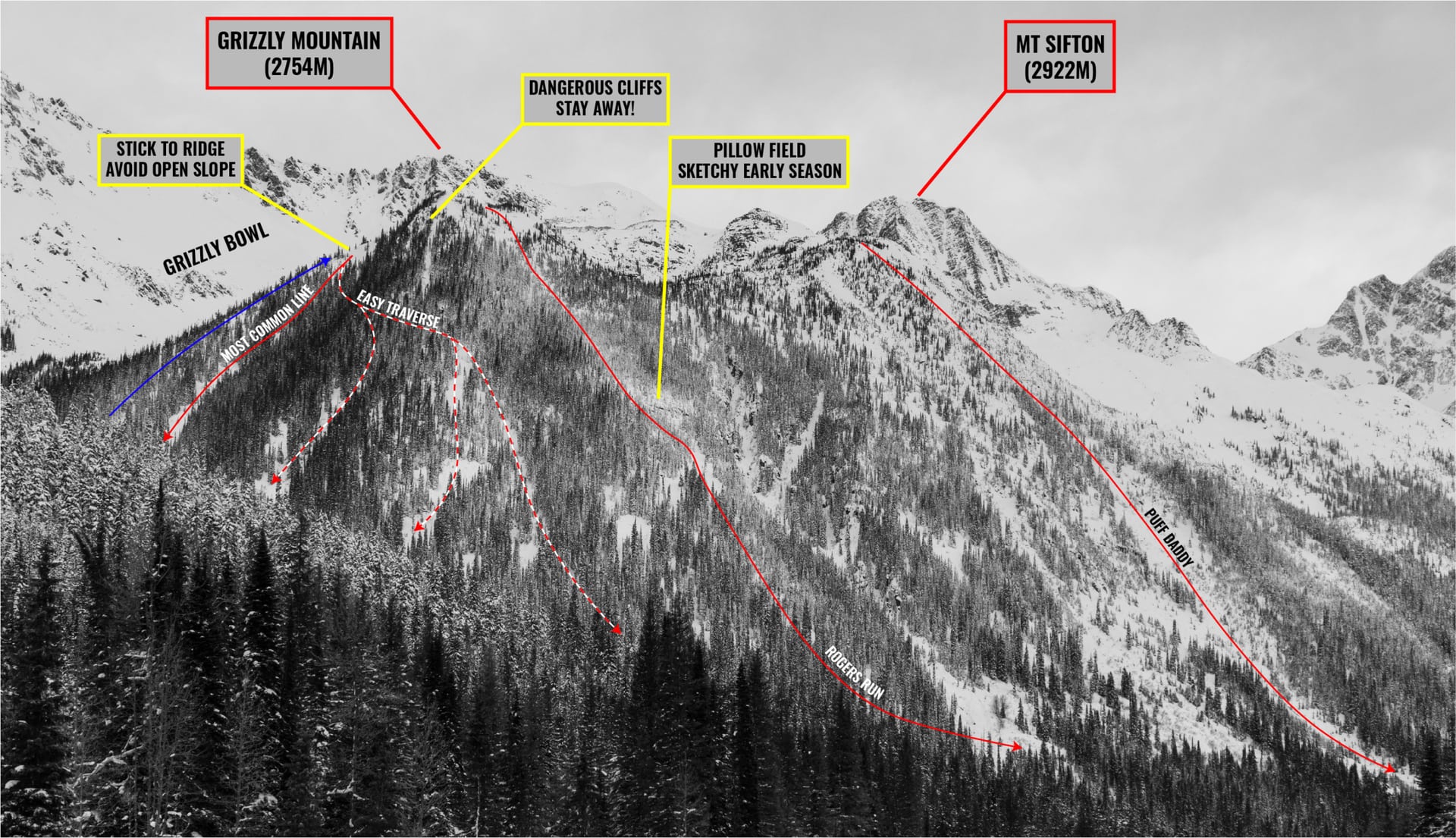
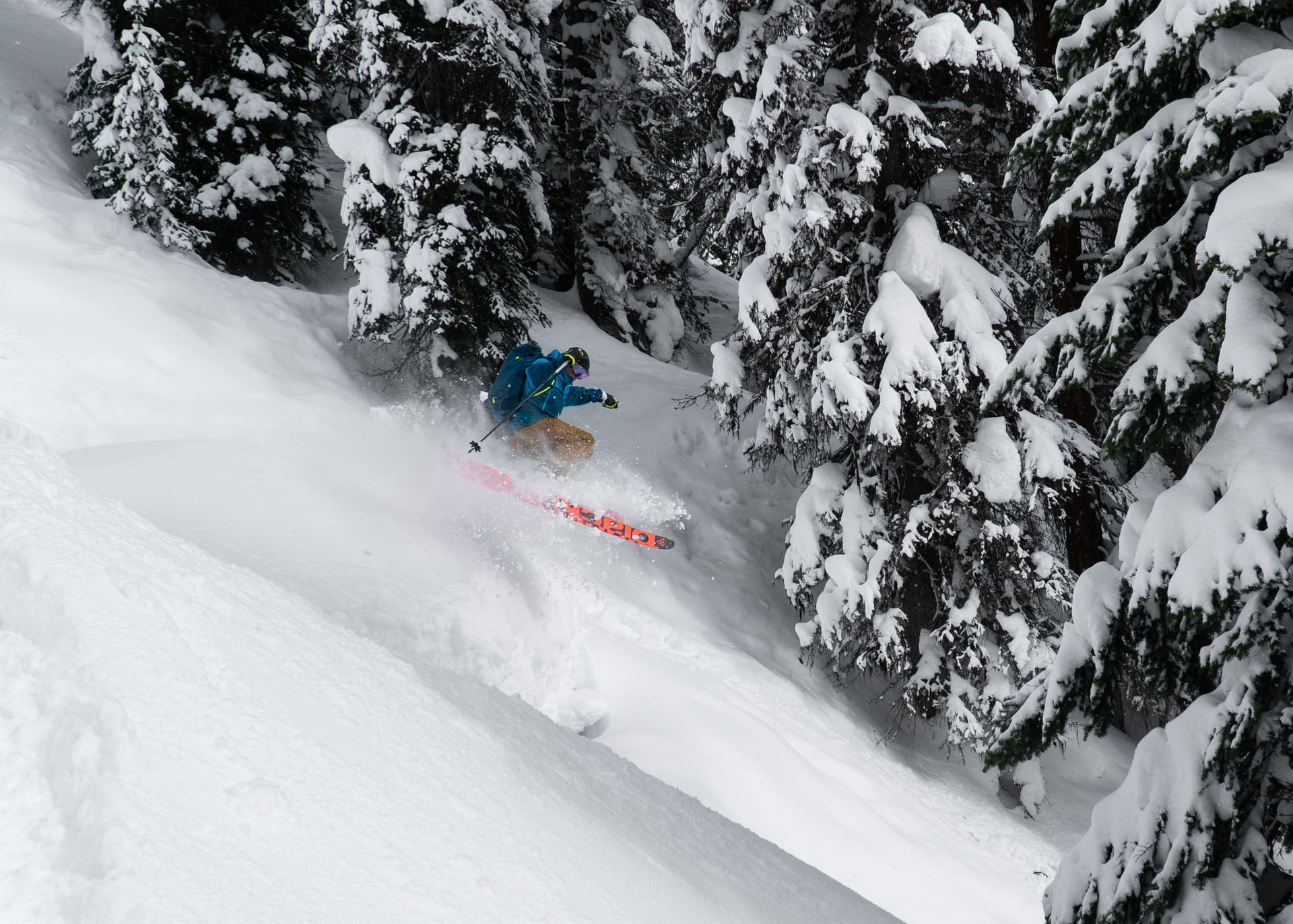
The snow was as expected, a little heavy but still very good. We weaved in and out of the open path, hitting pillows along the way. We stopped in the lower third of the run as the snow quality was deteriorating. A short but sweet lap!
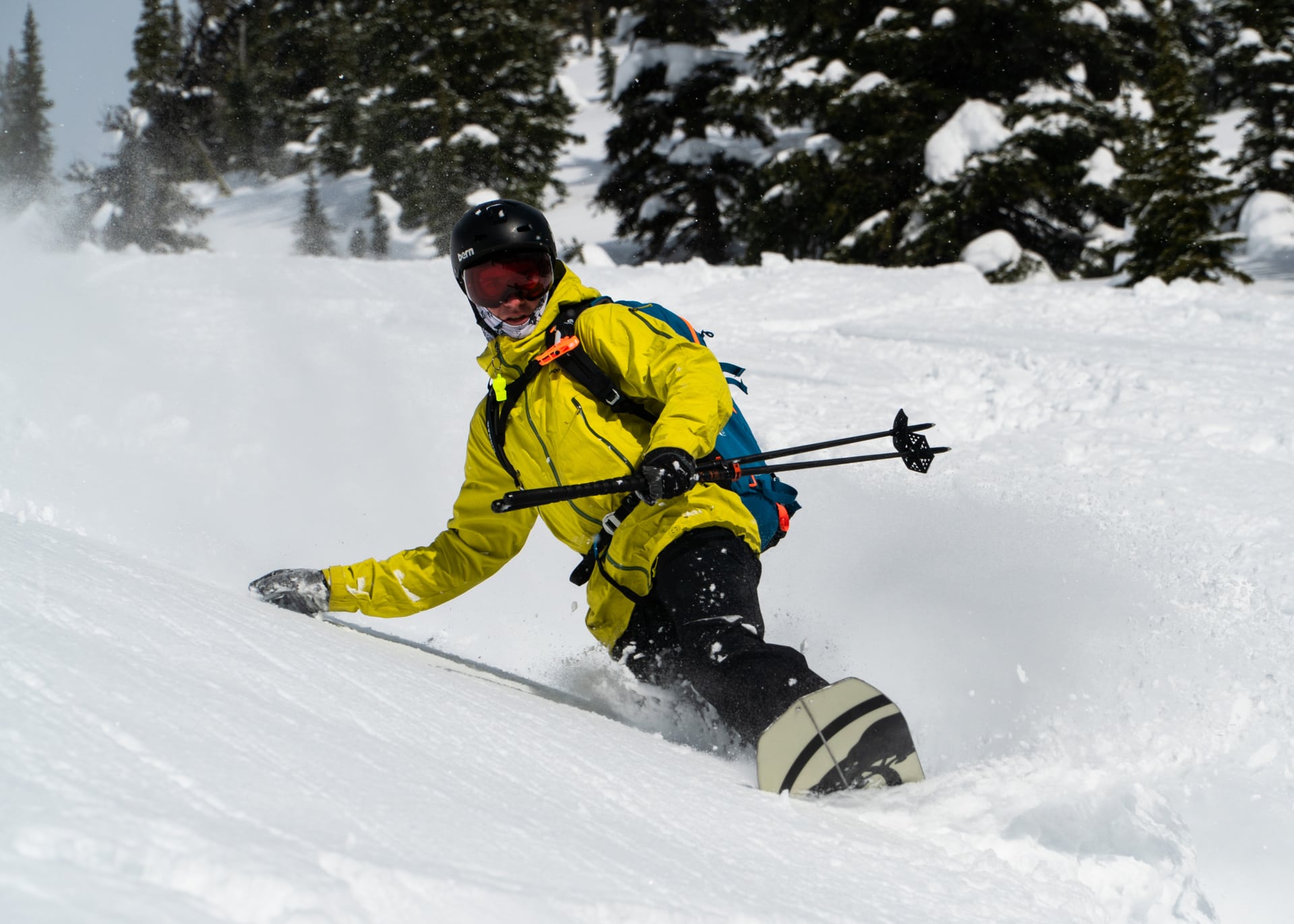
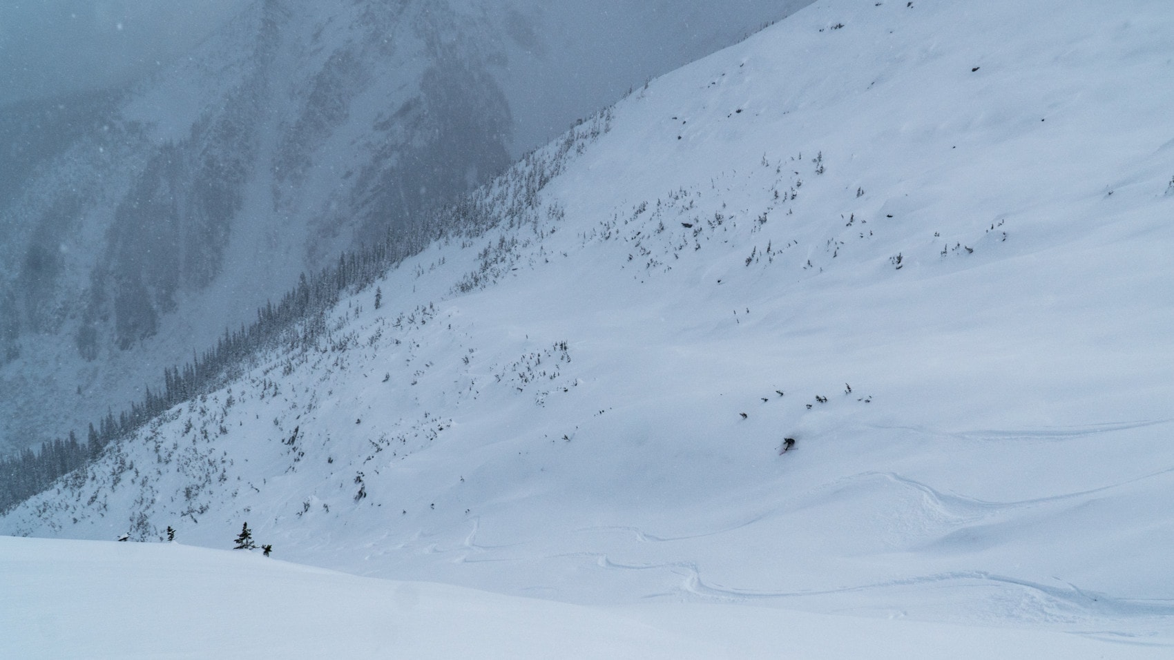
After such a great run, we couldn’t go home just yet. We sped up the shoulder once again on the existing uptrack. After a breezy ascent, we transitioned for the descent. We selected a line to the skier’s left. While it require a short traverse through trees and bushes, it led us on a SE aspect, mostly sheltered from the sun’s warming effect. The snow there had remained well-preserved, showing no signs of rapid warming. The run was epic!
We finished the day with this amazing run. Those must have been the most easily accessible powder turns of the season (not counting lift-assisted touring days). What a blast!
Route Info
For more beta on my adventures, check out the Route Map. This online map interface is a repository of Beyond Our Peak’s published ski touring and mountaineering routes. It’s the best way to browse through trip reports. Give it a shot!