The Mt Revelstoke to Sale Mountain Traverse has been on my list since I first moved to Revelstoke. The 30-km route spans the alpine wilderness between Mount Revelstoke and Sale Mountain, winding its way through broken ridges, narrow cols, expansive glaciers, and emerald lakes. This protected land is far off the beaten path but still within the boundaries of the Mount Revelstoke National Park. It definitely felt remote traveling amongst grizzlies and mountain goats. Very few have had the pleasure of looking down on the Clachnacudainn Icefield, the Woolsey Glacier, or Gordon Lake at the foothills of Mt Dickey.
Related: Jade Pass Trail, Mt Revelstoke: Keeping It Local
Report from August 17, 2020
Day 1: Mt Revelstoke to Woolsey Glacier
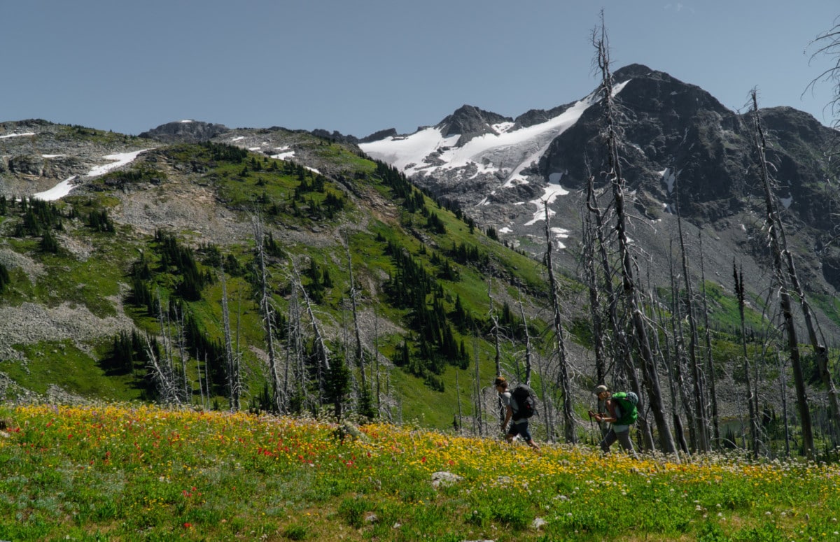
Our day started at the Mt Revelstoke parking lot next to Balsam Lake. Kaitlin, Freddy, and I bolted past Miller Lake and up towards Jade Pass, skirting around tourists walking at a leisurely pace. They must have been wondering what we were up to with our loaded packs. We gained the pass in no time at all, roughly 90 minutes. Our point of view granted us a wonderful sight of Upper and Lower Jade Lakes. The hike to this point is described in detail in my previous trip report, Mt Revelstoke Hiking: Keeping It Local.
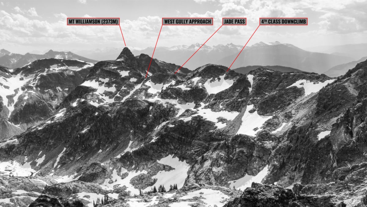
After a short water break, we headed north towards Mt Williamson. I was debating whether we should climb the peak or not. We opted to come back another time for the summit. Navigating 4th-class terrain is no simple task with a heavy pack. We bypassed the peak through a rocky bench to the west and climbed up a northwest-facing gully.
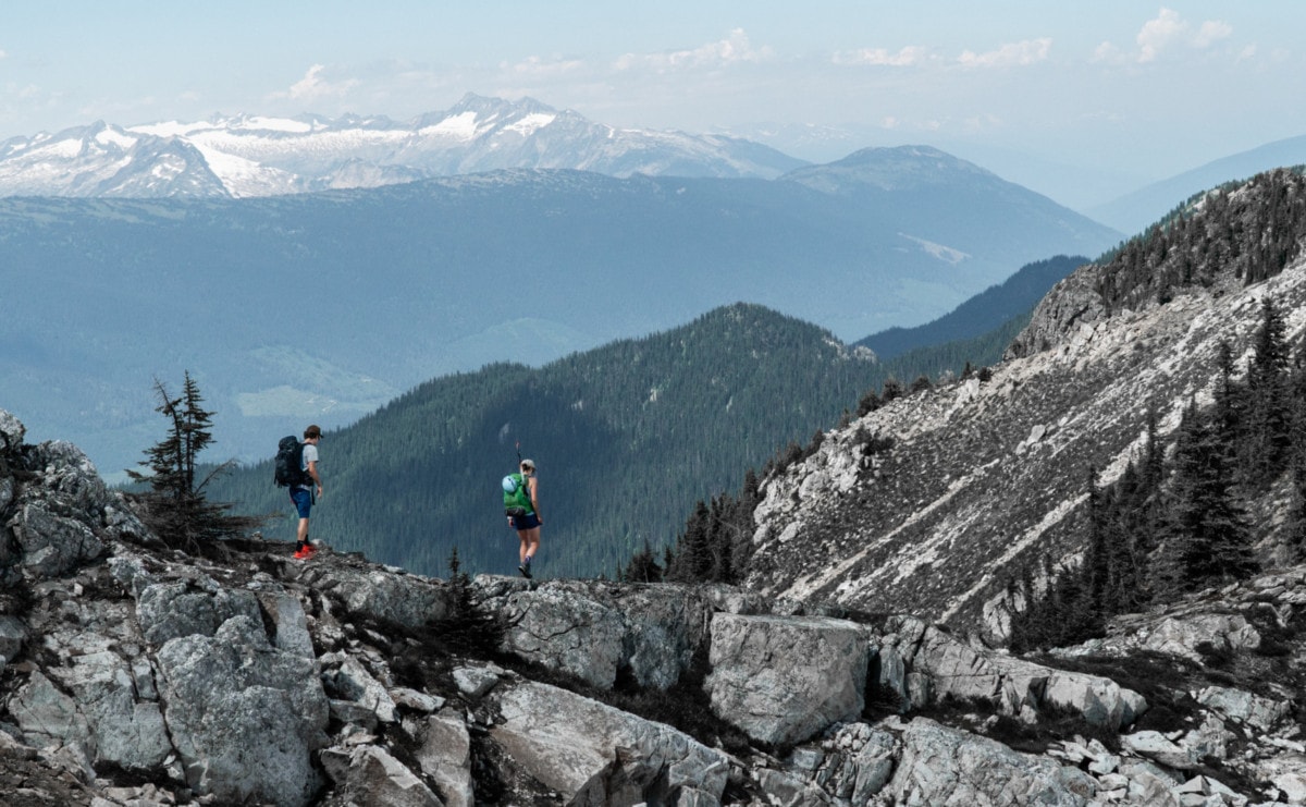
Moments later, we found ourselves on top of the long, broken ridge spanning north of Mt Williamson. The views from here were spectacular. The Inverness Peaks loomed over the Clachnacudainn Drainage from across the valley. My eyes fixated on this bright blue alpine lake lying on the east flank of the ridge. This would be the first of many lakes encountered on our traverse from Mt Revelstoke to Sale Mountain.
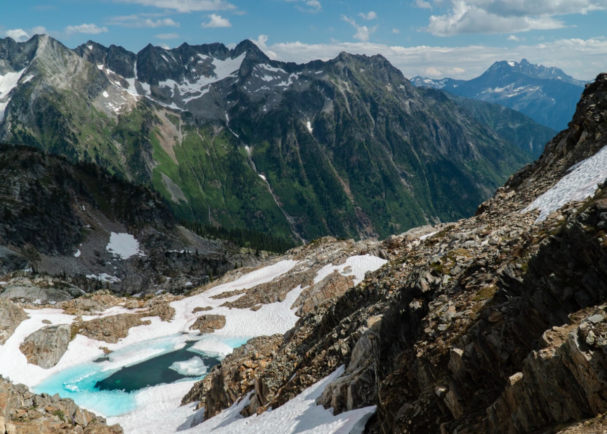
Snapping back to reality, we scrambled over a series of small bumps through chossy rock, double-checking our handholds at every move. The ridge wasn’t particularly difficult with one short section of 4th-class rock but it certainly was endless. Up and down, we go!
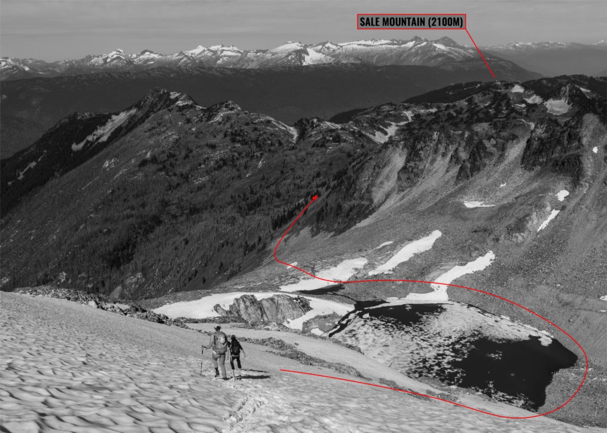
Eventually, we gained the last of the series of summits, topped with two towering cairns. We weren’t quite sure what they marked but someone did put a lot of effort into building those towers. We looked at mountains beyond and planned our route. We choose to go up a scree slope between two distinct summits. For the lack of a better name, I’ll call it Twin Peaks Col.
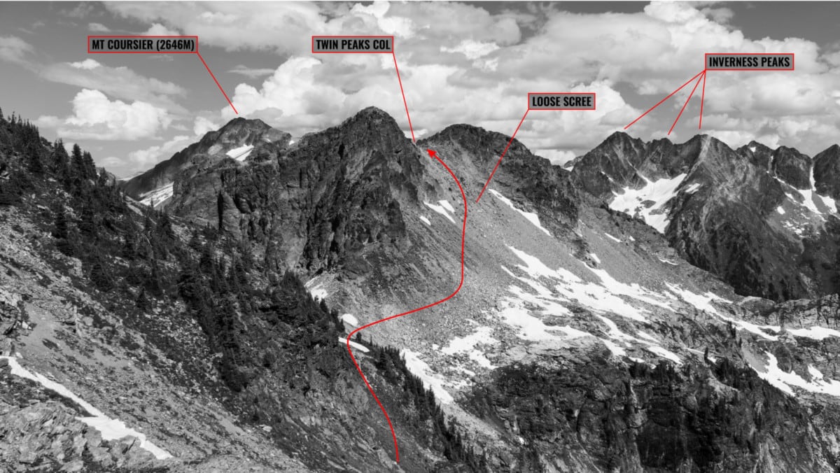
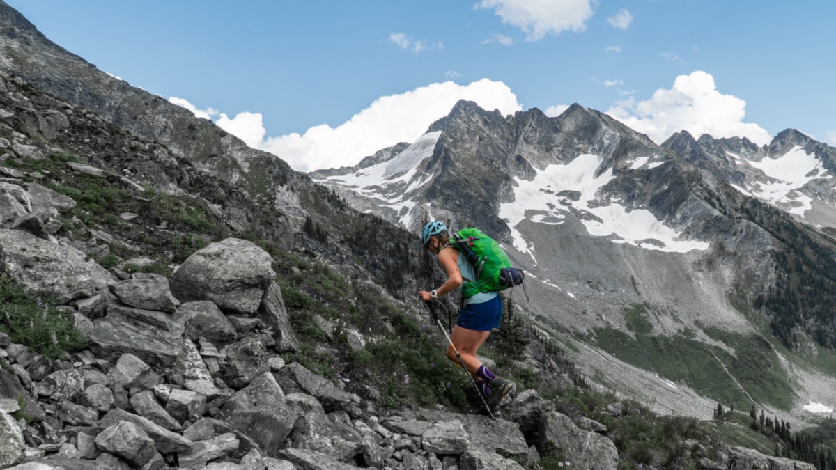
The hike up the scree slope turned out to be quite the slog. Loose rocks, poor footholds, and difficult route finding made the ascent harder than it seemed from our previous vantage point. In the intense summer heat, beads of sweat was running down our forehead. We eventually gained Twin Peaks Col.
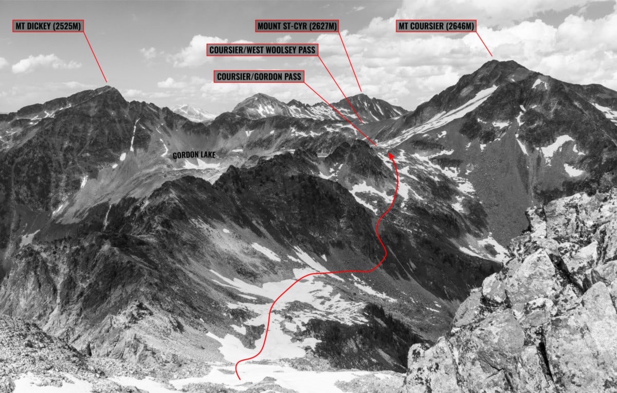
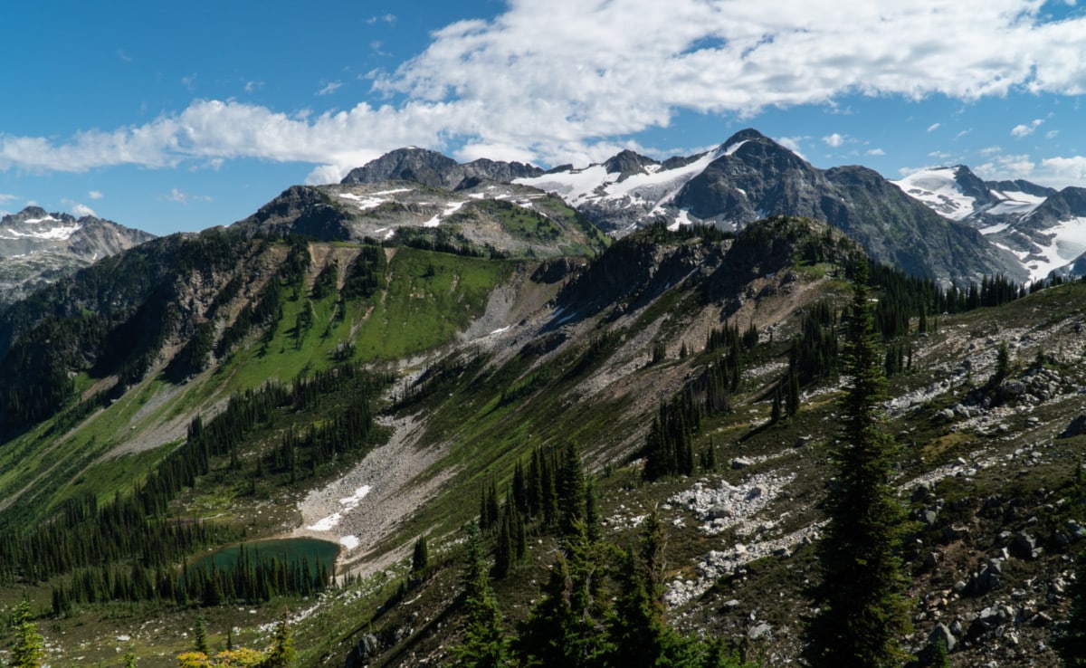
Finally, we reached the col. From our vantage point, we could see the second third of the traverse from Twin Peak Col all the way to Mt St-Cyr. The terrain below seemed pretty easy to navigate with a few snow slopes followed by grassy and rocky terrain. I gazed in awe at the surrounding peaks of Mt Dickey, Mt St-Cyr, and Mt Coursier.
The downclimb from the col required a few 4th-class moves, followed by some controlled slippage on dirt and scree. We landed on a mellow snow slope peppered by goat and grizzly prints. We staggered our paths to avoid kicking the loose rocks on each other. We briskly traversed above the head of the Clachnacudainn Creek and followed a goat trail through shrubs, wildflowers, and rock slabs.
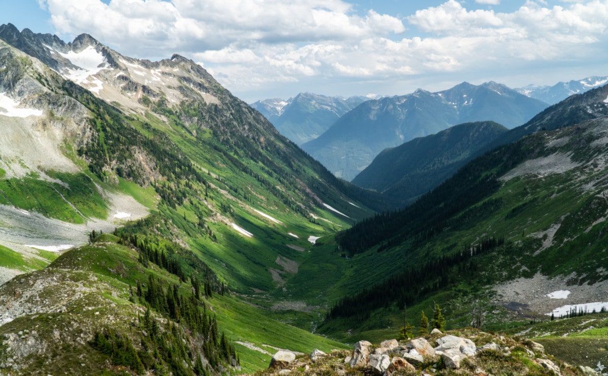
As we hiked higher and higher towards the head of the Coursier/Gordon Pass, the views got progressively more glorious. I caught my breath for a second and looked back. So lush! The Claichnacudainn Valley extended beneath my feet all the way to the Trans-Canada Highway. That’s a sight very few humans have seen.
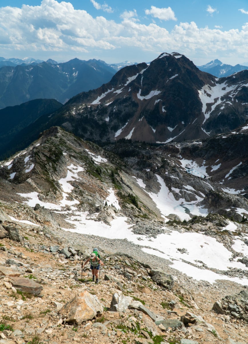
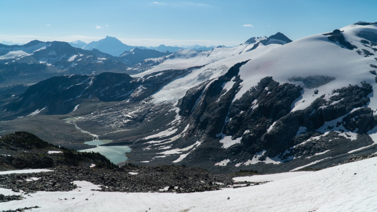
It took no more than 95 minutes to gain the Coursier/Gordon Col from Twin Peaks Col. After more than 10 kilometers of scrambling over chossy rock and scree, we finally stepped onto glacier ice at the head of the Gordon Glacier. I’ve always preferred snow travel over rock scrambling. It’s easier on the legs and, in most cases, more direct. Plus, who doesn’t like to boot ski?
We proceeded down the Gordon Glacier all the way to the southern end of its alpine lake, glissading when possible to speed things up. On our right, we spotted a sizable rockfall, originating from the top of Mt Coursier. The debris had fallen to the bottom of the glacial cirque, a reminder of the constant rockfall hazard when traveling in the alpine.
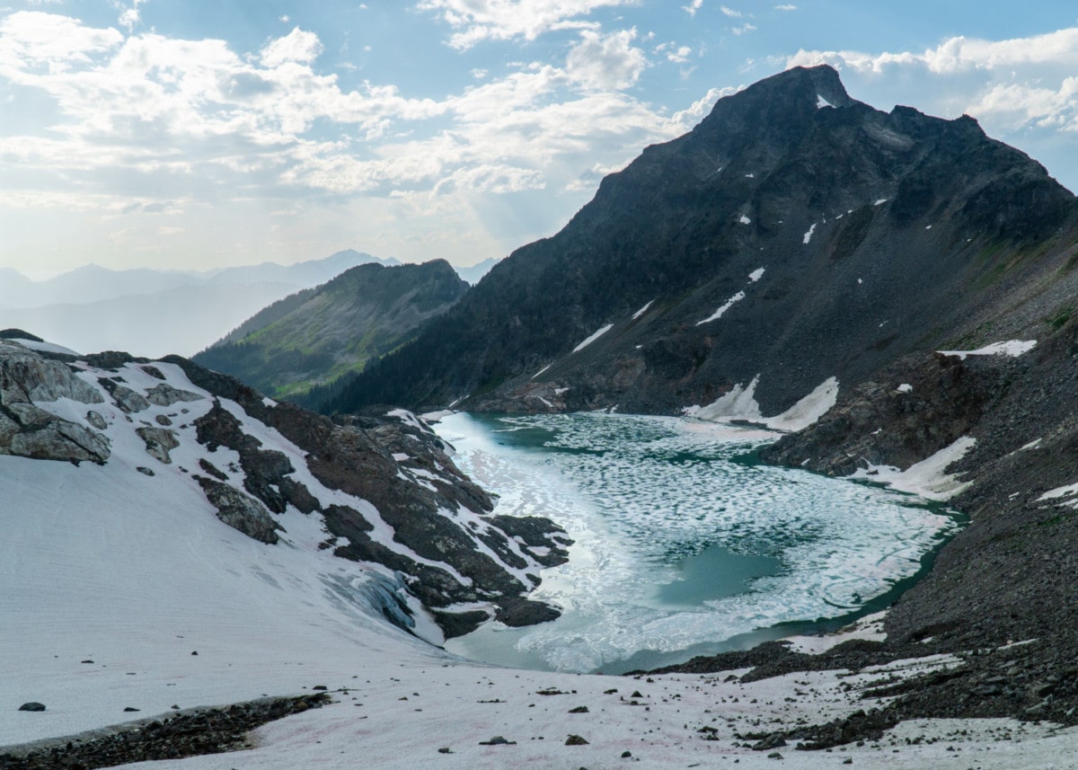
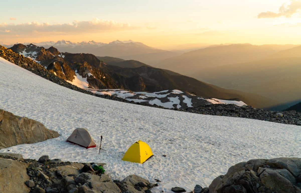
We scrambled wet slabs glistening in the dim sunlight to a rocky bench – not ideal climbing conditions with loaded packs. We climbed this section as carefully as we could, not really trusting our footing on the wet, mossy slabs. It was either that or a sketchy scree slope. After a tough scramble and some fallen rocks nearly sending me into oblivion, we crossed the Coursier/West Woolsey Pass situated at the upper west boundary of the Woolsey Glacier. At this point, we decided to set up our bivy right below the glaciated slopes of Mt Coursier. The sunset was surreal, only to be obscured by the shadowy mass of Mt Dickey, lying on its course.
Day 2: West Woolsey to Sale Mountain
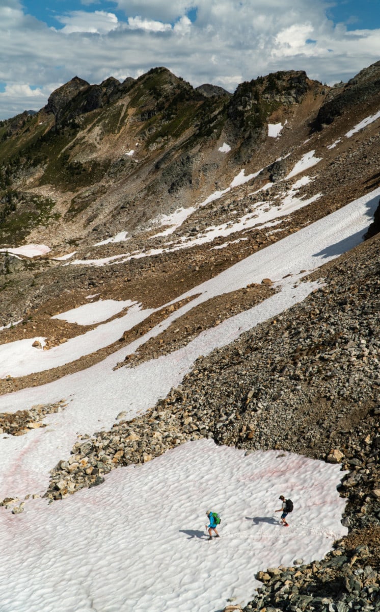
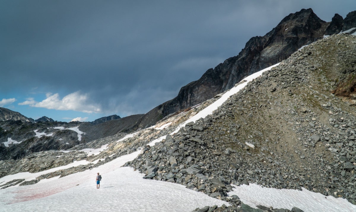
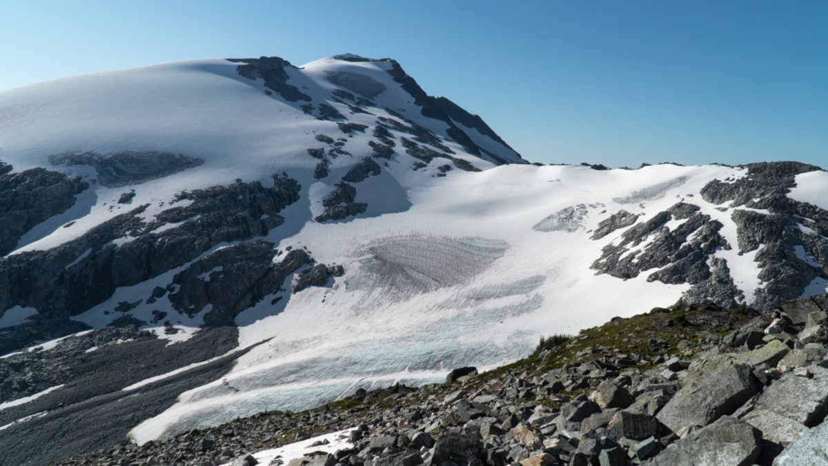
From our perch, we woke up to a valley shrouded in fog. What a sight! We sped through breakfast and headed down the Woolsey Glacier towards the Latvian Col. There’s no better warmup than a fast glissade down snowy slopes.
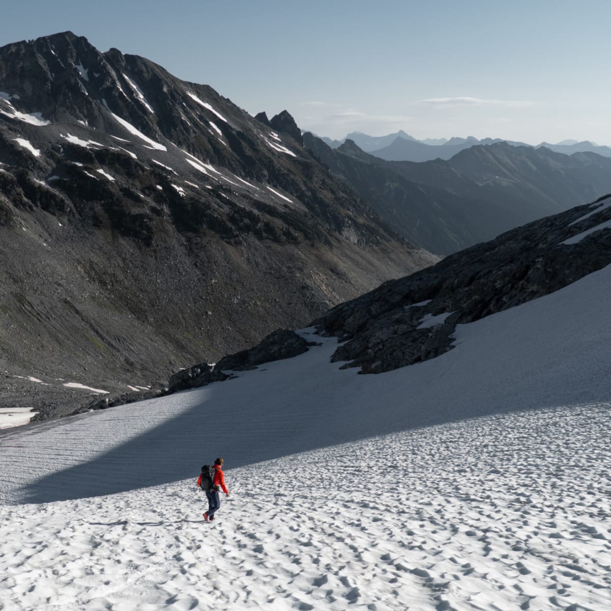
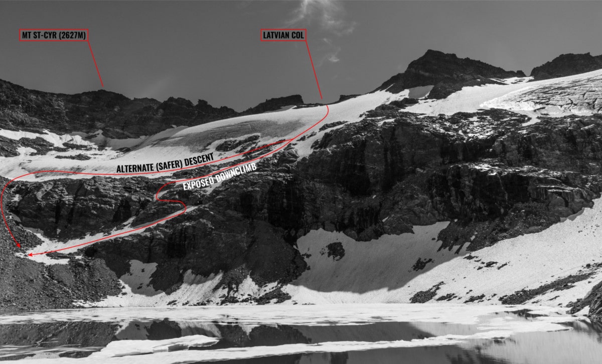
We picked our way through the snowfield, avoiding patches of blue ice. To save weight, we didn’t bring any glacier gear. We took a moment to fill our water bottles at a nearby alpine lake. We looked up at Mount St-Cyr across the valley and planned our route. We aimed to gain the Latvian Col, an obvious U-shaped feature.
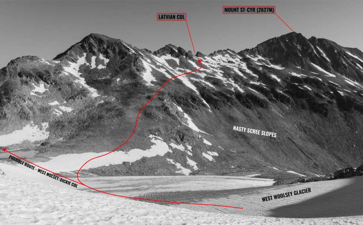
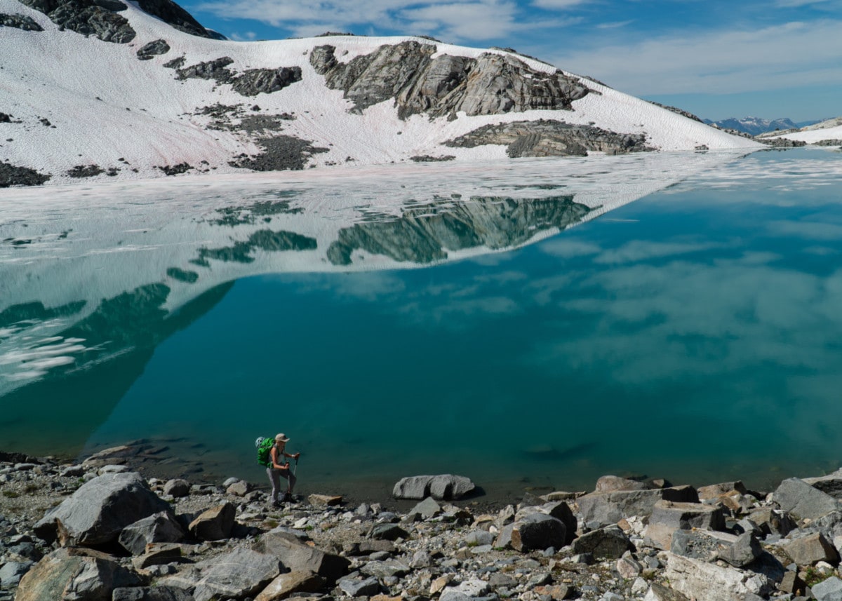
We did short work of the climb, involving scrambling over stable boulders and traversing soft snow slopes. From our height, the view of the Clachnacudainn Icefield terminated by Margareth Lake were absolutely stunning.
We pressed on the north side of the col, scouting our route in the process. Sadly, the alpine section of the Mt Revelstoke to Sale Mountain Traverse was nearing its end but we still had ways to go, precisely 5 km of bushwhacking through wildflowers and dense shrubs in the typical Selkirk sub-alpine.
We first headed skier’s left of the col towards a seemingly gentle snow slope and wet slabs. It turns out, the slabs ended abruptly into a cliff above an exposed glacial tongue. We doubled-back and aimed for the snow patches, skier’s right of the col. This way was much safer but still exposed, requiring a slight bit of 4th-class downclimbing on a set of overlapping ledges. There was an easier, albeit longer option further to the right that would take us through a gentle scree slope. I hate scree, as many do!
We walked along the contour of another alpine lake. This must have been our 6th at this point. My body could barely thermo-regulate in the heat. I took the opportunity to dunk my head in the freezing water. It worked.
Our path took us down a steady descent towards the sub-alpine of the St-Cyr drainage. Our scramble terminated at a steep, grassy slope blanketed with vibrant wildflowers, and hidden grizzly tracks. The over-saturated landscape was gloriously stunning to the point that it seemed like it had gone through a bad photoshop edit.
Looking back, the Latvian Col was staring at us. Even further, our bivy site below Mt Coursier seemed like a distant memory. It’s amazing how far a set of legs can take you… humans are resilient machines.
We followed the obvious ridge leading to Sale Mountain. So many ups and downs. In retrospect, I would recommend setting a trail through the burnt hills on the southern side of the ridge until gaining the ridge is absolutely necessary. This path would avoid an exposed downclimb through chossy rocks.
The remainder of the traverse was a simple hike following a faint trail. In the heat, it seemed eternal. 15 hours later spanning two days, we arrived at the Sale Mountain parking lot where we found Kaitlin’s SUV still in one piece. We drove down the Sale Mountain FSR in okay shape, dreaming of cold water and hot food.
Note: This trip was performed successfully using Ben Wilkey’s beta on Revelstoke Trails. Thanks Ben!
Photos

2The north ridge of Mt Williamson. Photo: Beyond Our Peak The route up Twin Peaks Col. Photo: Beyond Our Peak 
The route to Mt Coursier and the Gordon Glacier. Photo: Beyond Our Peak 
The southeast face of Mt St-Cyr with the route to the Latvian Col. Photo: Beyond Our Peak 
The path to Sale Mountain from the Latvian Col (north face). Photo: Beyond Our Peak 
The descent from the Latvian Col towards Sale Mountain. Photo: Beyond Our Peak
Statistics
| Highest Elevation | 2480m |
| Vertical Gain/Loss | 2400m |
| Distance Traveled | 31km |
| Duration | 15h |
For more beta on my adventures, check out the Route Map. This google map interface is a repository of some of my ski touring, mountaineering and hiking adventures. It includes a loose GPS trace for your convenience.
Beautiful photography, as always!
Thanks! Hope you had a great read too!