Spanning from the summit of Mt Begbie, Revelstoke’s iconic peak, the Begbie Shoulder sports some of the town’s finest powder skiing through magical old-growth forest and steep, featured chutes. This gem of a ski touring destination is located a mere 20-minute drive south of Revelstoke along Highway 23S. There’s one caveat: it takes a fair amount of bushwhacking to gain the Begbie Shoulder. Trust me: it’s well worth the effort! With a snowmobile in your arsenal, this becomes a non-issue. Read on!
Related: Ski Touring Mt Macpherson: Glacial Day In The Womb
Report from December 31, 2020
Rigel, Freddy, and I rolled into the Begbie Shoulder parking lot, already lined with huge trucks carrying several snowmobiles. This is no surprise: after all, Revelstoke is North America’s sledding capital and the shoulder is a prime spot: a well-maintained logging road crosses its length. We looked up at the lengthy ridge, 1400m above us, then scoped out the terrain below. Our uptrack would take us through an old cutblock filled with thick new-growth and sparsely spaced old-growth forest beyond. It takes a certain type of people to forge a path through dense Monashees bush.
Begbie Shoulder FSR Update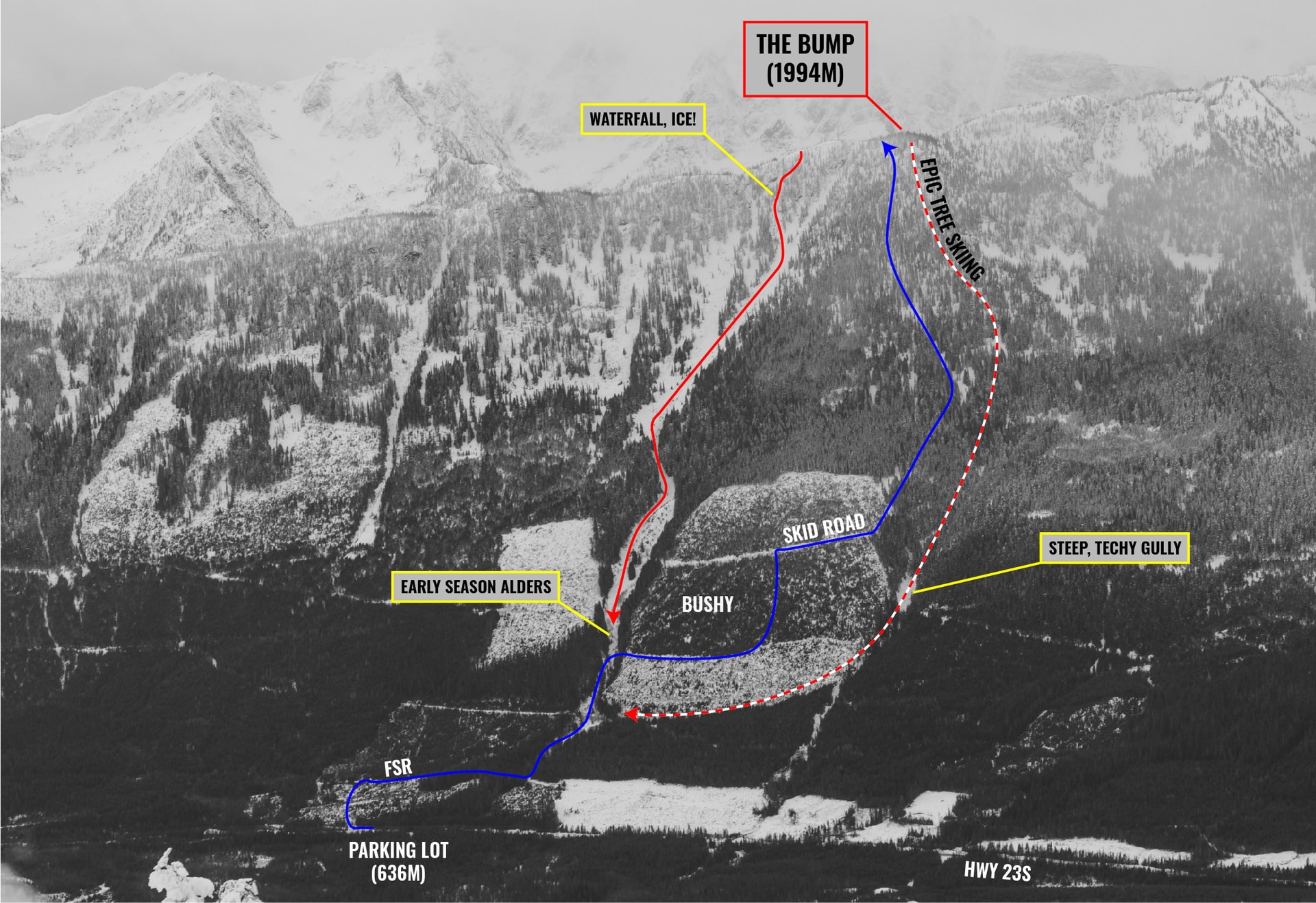
We began the ascent along the Forest Service Road (FSR) only to duck into a patch of sparse new growth. This move allowed us to skip a 2km detour of bumpy roads. 500 meters further, we veered off the FSR into an alder-infested gully leading us to the old, bushy (aforementioned) cutblock. At this point, our path diverged from the snowmobile route along the FSR.
Ski touring on FSRs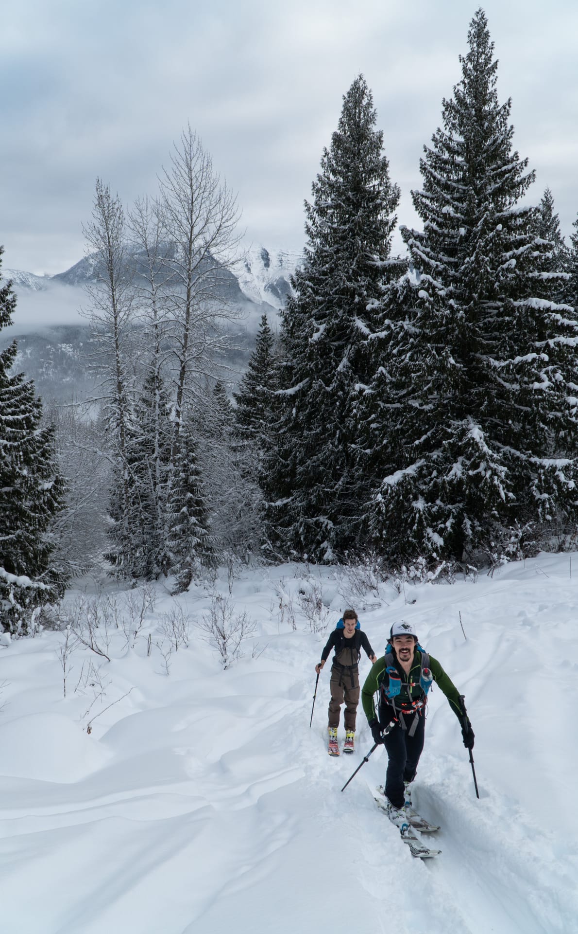
We followed the gully as it steepened and narrowed into an unclimbable ravine. At which point, we exited to our right into the old cutblock. Boy, was it bushy in there! Through much cursing, bruising, and suffering, we carved a path through the new growth, stomping on branches and pushing entire trees aside – not that I advertise doing so in a natural landscape. This was literally the only way to make it through. After an hour of brutal bushwhacking, testing our physical resilience and mental fortitude, we began wondering if it was all worth it for the bit of powder skiing at the top. Finally, as our patience waned, we emerged onto an abandoned skid road where we picked up our pace.
Note: Getting around the Begbie Shoulder is not an easy task. For that reason, I seriously recommend hiring a certified ski guide to show you around.
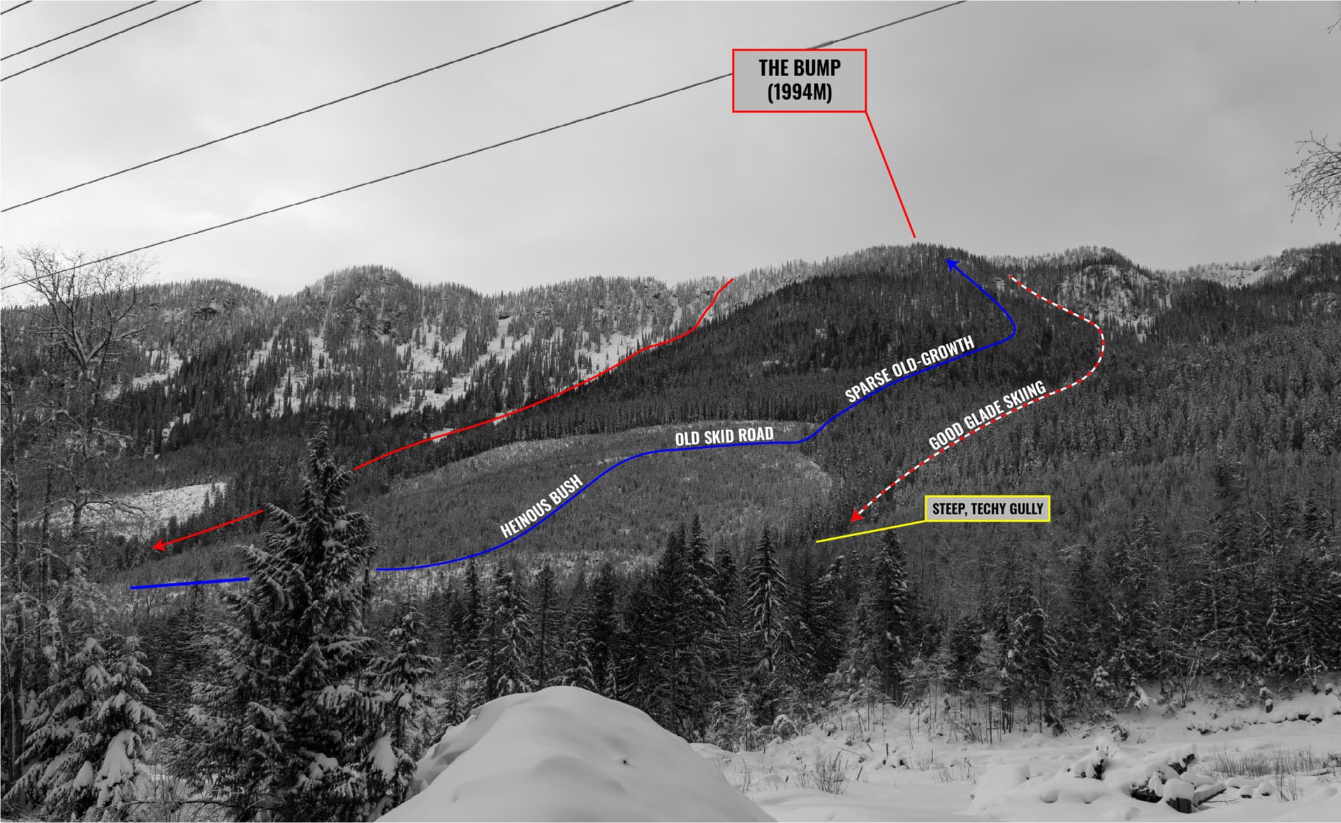
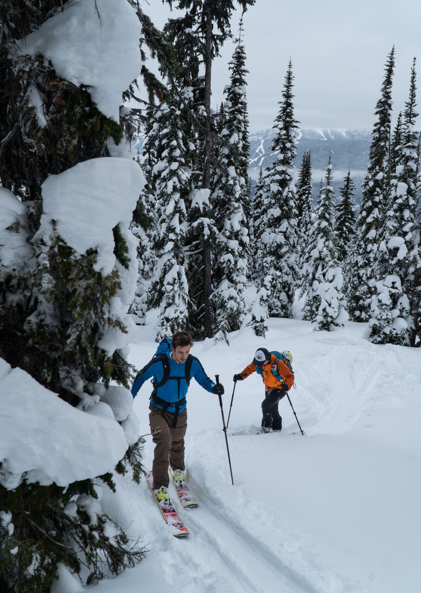
We connected with an old uptrack that dipped into the old-growth forest beyond. The transition between new and old growth is particularly abrupt, from dense bush to towering giants, covered in beard lichen, otherwise known as old man’s beard. It seems as though time froze in this magical forest, something pulled straight from the Lord of the Rings. At this elevation (roughly 1200m), the centennial trees are few and far between, an ideal setup for a breezy ascent and, most importantly, epic tree skiing.
Old Man's Beard Trivia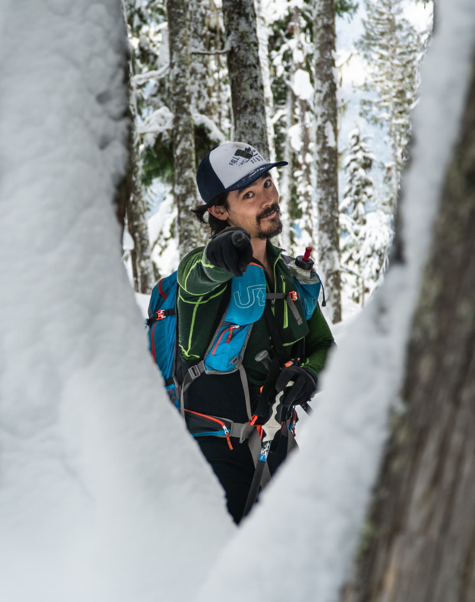
As we gained elevation, the forest opened up into a series of oblong clearings. The snowpack was getting deeper by the minutes, which naturally correlated with my increasing stoke. Exposed stumps and large boulders were now covered with a thick layer of snow. This featured landscape – gladed by mother nature – offered some incredible tree skiing through that would rival what many heli-ski operations have on the menu. This is Monashees trees skiing at its finest. Period.
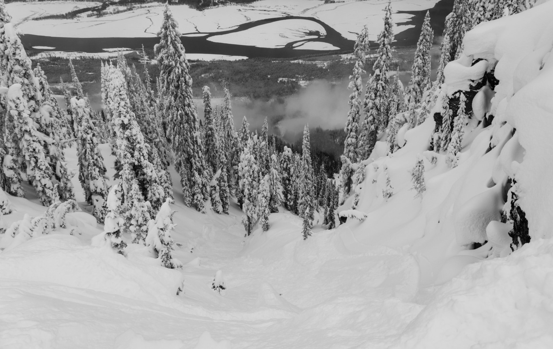
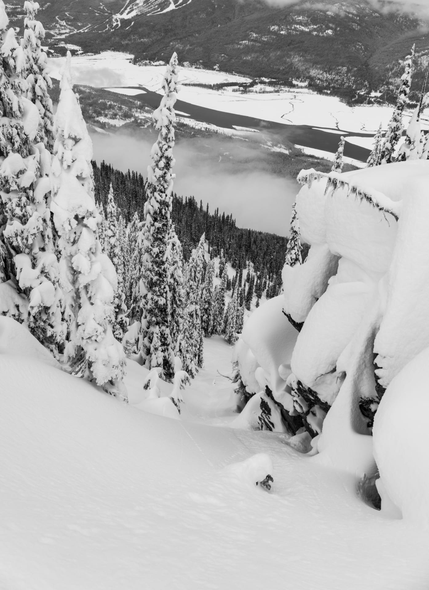
After nearly 1400m of elevation gain, we rounded the top of the ridge and peered into the Mulvehill Valley on the other side. We could just make out the toe of the Mulvehill Glacier, an expansive sheet of ice, riddled at its base with gnarly gullies. In the meantime, the low-lying clouds were spitting rime on us, icing up our gear.
Rime or Rhyme?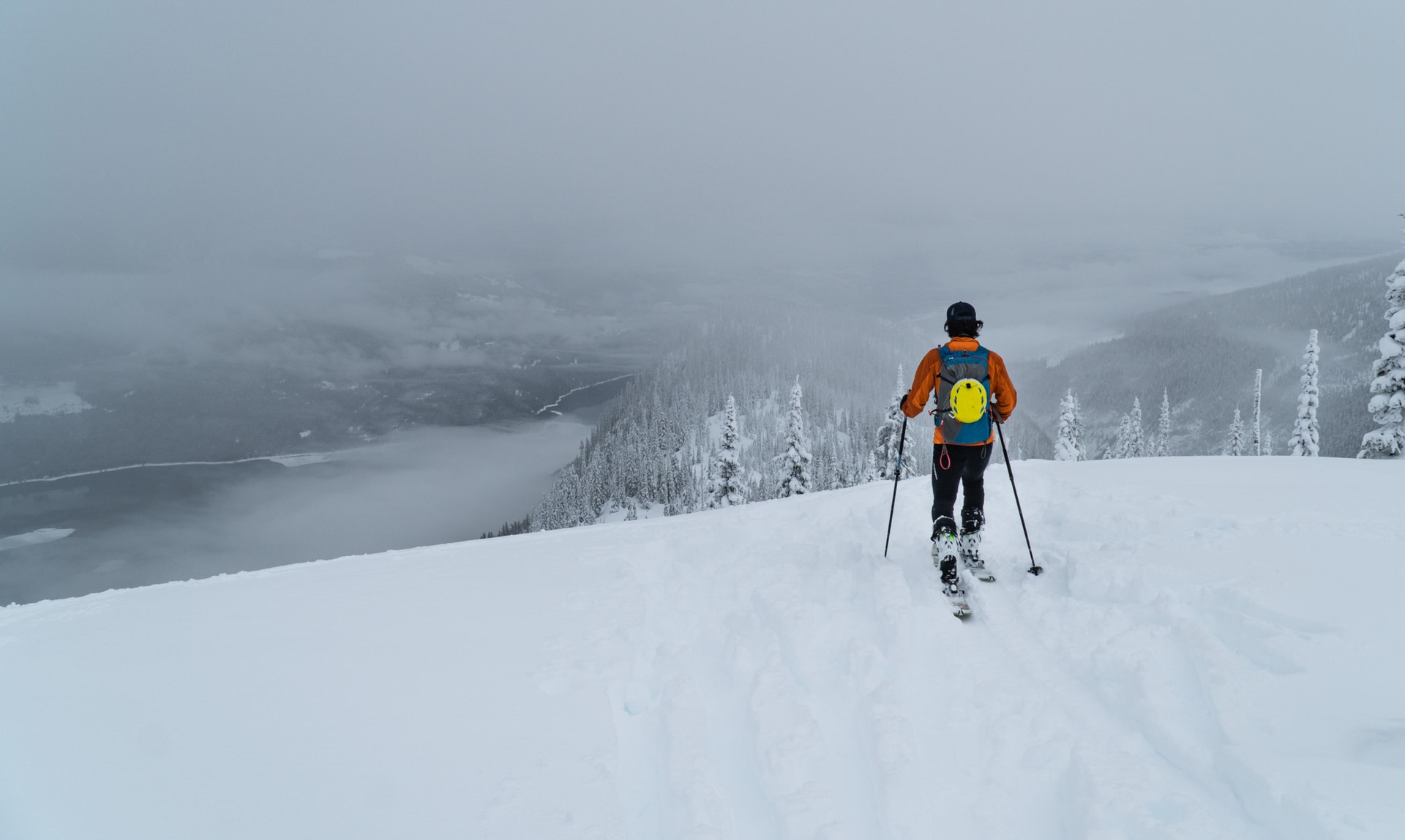
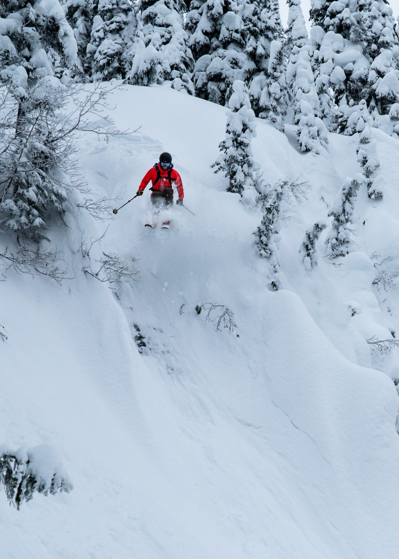
We traveled along the top of the shoulder, looking for the optimal descent route. The most popular option, the 112 Gully, had been absolutely smashed by a party of four who had just dropped. One guy remained at the top and directed us towards a series of smaller chutes further down the ridge. It turns out the chutes were untouched: a virgin blanket of snow waiting to be scored!
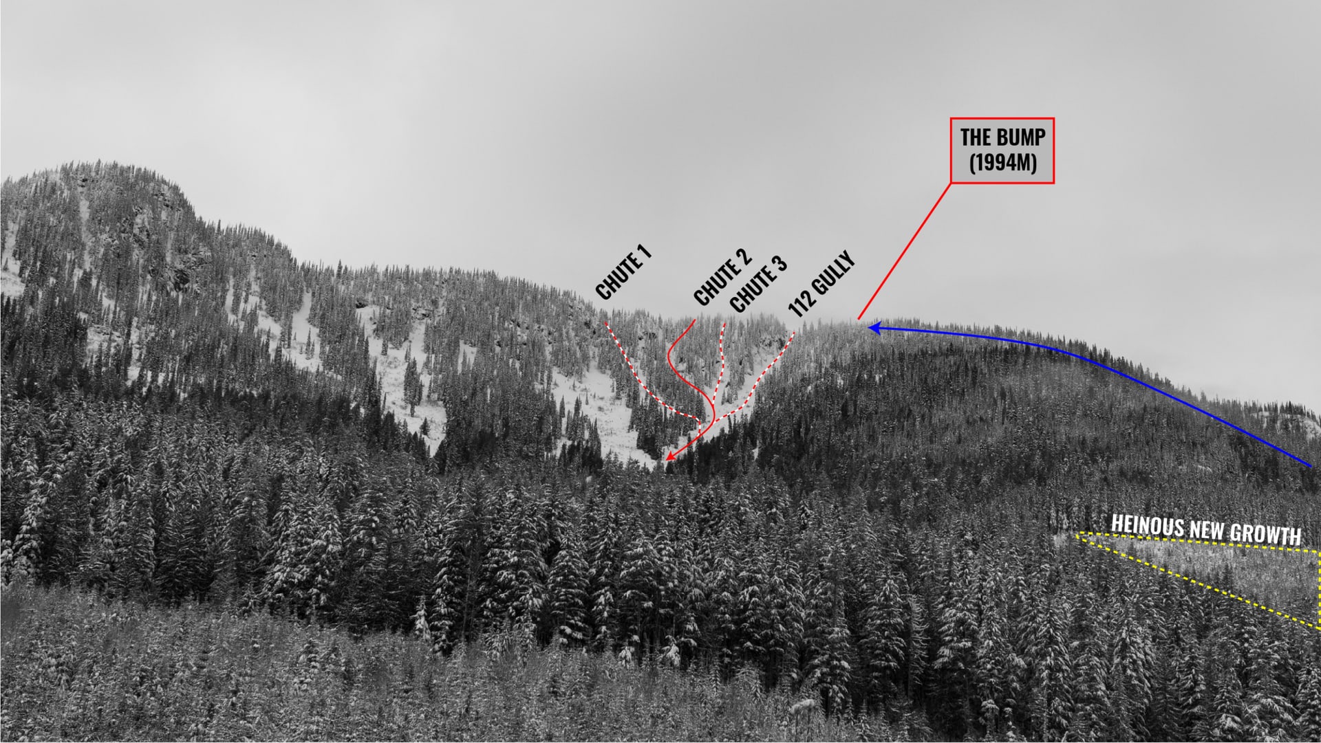
We choose the second as it also offered a nearby, sheltered slope on which we could dig a snow profile to assess the snowpack stability. It had been storming for more than a week; we had no clue whether the snowpack would support the added load or simply fracture under our weight. With the avalanche hazard at “Considerable” at treeline, I aggressively ski-cut the slope above our planned dig; no reactivity whatsoever. The ski-cut result in tandem with the clues from our snow profile granted us a bit of insight into what’s happening under the surface. Things were looking good.
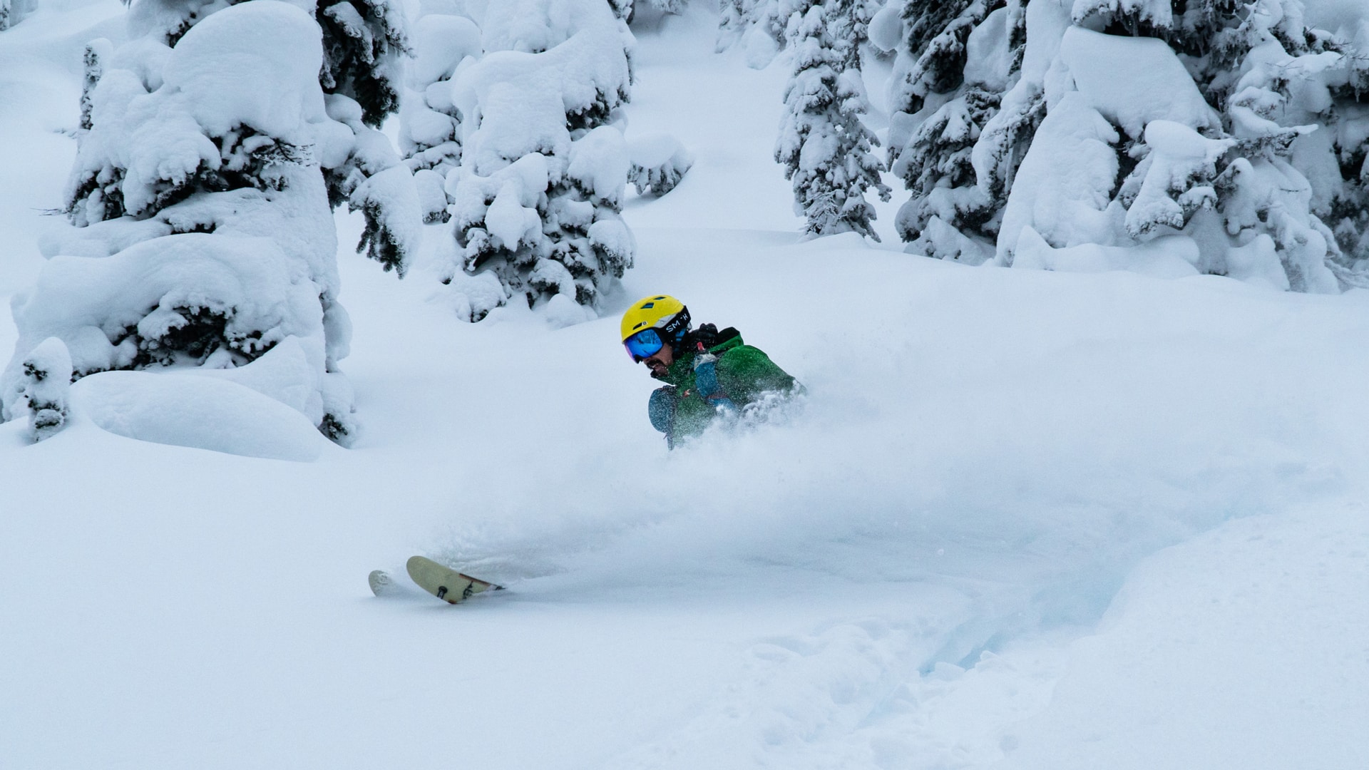
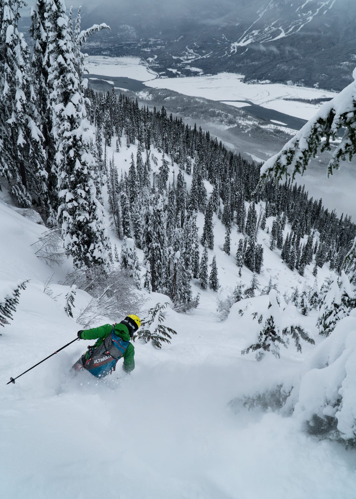
Following our stable test results, we transitioned for the descent, eager to ski a run I’ve heard about countless times. The snow was good, albeit a little heavier than expected: freezing levels had risen during the last storm. In any case, I couldn’t complain – I’m becoming a snow snob after spending too much time skiing Rogers Pass’ legendary powder. The terrain, however, was damn right incredible.

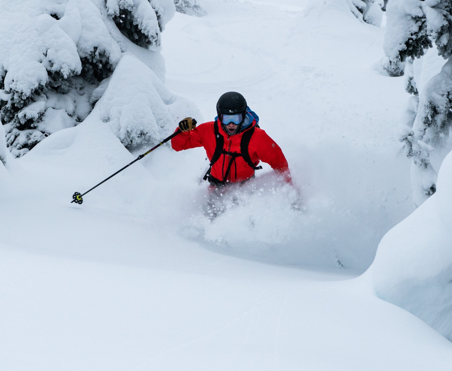
Freddy, his focused demeanor only hides his absolute STOKE. Photo: Beyond Our Peak 
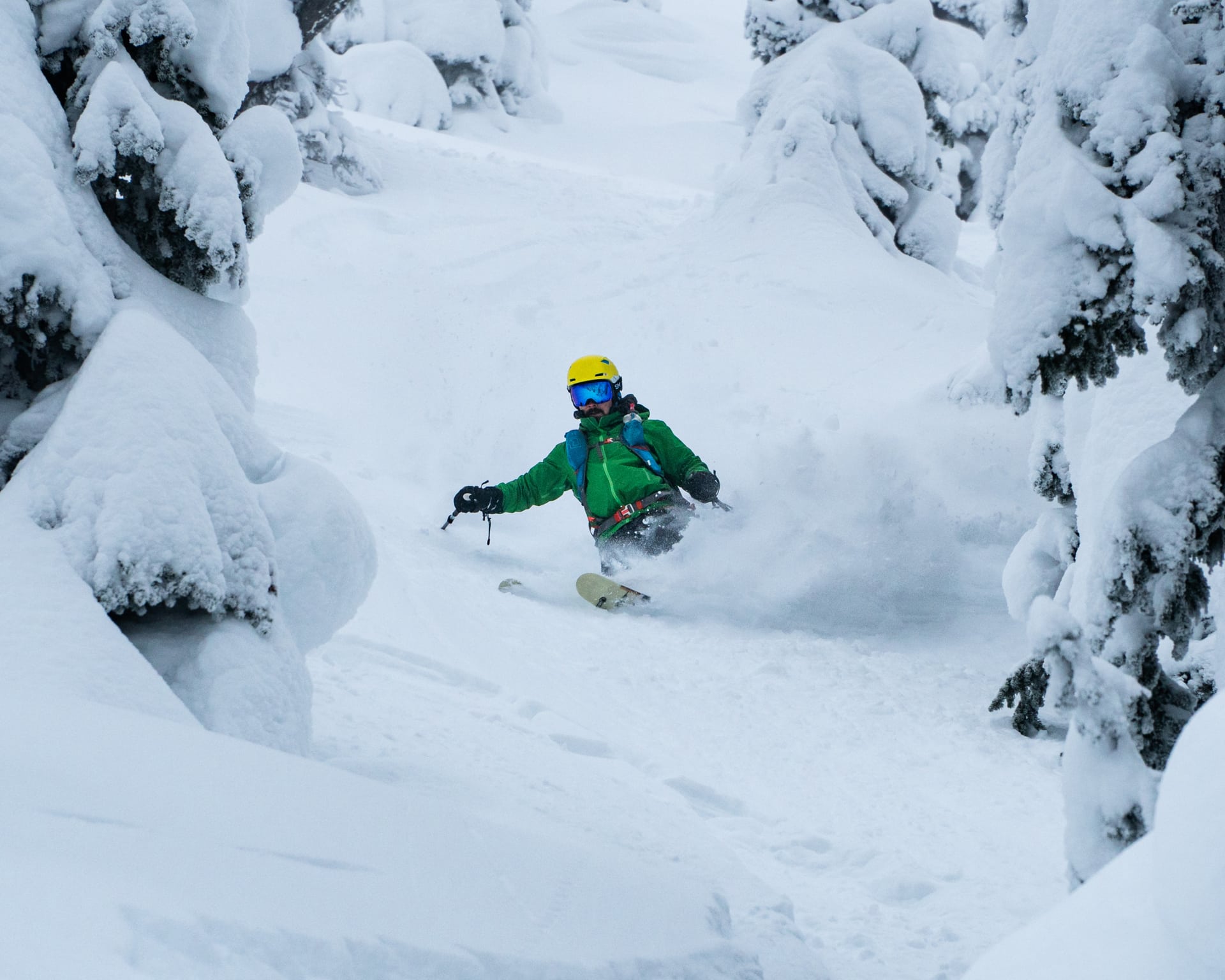
Rigel, slashing a powder turn right after the ridge. Photo: Beyond Our Peak
A little way down the chute, Rigel and I maneuvered around a frozen waterfall. Would it be called an icefall, then? Freddy, on the other hand, asked me to scope out a landing since he didn’t have a visual. Trusting my eye, he launched off the top and skipped over the ice only to land awkwardly and somersault downhill. This guy is built like a tank. I really wouldn’t advise getting sendy in the backcountry unless you know what you’re doing. As a general rule, I keep those shenanigans to the resort.
After recovering from his fall, we carried on with our descent through a large slidepath to which all the chutes connected. We skied down the uber-playful terrain, jumping left and right off natural booters. The slidepath later spat us into a steep gully, which we had climbed earlier in the day. We followed this tracked-out feature and joined up with our earlier uptrack. By the point, we were a few minutes away from the parking lot.
I won’t lie. For all the fantastic skiing the Begbie Shoulder has to offer, it takes a whole lot of work to get to. Contrary to Rogers Pass, the starting elevation is low (630m) and the ascent is a little under 1400 vertical meters. Don’t attempt this route on your first day out ski touring! Ample valley bottom snow, excellent fitness, and loads of patience is a must… unless you’ve got a sled. Then, it’s a different story. Otherwise, you’ll just end up getting frustrated with the bush. I recommend lapping the top 600m of gladed terrain to make the most out of your day.
Statistics
| Peak Elevation | 1994m |
| Vertical Gain/Loss | 1390m |
| Distance Traveled | 8.5km |
| Duration | 6h |
For more beta on my adventures, check out the Route Map. This online map interface is a repository of my ski touring and mountaineering adventures. Simply follow the rough trace!